Camino de Santiago Portuguťs. Etapa 09

MTB
Ref..: 19113
Published: 15/08/2014
Performed: 09/05/2012
Distance in Km: 48.08
Climb in m: 650
IBP: 34 BYC
 Not from STRAVA
Near ...
Arcos
Arcos
 No activities
This route belongs to a multi-day journey 12 days documented with 12 independent routes
You can download the tracks of this multi-day route from each of the associated stages .| Day or stage | One day stage | Distance | Climb in | IBP |
| Day 1 | 12151 Camino de Santiago Portuguťs. Etapa 01 | 50 Km | 246 m | 27 |
| Day 2 | 12152 Camino de Santiago Portuguťs. Etapa 02 | 54 Km | 200 m | 30 |
| Day 3 | 12371 Camino de Santiago Portuguťs. Etapa 03 | 60 Km | 322 m | 33 |
| Day 4 | 12724 Camino de Santiago Portuguťs. Etapa 04 | 45 Km | 922 m | 59 |
| Day 5 | 19060 Camino de Santiago Portuguťs. Etapa 05 | 51 Km | 664 m | 45 |
| Day 6 | 19063 Camino de Santiago Portuguťs. Etapa 06 | 66 Km | 574 m | 38 |
| Day 7 | 19083 Camino de Santiago Portuguťs. Etapa 07 | 68 Km | 1565 m | 110 |
| Day 8 | 19084 Camino de Santiago Portuguťs. Etapa 08 | 40 Km | 508 m | 27 |
| Day 9 | 19113 Camino de Santiago Portuguťs. Etapa 09 (This) | 48 Km | 650 m | 36 |
| Day 10 | 19114 Camino de Santiago Portuguťs. Etapa 10 | 46 Km | 805 m | 55 |
| Day 11 | 19284 Camino de Santiago Portuguťs. Etapa 11 | 57 Km | 792 m | 47 |
| Day 12 | 19559 Camino de Santiago Portuguťs. Etapa 12 | 41 Km | 676 m | 33 |
| Total 12 days | 626 Km | 7924 m | 45 / dŪa |

Description of the route
Camino de Santiago Portuguťs. Etapa 09
Esta noche hemos dormido de maravilla, a pesar del gran nķmero de peregrinos que habŪa en el albergue, tenŪamos una habitaciůn en donde solamente estŠbamos cuatro y, cuando nos hemos despertado, ya solo quedŠbamos nosotros y otros cuatro peregrinos que, poco a poco, van saliendo. Nos ponemos a desayunar y, entre tanto, aparece un peregrino que se dirige hacia FŠtima y que solo quiere sellar, no habiendo nadie de la Asociaciůn hago de hospitalero y le doy cuanta informaciůn necesita, pero no localizo el sello, asŪ que tiene que marcharse sin sellar.
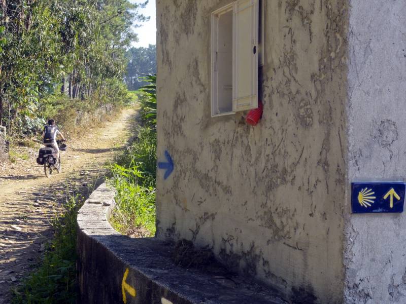
El tiempo es estupendo y no se ve una sola nube en el cielo, pero no hace calor; ya pasaron hace tiempo aquellos dŪas de bochorno inaguantable y ahora el sol es para disfrutarlo. Iniciamos ruta atravesando SŠo Pedro de Rates y continuando por una pista forestal durante seis kilůmetros hasta llegar a Pedra Furada, donde el trazado del Caminho se cubre de asfalto y continķa por la carretera N-306 durante tres kilůmetros hasta llegar a Pereira, donde se desvŪa por una carretera vecinal que nos lleva hasta Pereirů y luego a Barcelinhos. Cruzamos el rŪo CŠvado y entramos en Barcelos, la ciudad del famoso galo portuguťs. Visita turŪstica a la ciudad, compra de souvenirs incluŪda, y nos dirigimos a una tienda de bicis donde le arreglan los frenos de disco a la bici de Josu, ya que le estaban dando problemas.
Salimos de Barcelos y seguimos por carreteritas vecinales hasta Vila Boa, para seguir por caminos de tierra hasta Arantes y por una combinaciůn de ambos, en fuerte ascenso, hasta Portela de Tamel, con su nuevo albergue de peregrinos, donde paramos a comer en un restaurante con una estupenda terraza climatizada °como se aprecian estos buenos momentos tras un buen esfuerzo!
Tras la fuerte subida y la estupenda comida, ahora toca bajar, y lo hacemos por un tramo de bosque bajo combinando asfalto y tierra hasta la ribera del rŪo Neira, que cruzamos por el Ponte das TŠbuas, para seguir por las aldeas de BalugŠes, Devesa y Outeiro, donde nos espera un fuerte ascenso hasta el Alto de Albergaria. Todo lo que sube baja y el descenso, por pistas forestales, es una gozada. Llegados a Albergaria seguimos por pistas de tierra entre cultivos de regadŪo y caserŪo disperso hasta llegar a Ponte de Lima y cruzar el puente romano para llegar a su estupendo albergue de peregrinos, donde OvŪdio De Sousa, nos recibe con los brazos abiertos mostrando una estupenda hospitalidad °y van dos seguidas, que maravilla! Nos vamos a hacer las compras al centro del pueblo, la visita turŪstica, y la pertinente cervecita en una terraza antes de volver al albergue. Mientras preparamos la cena conocemos a Antonio Lůpez, un experimentado peregrino malagueŮo muy simpŠtico, con el que tenemos una larga charla. Luego, mientras cenamos, tambiťn tenemos una agradable charla con OvŪdio De Sousa, hospitalero de vocaciůn y uno de los impulsores del albergue de Ponte de Lima, nuestra casa de hoy.
Esta noche hemos dormido de maravilla, a pesar del gran nķmero de peregrinos que habŪa en el albergue, tenŪamos una habitaciůn en donde solamente estŠbamos cuatro y, cuando nos hemos despertado, ya solo quedŠbamos nosotros y otros cuatro peregrinos que, poco a poco, van saliendo. Nos ponemos a desayunar y, entre tanto, aparece un peregrino que se dirige hacia FŠtima y que solo quiere sellar, no habiendo nadie de la Asociaciůn hago de hospitalero y le doy cuanta informaciůn necesita, pero no localizo el sello, asŪ que tiene que marcharse sin sellar.
El tiempo es estupendo y no se ve una sola nube en el cielo, pero no hace calor; ya pasaron hace tiempo aquellos dŪas de bochorno inaguantable y ahora el sol es para disfrutarlo. Iniciamos ruta atravesando SŠo Pedro de Rates y continuando por una pista forestal durante seis kilůmetros hasta llegar a Pedra Furada, donde el trazado del Caminho se cubre de asfalto y continķa por la carretera N-306 durante tres kilůmetros hasta llegar a Pereira, donde se desvŪa por una carretera vecinal que nos lleva hasta Pereirů y luego a Barcelinhos. Cruzamos el rŪo CŠvado y entramos en Barcelos, la ciudad del famoso galo portuguťs. Visita turŪstica a la ciudad, compra de souvenirs incluŪda, y nos dirigimos a una tienda de bicis donde le arreglan los frenos de disco a la bici de Josu, ya que le estaban dando problemas.
Salimos de Barcelos y seguimos por carreteritas vecinales hasta Vila Boa, para seguir por caminos de tierra hasta Arantes y por una combinaciůn de ambos, en fuerte ascenso, hasta Portela de Tamel, con su nuevo albergue de peregrinos, donde paramos a comer en un restaurante con una estupenda terraza climatizada °como se aprecian estos buenos momentos tras un buen esfuerzo!
Tras la fuerte subida y la estupenda comida, ahora toca bajar, y lo hacemos por un tramo de bosque bajo combinando asfalto y tierra hasta la ribera del rŪo Neira, que cruzamos por el Ponte das TŠbuas, para seguir por las aldeas de BalugŠes, Devesa y Outeiro, donde nos espera un fuerte ascenso hasta el Alto de Albergaria. Todo lo que sube baja y el descenso, por pistas forestales, es una gozada. Llegados a Albergaria seguimos por pistas de tierra entre cultivos de regadŪo y caserŪo disperso hasta llegar a Ponte de Lima y cruzar el puente romano para llegar a su estupendo albergue de peregrinos, donde OvŪdio De Sousa, nos recibe con los brazos abiertos mostrando una estupenda hospitalidad °y van dos seguidas, que maravilla! Nos vamos a hacer las compras al centro del pueblo, la visita turŪstica, y la pertinente cervecita en una terraza antes de volver al albergue. Mientras preparamos la cena conocemos a Antonio Lůpez, un experimentado peregrino malagueŮo muy simpŠtico, con el que tenemos una larga charla. Luego, mientras cenamos, tambiťn tenemos una agradable charla con OvŪdio De Sousa, hospitalero de vocaciůn y uno de los impulsores del albergue de Ponte de Lima, nuestra casa de hoy.
Presence of ramps
| Climbs | Distance | % of the total | Speed | Your speed would be | Time | Your time would be | |
| 15 - 30% | 0.12 | 0.25 | 9.04 | ? | 0:00:48 | ? | |
| 10 - 15% | 0.287 | 0.6 | 8.98 | ? | 0:01:55 | ? | |
| 5 - 10% | 3.609 | 7.51 | 8.95 | ? | 0:24:12 | ? | |
| 1 - 5% | 14.011 | 29.14 | 8.91 | ? | 1:34:19 | ? | |
| Total* | 18.027 Km | 37.49 % | 8.92 Km/h | ?
Km/h  |
2:01:14 h | ? h |
|
| Flat | |||||||
| 1 - -1% | 12.413 Km | 25.82 % | 8.9 Km/h | ?
Km/h |
1:23:40 h | ? h |
|
| Descents | |||||||
| -1 - -5% | 13.344 | 27.75 | 8.92 | ? | 1:29:45 | ? | |
| -5 - -10% | 3.578 | 7.44 | 8.94 | ? | 0:24:01 | ? | |
| -10 - -15% | 0.718 | 1.49 | 8.91 | ? | 0:04:50 | ? | |
| -15 - -30% | 0 | 0 | 0 | ? | 0:00:00 | ? | |
| Total* | 17.64 Km | 36.69 % | 8.92 Km/h | ?
Km/h |
1:58:36 h | ? h |
|
How long would it take you?
 |
|
ŅCuanto consumirŠ tu E-BIKE?
Entra tu E-IBP (formato n,nn)
| Detected activity type = () |
| Penalization due to track conditions: 31 % ( > 50 % = MTB, < 50 % = RDB) |
|
|
| Correction level applied to the track: 0 |
|
|
| DIFFICULTY OF THE ROUTE |
IBP = 34 BYC |
| According to your statistics Your time in motion would be: ? h |
| Your average speed would be:
? Km/h |
| Total Distance: 48.08 Km |
| Analysed distance: 48.08 Km |
| Linear distance: 38.86 Km |
| Cumulated positive ramps: 650 m |
 list of points info list of points info |
| Cumulated negative ramps: 699 m | |
| Maximum height: 195 m | |
| Minimum height: 14 m | |
| Climbing Ratio: 3.61 % | |
| Descent ratio: 3.96 % | |
| Cumulated postive ramps per Km: 13.52 m | |
| Cumulated negative ramps per Km: 14.54 m | |
| Total time: 5:23:30 h |
| Time in movement: 5:23:30 h |
| According to your statistics Your time in motion would be: ? h
|
| Stopped time: 0:00:00 h |
| Maximum slope filter: ~30 % |
| Minimum separation analysed: ~30 m |
| Number of points: 315 (cad. 152.64 m) |
| Significant waypoints: 309 (cad. 155.6 m / 98.1 %) |
| Changes in direction per Km: 3.99 |
| Changes in direction > 5ļ por Km: 3.99 |
| Cumulated straight stretches: 0.141 Km |
| Straight stretches per Km: 2.93 m |
| Penalized slope changes: 7 |
| Penalized slope changes per Km: 0.146 |
| Average speed in total: 8.92 Km/h |
| Average speed while moving: 8.92 Km/h |
| According to your statistics Your average speed would be: ? Km/h
|
| Maximum sustained speed: 9.22 Km/h |


