Camino de Santiago Portuguťs. Etapa 01

MTB
Ref..: 12151
Published: 03/02/2013
Performed: 30/12/2011
Distance in Km: 46.21
Climb in m: 193
IBP: 18 BYC
 Not from STRAVA
Near ...
Algťs
Algťs
 No activities
This route belongs to a multi-day journey 12 days documented with 12 independent routes
You can download the tracks of this multi-day route from each of the associated stages .| Day or stage | One day stage | Distance | Climb in | IBP |
| Day 1 | 12151 Camino de Santiago Portuguťs. Etapa 01 (This) | 50 Km | 246 m | 27 |
| Day 2 | 12152 Camino de Santiago Portuguťs. Etapa 02 | 54 Km | 200 m | 30 |
| Day 3 | 12371 Camino de Santiago Portuguťs. Etapa 03 | 60 Km | 322 m | 33 |
| Day 4 | 12724 Camino de Santiago Portuguťs. Etapa 04 | 45 Km | 922 m | 59 |
| Day 5 | 19060 Camino de Santiago Portuguťs. Etapa 05 | 51 Km | 664 m | 45 |
| Day 6 | 19063 Camino de Santiago Portuguťs. Etapa 06 | 66 Km | 574 m | 38 |
| Day 7 | 19083 Camino de Santiago Portuguťs. Etapa 07 | 68 Km | 1565 m | 110 |
| Day 8 | 19084 Camino de Santiago Portuguťs. Etapa 08 | 40 Km | 508 m | 27 |
| Day 9 | 19113 Camino de Santiago Portuguťs. Etapa 09 | 48 Km | 650 m | 36 |
| Day 10 | 19114 Camino de Santiago Portuguťs. Etapa 10 | 46 Km | 805 m | 55 |
| Day 11 | 19284 Camino de Santiago Portuguťs. Etapa 11 | 57 Km | 792 m | 47 |
| Day 12 | 19559 Camino de Santiago Portuguťs. Etapa 12 | 41 Km | 676 m | 33 |
| Total 12 days | 626 Km | 7924 m | 45 / dŪa |

Description of the route
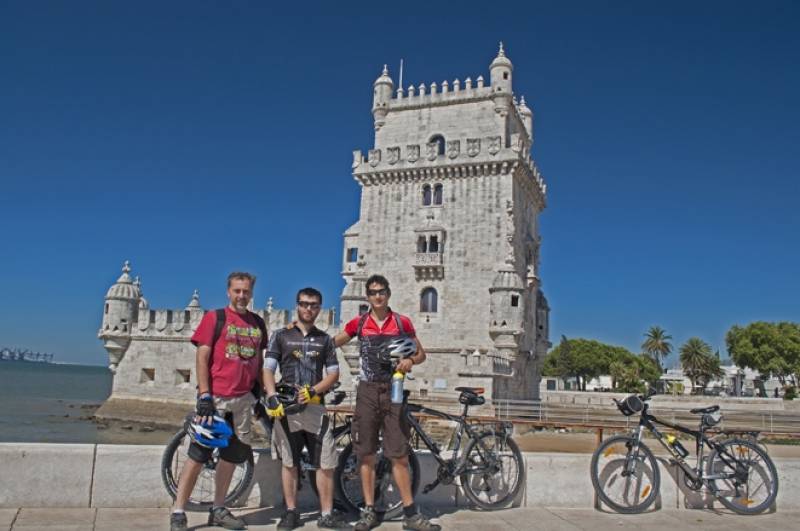
Punto de partida: Lisboa, torre de Belem
Como ocurre en EspaŮa, en Portugal tampoco hay un ķnico Camino de Santiago; sin embargo el Camino Central Portuguťs es el mŠs seguido de todos ellos, con tres tramos muy diferenciados: Desde Lisboa a Porto apenas hay peregrinos, son muy pocos los albergues y la ķnica seŮalizaciůn que encontraremos serŠn nuestras amigas las flechas amarillas. Desde Porto ya contamos con una red de albergues de peregrinos, comienzan a verse poco a poco mŠs seŮales y mŠs peregrinos. Desde Tui hasta Santiago es como los 100 ķltimos kilůmetros del Camino Francťs...
Merece la pena un primer dŪa en Lisboa, para visitarla y disfrutarla con calma, y para descubrir sus hermosos rincones. La primera flecha amarilla la encontraremos en un costado de la catedral lisboeta; seguiremos las mismas atravesando la capital lusa por el popular barrio de La Alfama hacia el Parque das NaÁioes y el imponente Ponte Vasco de Gama que atraviesa el rŪo Tajo. Salimos de Lisboa hacia Sacavťm y seguiremos las seŮales que nos indican los dos principales caminos de peregrinaciůn lusa: flechas azules del Camino de FŠtima y flechas amarillas del Camino de Santiago (ahora coincidentes). Avanzamos siempre en llano por caminos y carreteras que tratan de evitar las grandes carreteras que conducen a Lisboa y los nķcleos urbanos de sus ciudades satťlites, asŪ pasaremos Alpriate, Alberca de Ribatejo, Alhandra y Vilafranca de Xira, ciudad a orillas del Tajo donde haremos la primera noche.
Como antes apuntaba, hasta poco antes de Porto, no hay albergues de peregrinos, por lo que hay que buscar hostales, pensiones... o pedir autorizaciůn a los Bombeiros Voluntarios (una mezcla de Bomberos y de Protecciůn Civil) que suelen dejar parte de sus dependencias para dormir y ducharse.
Presence of ramps
| Climbs | Distance | % of the total | Speed | Your speed would be | Time | Your time would be | |
| 15 - 30% | 0 | 0 | 0 | ? | 0:00:00 | ? | |
| 10 - 15% | 0 | 0 | 0 | ? | 0:00:00 | ? | |
| 5 - 10% | 0.861 | 1.86 | 17.12 | ? | 0:03:01 | ? | |
| 1 - 5% | 6.75 | 14.61 | 15.75 | ? | 0:25:43 | ? | |
| Total* | 7.61 Km | 16.47 % | 15.89 Km/h | ?
Km/h  |
0:28:44 h | ? h |
|
| Flat | |||||||
| 1 - -1% | 29.993 Km | 64.91 % | 9.33 Km/h | ?
Km/h |
3:12:56 h | ? h |
|
| Descents | |||||||
| -1 - -5% | 7.936 | 17.17 | 14.16 | ? | 0:33:38 | ? | |
| -5 - -10% | 0.518 | 1.12 | 0 | ? | 0:00:00 | ? | |
| -10 - -15% | 0.151 | 0.33 | 3.41 | ? | 0:02:40 | ? | |
| -15 - -30% | 0 | 0 | 0 | ? | 0:00:00 | ? | |
| Total* | 8.605 Km | 18.62 % | 14.22 Km/h | ?
Km/h |
0:36:18 h | ? h |
|
How long would it take you?
 |
|
ŅCuanto consumirŠ tu E-BIKE?
Entra tu E-IBP (formato n,nn)
| Detected activity type = () |
| Penalization due to track conditions: 16 % ( > 50 % = MTB, < 50 % = RDB) |
|
|
| Correction level applied to the track: 0 |
|
|
| DIFFICULTY OF THE ROUTE |
IBP = 18 BYC |
| According to your statistics Your time in motion would be: ? h |
| Your average speed would be:
? Km/h |
| Total Distance: 46.21 Km |
| Analysed distance: 46.21 Km |
| Linear distance: 32.67 Km |
| Cumulated positive ramps: 193.1 m |
 list of points info list of points info |
| Cumulated negative ramps: 218.1 m | |
| Maximum height: 52.5 m | |
| Minimum height: -1.3 m | |
| Climbing Ratio: 2.54 % | |
| Descent ratio: 2.53 % | |
| Cumulated postive ramps per Km: 4.18 m | |
| Cumulated negative ramps per Km: 4.72 m | |
| Total time: 47:58:40 h |
| Time in movement: 4:17:58 h |
| According to your statistics Your time in motion would be: ? h
|
| Stopped time: 43:40:42 h |
| Maximum slope filter: ~30 % |
| Minimum separation analysed: ~30 m |
| Number of points: 210 (cad. 220.04 m) |
| Significant waypoints: 199 (cad. 232.2 m / 94.76 %) |
| Changes in direction per Km: 2.47 |
| Changes in direction > 5ļ por Km: 2.38 |
| Cumulated straight stretches: 1.356 Km |
| Straight stretches per Km: 29.34 m |
| Penalized slope changes: 0 |
| Penalized slope changes per Km: 0 |
| Average speed in total: 0.96 Km/h |
| Average speed while moving: 10.75 Km/h |
| According to your statistics Your average speed would be: ? Km/h
|
| Maximum sustained speed: 10.75 Km/h |


