Salamanca-Zamora-Riego del Camino

MTB
Ref..: 999257
Published: 03/10/2021
Performed: 27/09/2021
Distance in Km: 102.27
Climb in m: 646
IBP: 57 BYC
 Not from STRAVA
Near ...
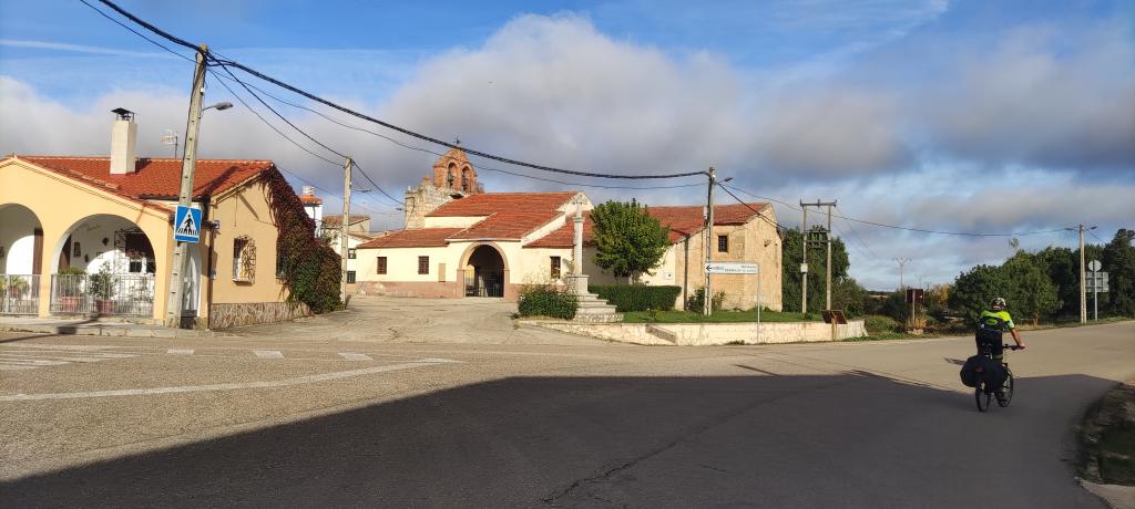
Carbajosa De La Sagrada, Pinilla, La, Salamanca
Carbajosa De La Sagrada, Pinilla, La, Salamanca

This route belongs to a multi-day journey 10 days documented with 10 independent routes
You can download the tracks of this multi-day route from each of the associated stages .
Description of the route
| Sexta etapa: Desde Salamanca a Zamora por carretera y desde aqui, hasta Riego del Camino por el Camino Via de la Plata |
Presence of ramps
| Climbs | Distance | % of the total | Speed | Your speed would be | Time | Your time would be | |
| 15 - 30% | 0 | 0 | 0 | ? | 0:00:00 | ? | |
| 10 - 15% | 0 | 0 | 0 | ? | 0:00:00 | ? | |
| 5 - 10% | 1.328 | 1.3 | 8.84 | ? | 0:09:01 | ? | |
| 1 - 5% | 27.456 | 26.85 | 14.05 | ? | 1:57:14 | ? | |
| Total* | 28.784 Km | 28.15 % | 13.68 Km/h | ?
Km/h  |
2:06:15 h | ? h |
|
| Flat | |||||||
| 1 - -1% | 40.908 Km | 40 % | 18.36 Km/h | ?
Km/h |
2:13:40 h | ? h |
|
| Descents | |||||||
| -1 - -5% | 31.755 | 31.05 | 21.66 | ? | 1:27:59 | ? | |
| -5 - -10% | 0.83 | 0.81 | 28.18 | ? | 0:01:46 | ? | |
| -10 - -15% | 0 | 0 | 0 | ? | 0:00:00 | ? | |
| -15 - -30% | 0.008 | 0.01 | 0 | ? | 0:00:00 | ? | |
| Total* | 32.593 Km | 31.87 % | 21.79 Km/h | ?
Km/h |
1:29:45 h | ? h |
|
How long would it take you?
 |
|
�Cuanto consumir� tu E-BIKE?
Entra tu E-IBP (formato n,nn)
| Detected activity type = () |
| Penalization due to track conditions: 21 % ( > 50 % = MTB, < 50 % = RDB) |
|
|
Correction level applied to the track:
2
 See analyis without corrections See analyis without corrections
|
|
|
| DIFFICULTY OF THE ROUTE |
IBP = 57 BYC |
| According to your statistics Your time in motion would be: ? h |
| Your average speed would be:
? Km/h |
| Total Distance: 102.27 Km |
| Analysed distance: 102.27 Km |
| Linear distance: 89.51 Km |
| Cumulated positive ramps: 645.61 m |
list of points info |
| Cumulated negative ramps: 710.1 m | |
| Maximum height: 885.51 m | |
| Minimum height: 638.83 m | |
| Climbing Ratio: 2.24 % | |
| Descent ratio: 2.18 % | |
| Cumulated postive ramps per Km: 6.31 m | |
| Cumulated negative ramps per Km: 6.94 m | |
| Total time: 8:39:58 h |
| Time in movement: 5:49:40 h |
| According to your statistics Your time in motion would be: ? h
|
| Stopped time: 2:50:18 h |
| Maximum slope filter: ~30 % |
| Minimum separation analysed: ~30 m |
| Number of points: 1704 (cad. 60.02 m) |
| Significant waypoints: 1291 (cad. 79.28 m / 75.76 %) |
| Changes in direction per Km: 4.7 |
| Changes in direction > 5� por Km: 1.95 |
| Cumulated straight stretches: 63.747 Km |
| Straight stretches per Km: 623.32 m |
| Penalized slope changes: 4 |
| Penalized slope changes per Km: 0.039 |
| Average speed in total: 11.8 Km/h |
| Average speed while moving: 17.55 Km/h |
| According to your statistics Your average speed would be: ? Km/h
|
| Maximum sustained speed: 49.94 Km/h |


