Vuelta ciclista por la tarde

Road
Ref..: 971612
Published: 20/06/2021
Performed: 19/06/2021
Distance in Km: 49.38
Climb in m: 760
IBP: 42 BYC
 View on STRAVA
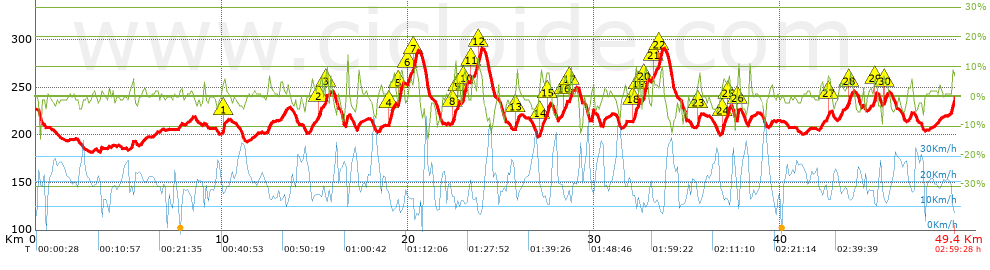


 list of points info

