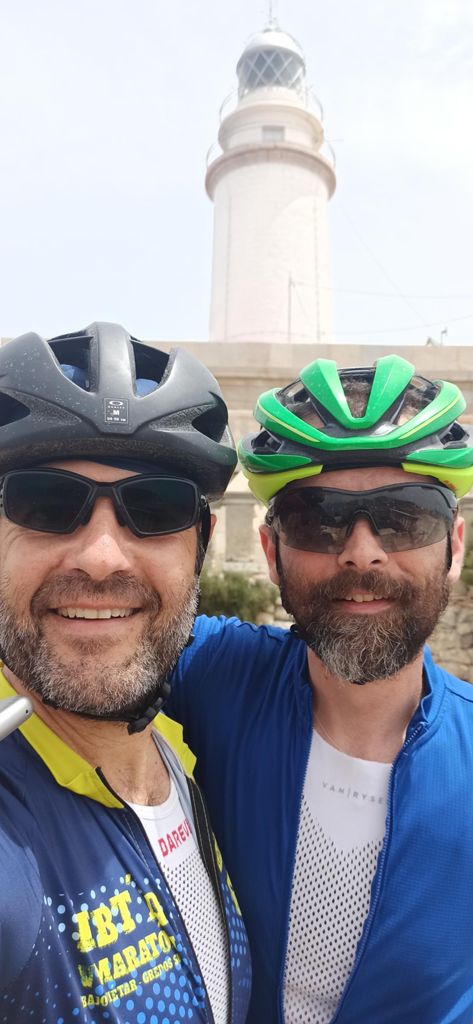
Inca-Lluc-Cabo Formentor

Road
Road
Ref..: 971386
Published: 20/06/2021
Performed: 19/06/2021
Distance in Km: 119.08
Climb in m: 1648
IBP: 118 BYC


 Height in m      Climb in %      Speed in Km/h      Speed < 2 Km/h

Climbs > 5%

Climbs >5% Climbs >10% Climbs >15% Climbs >20% Climbs >25%
 Steep slope of 133 m.   Average slope  Distances  Download as waypoint
1
 Km 3.822  5%  133 m
 Steep slope of 153 m.  Average slope  Distances  Download as waypoint
2
 Km 5.514  6%  153 m
 Steep slope of 729 m.  Average slope  Distances  Download as waypoint
3
 Km 7.637  6%  729 m
 Steep slope of 138 m.  Average slope  Distances  Download as waypoint
4
 Km 8.47  6%  138 m
 Steep slope of 631 m.  Average slope  Distances  Download as waypoint
5
 Km 8.791  6%  631 m
 Steep slope of 141 m.  Average slope  Distances  Download as waypoint
6
 Km 9.602  5%  141 m
 Steep slope of 303 m.  Average slope  Distances  Download as waypoint
7
 Km 10.033  6%  303 m
 Steep slope of 308 m.  Average slope  Distances  Download as waypoint
8
 Km 10.446  6%  308 m
 Steep slope of 233 m.  Average slope  Distances  Download as waypoint
9
 Km 10.865  6%  233 m
 Steep slope of 110 m.  Average slope  Distances  Download as waypoint
10
 Km 11.347  7%  110 m
 Steep slope of 182 m.  Average slope  Distances  Download as waypoint
11
 Km 11.564  6%  182 m
 Steep slope of 181 m.  Average slope  Distances  Download as waypoint
12
 Km 13.751  9%  181 m
 Steep slope of 170 m.  Average slope  Distances  Download as waypoint
13
 Km 14.032  6%  170 m
 Steep slope of 429 m.  Average slope  Distances  Download as waypoint
14
 Km 14.312  6%  429 m
 Steep slope of 155 m.  Average slope  Distances  Download as waypoint
15
 Km 14.937  5%  155 m
 Steep slope of 178 m.  Average slope  Distances  Download as waypoint
16
 Km 15.253  6%  178 m
 Steep slope of 109 m.  Average slope  Distances  Download as waypoint
17
 Km 17.497  8%  109 m
 Steep slope of 134 m.  Average slope  Distances  Download as waypoint
18
 Km 18.26  5%  134 m
 Steep slope of 150 m.  Average slope  Distances  Download as waypoint
19
 Km 18.517  6%  150 m
 Steep slope of 159 m.  Average slope  Distances  Download as waypoint
20
 Km 20.373  9%  159 m
 Steep slope of 171 m.  Average slope  Distances  Download as waypoint
21
 Km 21.755  7%  171 m
 Steep slope of 108 m.  Average slope  Distances  Download as waypoint
22
 Km 45.195  5%  108 m
 Steep slope of 211 m.  Average slope  Distances  Download as waypoint
23
 Km 45.404  7%  211 m
 Steep slope of 185 m.  Average slope  Distances  Download as waypoint
24
 Km 45.931  7%  185 m
 Steep slope of 1036 m.  Average slope  Distances  Download as waypoint
25
 Km 46.217  7%  1036 m
 Steep slope of 336 m.  Average slope  Distances  Download as waypoint
26
 Km 47.351  7%  336 m
 Steep slope of 448 m.  Average slope  Distances  Download as waypoint
27
 Km 47.789  7%  448 m
 Steep slope of 177 m.  Average slope  Distances  Download as waypoint
28
 Km 52.363  7%  177 m
 Steep slope of 440 m.  Average slope  Distances  Download as waypoint
29
 Km 55.791  9%  440 m
 Steep slope of 614 m.  Average slope  Distances  Download as waypoint
30
 Km 56.497  6%  614 m
 Steep slope of 173 m.  Average slope  Distances  Download as waypoint
31
 Km 58.608  5%  173 m
 Steep slope of 178 m.  Average slope  Distances  Download as waypoint
32
 Km 60.174  6%  178 m
 Steep slope of 188 m.  Average slope  Distances  Download as waypoint
33
 Km 60.975  7%  188 m
 Steep slope of 133 m.  Average slope  Distances  Download as waypoint
34
 Km 62.123  9%  133 m
 Steep slope of 233 m.  Average slope  Distances  Download as waypoint
35
 Km 62.365  9%  233 m
 Steep slope of 725 m.  Average slope  Distances  Download as waypoint
36
 Km 63.197  8%  725 m
 Steep slope of 426 m.  Average slope  Distances  Download as waypoint
37
 Km 65.434  7%  426 m
 Steep slope of 177 m.  Average slope  Distances  Download as waypoint
38
 Km 69.55  6%  177 m
 Steep slope of 341 m.  Average slope  Distances  Download as waypoint
39
 Km 73.478  6%  341 m
 Steep slope of 246 m.  Average slope  Distances  Download as waypoint
40
 Km 73.921  7%  246 m
 Steep slope of 423 m.  Average slope  Distances  Download as waypoint
41
 Km 74.267  8%  423 m
 Steep slope of 443 m.  Average slope  Distances  Download as waypoint
42
 Km 74.825  7%  443 m
 Steep slope of 374 m.  Average slope  Distances  Download as waypoint
43
 Km 75.376  7%  374 m
 Steep slope of 244 m.  Average slope  Distances  Download as waypoint
44
 Km 76.101  6%  244 m
 Steep slope of 172 m.  Average slope  Distances  Download as waypoint
45
 Km 76.653  7%  172 m
 Steep slope of 94 m.  Average slope  Distances  Download as waypoint
46
 Km 116.497  6%  94 m


Description of the route


Presence of ramps


 Climbs  Distance  % of the total  Speed  Your speed would be  Time  Your time would be
   15 - 30%  0.037  0.03  11.03  ?  0:00:12  ?
   10 - 15%  0.605  0.51  9.86  ?  0:03:41  ?
   5 - 10%  14.152  11.88  12.75  ?  1:06:37  ?
   1 - 5%  22.522  18.91  17.69  ?  1:16:24  ?
   Total*  37.316 Km  31.34 %  15.24 Km/h  ? Km/h    2:26:54 h  ? h  
 Flat
   1 - -1%  44.072 Km  37.01 %  25.45 Km/h  ? Km/h    1:43:55 h  ? h  
 Descents
   -1 - -5%  23.835  20.02  33.49  ?  0:42:42  ?
   -5 - -10%  12.397  10.41  41.99  ?  0:17:43  ?
   -10 - -15%  1.356  1.14  37.86  ?  0:02:09  ?
   -15 - -30%  0.104  0.09  31.11  ?  0:00:12  ?
   Total*  37.693 Km  31.65 %  36.03 Km/h  ? Km/h    1:02:46 h  ? h  
* The total has not necessarily coincide with the sum of the partials after correction of errors

How long would it take you?

How long would it take you to cover this route?
There are routes without a valid time information, but with your average stats you can assess the possible duration

Alfonso Puñal to cover this route you've need a time of:   5:13:35 h 
If you sign in and have a minimum of two tracks of this same modality, you can know your time for this route, calculated from your stats..


¿Cuanto consumirá tu E-BIKE?

Entra tu E-IBP (formato n,nn)

E-IBP :   X 118 = 


 Detected activity type =  ()
 Penalization due to track conditions: 38 %   ( > 50 % = MTB, < 50 % = RDB)
 Reliability of the track: A   (1647/72/0/-/-/72)
 Correction level applied to the track: 0
DIFFICULTY OF THE ROUTE
IBP = 118 BYC
According to your statistics
 Your time in motion would be: ? h
Your average speed would be: ? Km/h
 

 Total Distance: 119.08 Km
 Analysed distance: 119.08 Km
 Linear distance: 0.03 Km

 Cumulated positive ramps: 1647.8 m  list of points info
 Cumulated negative ramps: 1643.54 m
 Maximum height: 551.6 m
 Minimum height: -14 m
 Climbing Ratio: 4.42 %
 Descent ratio: 4.36 %
 Cumulated postive ramps per Km: 13.84 m
 Cumulated negative ramps per Km: 13.8 m

 Total time: 6:50:56 h
 Time in movement: 5:13:35 h
 According to your statistics
 Your time in motion would be: ? h  
 Stopped time: 1:37:21 h
 Maximum slope filter: ~30 %
 Minimum separation analysed: ~30 m
 Number of points: 8932   (cad. 13.33 m)
 Significant waypoints: 3357   (cad. 35.47 m / 37.58 %)

 Changes in direction per Km: 10.59
 Changes in direction > 5º por Km: 4.11
 Cumulated straight stretches: 54.556 Km
 Straight stretches per Km: 458.15 m
 Penalized slope changes: 15
 Penalized slope changes per Km: 0.126

 Average speed in total: 17.39 Km/h
 Average speed while moving: 22.78 Km/h
 According to your statistics
 Your average speed would be: ? Km/h  
 Maximum sustained speed: 64.11 Km/h


Comments

You can be the first one in commenting this route

 
My comments
:
Add comment  (Registered users)
 
Notify me answers to my comment  Do not notify answers to my comment


Share this route with a friend

Your friend will receive a message with a link to this page:
will see your email and your user name if you do it as registered user.


Write here your name (optional)

E-mail address of your friend(s). You can include various addresses separated by commas

Text or comment (optional) maximum 255 characters long, 255 Available characters

As a non registered users you need to fill-in the captcha text.
  Change image
Type the image characters.
 
 Share with a friend


Visited history

Delete history

Marked routes for review later or compare

My favorites


  Notify anomaly in this route Share in Facebook