42 BTT#21

MTB
Ref..: 948902
Published: 29/03/2021
Performed: 28/03/2021
Distance in Km: 41.81
Climb in m: 808
IBP: 65 BYC
 View on STRAVA
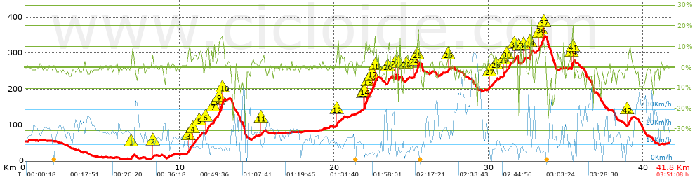


 list of points info

