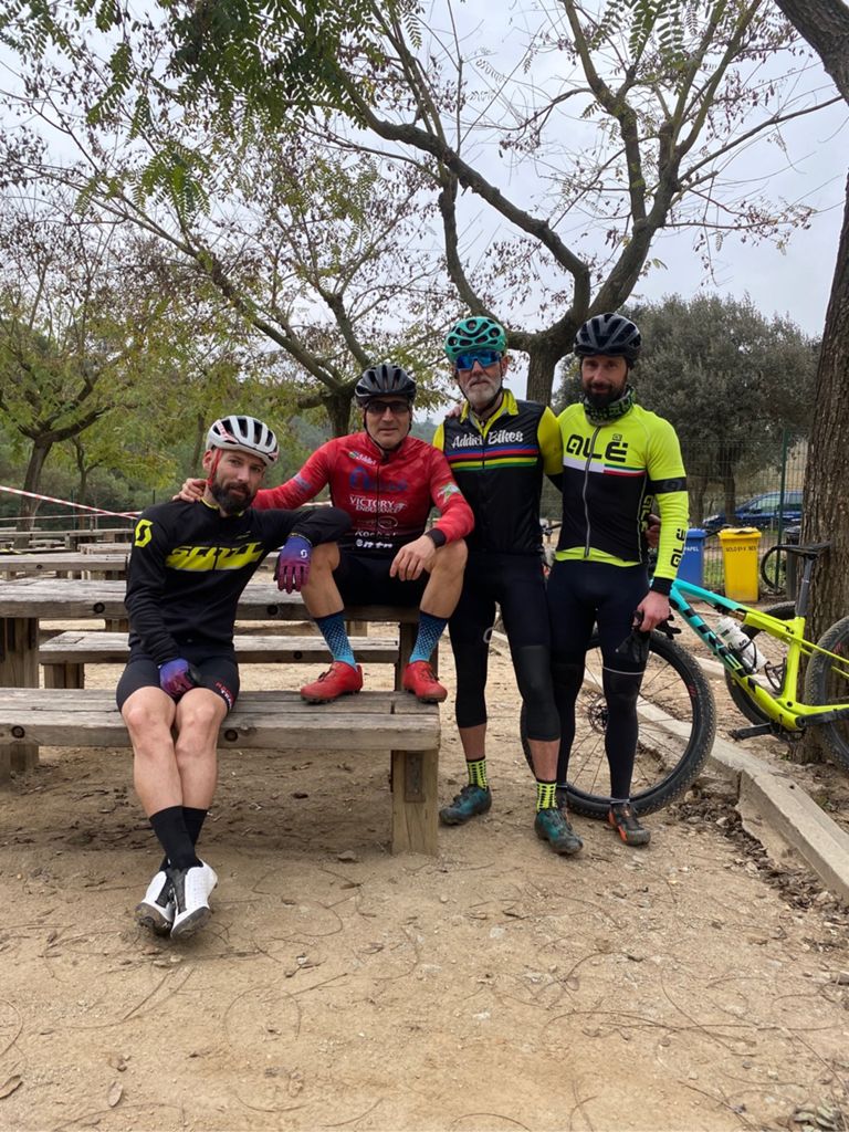
SALIDA ESPECTACULAR POR COLLSEROLLA CON MUY BUENA COMPAÑÍA!!!

MTB
MTB
Ref..: 941752
Published: 03/03/2021
Performed: 03/03/2021
Distance in Km: 59.12
Climb in m: 1459
IBP: 123 BYC

CARLOS_ALDEA_TUDELA
531 published routes

Add to my Group or Club

 Height in m      Climb in %      Speed in Km/h      Speed < 2 Km/h

Climbs > 5%

Climbs >5% Climbs >10% Climbs >15% Climbs >20% Climbs >25%
 Steep slope of 109 m.   Average slope  Distances  Download as waypoint
1
 Km 0.362  5%  109 m
 Steep slope of 138 m.  Average slope  Distances  Download as waypoint
2
 Km 0.785  8%  138 m
 Steep slope of 271 m.  Average slope  Distances  Download as waypoint
3
 Km 1.58  9%  71 m
4
 Km 1.651  12%  168 m
5
 Km 1.818  13%  32 m
 Steep slope of 103 m.  Average slope  Distances  Download as waypoint
6
 Km 2.31  10%  103 m
 Steep slope of 235 m.  Average slope  Distances  Download as waypoint
7
 Km 3.031  7%  235 m
 Steep slope of 113 m.  Average slope  Distances  Download as waypoint
8
 Km 3.71  7%  113 m
 Steep slope of 178 m.  Average slope  Distances  Download as waypoint
9
 Km 6.039  7%  178 m
 Steep slope of 138 m.  Average slope  Distances  Download as waypoint
10
 Km 6.992  6%  138 m
 Steep slope of 239 m.  Average slope  Distances  Download as waypoint
11
 Km 7.41  8%  239 m
 Steep slope of 98 m.  Average slope  Distances  Download as waypoint
12
 Km 7.751  9%  98 m
 Steep slope of 711 m.  Average slope  Distances  Download as waypoint
13
 Km 8.06  8%  313 m
14
 Km 8.374  11%  129 m
15
 Km 8.502  10%  269 m
 Steep slope of 377 m.  Average slope  Distances  Download as waypoint
16
 Km 8.986  5%  111 m
17
 Km 9.097  13%  231 m
18
 Km 9.328  5%  35 m
 Steep slope of 242 m.  Average slope  Distances  Download as waypoint
19
 Km 16.216  8%  242 m
 Steep slope of 204 m.  Average slope  Distances  Download as waypoint
20
 Km 16.564  6%  98 m
21
 Km 16.661  11%  106 m
 Steep slope of 537 m.  Average slope  Distances  Download as waypoint
22
 Km 17.11  6%  33 m
23
 Km 17.143  14%  131 m
24
 Km 17.274  7%  373 m
 Steep slope of 840 m.  Average slope  Distances  Download as waypoint
25
 Km 19.137  18%  92 m
26
 Km 19.23  9%  99 m
27
 Km 19.329  15%  92 m
28
 Km 19.421  23%  32 m
29
 Km 19.454  6%  147 m
30
 Km 19.6  17%  99 m
31
 Km 19.699  6%  279 m
 Steep slope of 274 m.  Average slope  Distances  Download as waypoint
32
 Km 20.807  8%  274 m
 Steep slope of 97 m.  Average slope  Distances  Download as waypoint
33
 Km 22.185  16%  97 m
 Steep slope of 101 m.  Average slope  Distances  Download as waypoint
34
 Km 22.396  5%  101 m
 Steep slope of 235 m.  Average slope  Distances  Download as waypoint
35
 Km 22.79  6%  37 m
36
 Km 22.828  13%  164 m
37
 Km 22.991  6%  34 m
 Steep slope of 137 m.  Average slope  Distances  Download as waypoint
38
 Km 23.706  11%  137 m
 Steep slope of 449 m.  Average slope  Distances  Download as waypoint
39
 Km 24.481  9%  131 m
40
 Km 24.612  11%  318 m
 Steep slope of 228 m.  Average slope  Distances  Download as waypoint
41
 Km 25.747  7%  32 m
42
 Km 25.779  18%  96 m
43
 Km 25.874  14%  66 m
44
 Km 25.94  10%  34 m
 Steep slope of 147 m.  Average slope  Distances  Download as waypoint
45
 Km 26.526  10%  147 m
 Steep slope of 130 m.  Average slope  Distances  Download as waypoint
46
 Km 26.841  15%  130 m
 Steep slope of 342 m.  Average slope  Distances  Download as waypoint
47
 Km 27.81  8%  342 m
 Steep slope of 101 m.  Average slope  Distances  Download as waypoint
48
 Km 29.39  9%  101 m
 Steep slope of 459 m.  Average slope  Distances  Download as waypoint
49
 Km 29.883  8%  230 m
50
 Km 30.113  17%  63 m
51
 Km 30.176  24%  98 m
52
 Km 30.274  18%  31 m
53
 Km 30.305  12%  37 m
 Steep slope of 196 m.  Average slope  Distances  Download as waypoint
54
 Km 30.484  13%  131 m
55
 Km 30.614  10%  65 m
 Steep slope of 312 m.  Average slope  Distances  Download as waypoint
56
 Km 31.418  7%  312 m
 Steep slope of 132 m.  Average slope  Distances  Download as waypoint
57
 Km 33.423  10%  132 m
 Steep slope of 156 m.  Average slope  Distances  Download as waypoint
58
 Km 34.544  7%  156 m
 Steep slope of 412 m.  Average slope  Distances  Download as waypoint
59
 Km 36.057  7%  412 m
 Steep slope of 244 m.  Average slope  Distances  Download as waypoint
60
 Km 36.867  8%  69 m
61
 Km 36.936  12%  101 m
62
 Km 37.036  5%  74 m
 Steep slope of 107 m.  Average slope  Distances  Download as waypoint
63
 Km 37.401  9%  107 m
 Steep slope of 169 m.  Average slope  Distances  Download as waypoint
64
 Km 47.627  7%  169 m
 Steep slope of 542 m.  Average slope  Distances  Download as waypoint
65
 Km 47.939  12%  102 m
66
 Km 48.041  6%  170 m
67
 Km 48.212  13%  101 m
68
 Km 48.313  8%  169 m
 Steep slope of 169 m.  Average slope  Distances  Download as waypoint
69
 Km 49.067  10%  169 m
 Steep slope of 166 m.  Average slope  Distances  Download as waypoint
70
 Km 49.343  10%  166 m
 Steep slope of 200 m.  Average slope  Distances  Download as waypoint
71
 Km 49.837  14%  131 m
72
 Km 49.968  8%  69 m
 Steep slope of 248 m.  Average slope  Distances  Download as waypoint
73
 Km 50.723  8%  108 m
74
 Km 50.832  11%  105 m
75
 Km 50.936  7%  35 m
 Steep slope of 198 m.  Average slope  Distances  Download as waypoint
76
 Km 51.253  6%  198 m
 Steep slope of 135 m.  Average slope  Distances  Download as waypoint
77
 Km 51.87  10%  135 m
 Steep slope of 171 m.  Average slope  Distances  Download as waypoint
78
 Km 52.527  6%  171 m
 Steep slope of 138 m.  Average slope  Distances  Download as waypoint
79
 Km 53.029  8%  138 m
 Steep slope of 168 m.  Average slope  Distances  Download as waypoint
80
 Km 57.362  10%  37 m
81
 Km 57.399  13%  99 m
82
 Km 57.498  8%  32 m


Description of the route


Presence of ramps


 Climbs  Distance  % of the total  Speed  Your speed would be  Time  Your time would be
   15 - 30%  1.335  2.26  4.78  ?  0:16:45  ?
   10 - 15%  3.191  5.4  7.36  ?  0:26:00  ?
   5 - 10%  7.837  13.26  10.04  ?  0:46:51  ?
   1 - 5%  10.287  17.4  13.12  ?  0:47:03  ?
   Total*  22.649 Km  38.31 %  9.94 Km/h  ? Km/h    2:16:39 h  ? h  
 Flat
   1 - -1%  15.524 Km  26.26 %  18.37 Km/h  ? Km/h    0:50:43 h  ? h  
 Descents
   -1 - -5%  9.773  16.53  20.21  ?  0:29:01  ?
   -5 - -10%  6.516  11.02  21.04  ?  0:18:35  ?
   -10 - -15%  2.308  3.9  12.34  ?  0:11:13  ?
   -15 - -30%  2.351  3.98  10.7  ?  0:13:11  ?
   Total*  20.947 Km  35.43 %  17.46 Km/h  ? Km/h    1:12:00 h  ? h  
* The total has not necessarily coincide with the sum of the partials after correction of errors

How long would it take you?

How long would it take you to cover this route?
There are routes without a valid time information, but with your average stats you can assess the possible duration

CARLOS_ALDEA_TUDELA to cover this route you've need a time of:   4:19:22 h 
If you sign in and have a minimum of two tracks of this same modality, you can know your time for this route, calculated from your stats..


¿Cuanto consumirá tu E-BIKE?

Entra tu E-IBP (formato n,nn)

E-IBP :   X 123 = 


 Detected activity type =  ()
 Penalization due to track conditions: 76 %   ( > 50 % = MTB, < 50 % = RDB)
 Reliability of the track: B   (1459/60/0/-/-/60)
 Correction level applied to the track: 0
DIFFICULTY OF THE ROUTE
IBP = 123 BYC
According to your statistics
 Your time in motion would be: ? h
Your average speed would be: ? Km/h
 

 Total Distance: 59.12 Km
 Analysed distance: 59.12 Km
 Linear distance: 0.01 Km

 Cumulated positive ramps: 1459.26 m  list of points info
 Cumulated negative ramps: 1461.06 m
 Maximum height: 327 m
 Minimum height: 22.2 m
 Climbing Ratio: 6.44 %
 Descent ratio: 6.97 %
 Cumulated postive ramps per Km: 24.68 m
 Cumulated negative ramps per Km: 24.71 m

 Total time: 4:46:50 h
 Time in movement: 4:19:22 h
 According to your statistics
 Your time in motion would be: ? h  
 Stopped time: 0:27:28 h
 Maximum slope filter: ~30 %
 Minimum separation analysed: ~30 m
 Number of points: 4259   (cad. 13.88 m)
 Significant waypoints: 1604   (cad. 36.86 m / 37.66 %)

 Changes in direction per Km: 10.79
 Changes in direction > 5º por Km: 7.68
 Cumulated straight stretches: 10.738 Km
 Straight stretches per Km: 181.63 m
 Penalized slope changes: 16
 Penalized slope changes per Km: 0.271

 Average speed in total: 12.37 Km/h
 Average speed while moving: 13.68 Km/h
 According to your statistics
 Your average speed would be: ? Km/h  
 Maximum sustained speed: 48.6 Km/h


Comments

You can be the first one in commenting this route

 
My comments
:
Add comment  (Registered users)
 
Notify me answers to my comment  Do not notify answers to my comment


Share this route with a friend

Your friend will receive a message with a link to this page:
will see your email and your user name if you do it as registered user.


Write here your name (optional)

E-mail address of your friend(s). You can include various addresses separated by commas

Text or comment (optional) maximum 255 characters long, 255 Available characters

As a non registered users you need to fill-in the captcha text.
  Change image
Type the image characters.
 
 Share with a friend


Visited history

Delete history

Marked routes for review later or compare

My favorites


  Notify anomaly in this route Share in Facebook