Colonada , corriols per la Garrotxa

MTB
Ref..: 940439
Published: 27/02/2021
Performed: 27/02/2021
Distance in Km: 42.55
Climb in m: 1355
IBP: 124 BYC
 Not from STRAVA
Near ...
Olot, Sant Cristofol Les Fonts, Sant Joan Les Fonts
Olot, Sant Cristofol Les Fonts, Sant Joan Les Fonts
 No activities
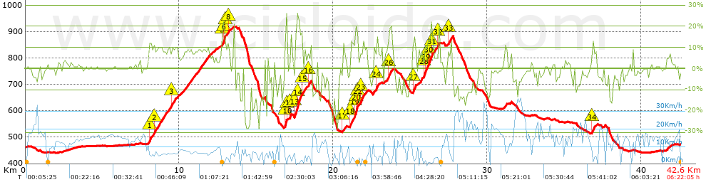


 list of points info

