Morcuera Rascafria

MTB
Ref..: 921381
Published: 29/11/2020
Performed: 28/11/2020
Distance in Km: 33.45
Climb in m: 807
IBP: 41 BYC
 View on STRAVA
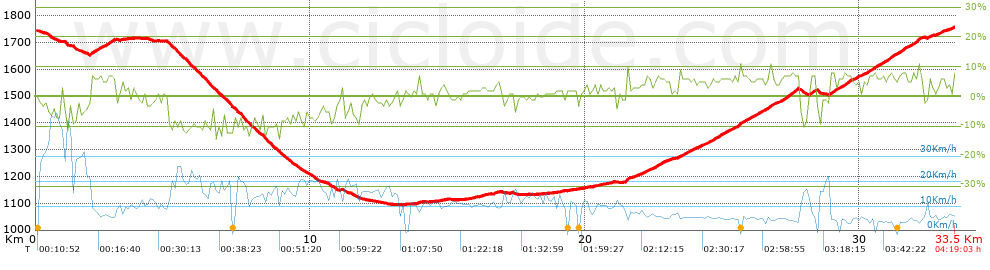


 list of points info

