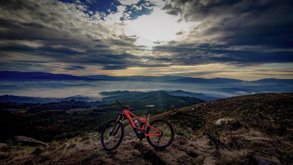
MFraga do Rei e Picaraña

MTB
MTB
Ref..: 912249
Published: 19/10/2020
Performed: 18/10/2020
Distance in Km: 35.61
Climb in m: 1241
IBP: 92 BYC

Near ...
Abelleira (Angoares), Angoares (San Pedro), Arcos (Ponteareas), Areas (Ponteareas), Canedo (Ponteareas), Celeiros (San Fins)
Endoureiro
Author: Endoureiro
350 published routes

Add to my Group or Club

 Height in m      Climb in %      Speed in Km/h      Speed < 2 Km/h

Climbs > 5%

Climbs >5% Climbs >10% Climbs >15% Climbs >20% Climbs >25%
 Steep slope of 243 m.   Average slope  Distances  Download as waypoint
1
 Km 1.115  12%  142 m
2
 Km 1.257  5%  101 m
 Steep slope of 766 m.  Average slope  Distances  Download as waypoint
3
 Km 1.639  6%  75 m
4
 Km 1.714  11%  110 m
5
 Km 1.824  9%  110 m
6
 Km 1.934  12%  131 m
7
 Km 2.065  8%  340 m
 Steep slope of 240 m.  Average slope  Distances  Download as waypoint
8
 Km 2.714  7%  240 m
 Steep slope of 406 m.  Average slope  Distances  Download as waypoint
9
 Km 3.192  14%  132 m
10
 Km 3.324  8%  274 m
 Steep slope of 268 m.  Average slope  Distances  Download as waypoint
11
 Km 3.853  9%  268 m
 Steep slope of 573 m.  Average slope  Distances  Download as waypoint
12
 Km 4.225  6%  106 m
13
 Km 4.331  12%  432 m
14
 Km 4.763  13%  35 m
 Steep slope of 332 m.  Average slope  Distances  Download as waypoint
15
 Km 4.931  6%  33 m
16
 Km 4.963  10%  165 m
17
 Km 5.129  11%  134 m
 Steep slope of 136 m.  Average slope  Distances  Download as waypoint
18
 Km 5.593  10%  136 m
 Steep slope of 234 m.  Average slope  Distances  Download as waypoint
19
 Km 5.841  8%  234 m
 Steep slope of 263 m.  Average slope  Distances  Download as waypoint
20
 Km 6.386  9%  263 m
 Steep slope of 365 m.  Average slope  Distances  Download as waypoint
21
 Km 8.199  7%  365 m
 Steep slope of 329 m.  Average slope  Distances  Download as waypoint
22
 Km 8.678  6%  329 m
 Steep slope of 1194 m.  Average slope  Distances  Download as waypoint
23
 Km 9.19  8%  1194 m
 Steep slope of 363 m.  Average slope  Distances  Download as waypoint
24
 Km 10.657  9%  267 m
25
 Km 10.924  11%  96 m
 Steep slope of 275 m.  Average slope  Distances  Download as waypoint
26
 Km 12.644  5%  67 m
27
 Km 12.712  11%  138 m
28
 Km 12.849  10%  70 m
 Steep slope of 114 m.  Average slope  Distances  Download as waypoint
29
 Km 15.775  5%  114 m
 Steep slope of 181 m.  Average slope  Distances  Download as waypoint
30
 Km 20.703  7%  181 m
 Steep slope of 106 m.  Average slope  Distances  Download as waypoint
31
 Km 22.282  7%  106 m
 Steep slope of 512 m.  Average slope  Distances  Download as waypoint
32
 Km 22.955  7%  512 m
 Steep slope of 830 m.  Average slope  Distances  Download as waypoint
33
 Km 23.57  7%  70 m
34
 Km 23.641  14%  337 m
35
 Km 23.978  9%  97 m
36
 Km 24.075  12%  261 m
37
 Km 24.336  8%  65 m
 Steep slope of 964 m.  Average slope  Distances  Download as waypoint
38
 Km 24.507  16%  96 m
39
 Km 24.602  8%  868 m
 Steep slope of 443 m.  Average slope  Distances  Download as waypoint
40
 Km 25.709  5%  73 m
41
 Km 25.782  9%  103 m
42
 Km 25.884  9%  97 m
43
 Km 25.982  10%  135 m
44
 Km 26.117  13%  35 m
 Steep slope of 104 m.  Average slope  Distances  Download as waypoint
45
 Km 27.643  7%  104 m
 Steep slope of 280 m.  Average slope  Distances  Download as waypoint
46
 Km 28.132  6%  280 m
 Steep slope of 307 m.  Average slope  Distances  Download as waypoint
47
 Km 28.74  6%  307 m
 Steep slope of 901 m.  Average slope  Distances  Download as waypoint
48
 Km 29.187  8%  901 m
 Steep slope of 506 m.  Average slope  Distances  Download as waypoint
49
 Km 30.449  5%  73 m
50
 Km 30.523  10%  102 m
51
 Km 30.624  9%  102 m
52
 Km 30.726  9%  132 m
53
 Km 30.858  11%  97 m
 Steep slope of 166 m.  Average slope  Distances  Download as waypoint
54
 Km 31.059  6%  36 m
55
 Km 31.095  12%  130 m
 Steep slope of 148 m.  Average slope  Distances  Download as waypoint
56
 Km 35.026  6%  148 m


Description of the route


Presence of ramps


 Climbs  Distance  % of the total  Speed  Your speed would be  Time  Your time would be
   15 - 30%  0.364  1.02  8.36  ?  0:02:37  ?
   10 - 15%  3.058  8.59  8.61  ?  0:21:18  ?
   5 - 10%  8.858  24.87  10.99  ?  0:48:21  ?
   1 - 5%  5.42  15.22  13.31  ?  0:24:26  ?
   Total*  17.7 Km  49.7 %  10.98 Km/h  ? Km/h    1:36:42 h  ? h  
 Flat
   1 - -1%  4.415 Km  12.4 %  16.8 Km/h  ? Km/h    0:15:46 h  ? h  
 Descents
   -1 - -5%  5.353  15.03  19.81  ?  0:16:13  ?
   -5 - -10%  3.17  8.9  18.14  ?  0:10:29  ?
   -10 - -15%  2.458  6.9  16  ?  0:09:13  ?
   -15 - -30%  2.516  7.06  15.86  ?  0:09:31  ?
   Total*  13.498 Km  37.9 %  17.83 Km/h  ? Km/h    0:45:26 h  ? h  
* The total has not necessarily coincide with the sum of the partials after correction of errors

How long would it take you?

How long would it take you to cover this route?
There are routes without a valid time information, but with your average stats you can assess the possible duration

Endoureiro to cover this route you've need a time of:   2:37:54 h 
If you sign in and have a minimum of two tracks of this same modality, you can know your time for this route, calculated from your stats..


¿Cuanto consumirá tu E-BIKE?

Entra tu E-IBP (formato n,nn)

E-IBP :   X 92 = 


 Detected activity type =  ()
 Penalization due to track conditions: 70 %   ( > 50 % = MTB, < 50 % = RDB)
 Reliability of the track: B   (1241/71/0/-/-/71)
 Correction level applied to the track: 0
DIFFICULTY OF THE ROUTE
IBP = 92 BYC
According to your statistics
 Your time in motion would be: ? h
Your average speed would be: ? Km/h
 

 Total Distance: 35.61 Km
 Analysed distance: 35.61 Km
 Linear distance: 2.46 Km

 Cumulated positive ramps: 1240.6 m  list of points info
 Cumulated negative ramps: 1222 m
 Maximum height: 381.4 m
 Minimum height: 17.6 m
 Climbing Ratio: 7.01 %
 Descent ratio: 9.05 %
 Cumulated postive ramps per Km: 34.84 m
 Cumulated negative ramps per Km: 34.32 m

 Total time: 3:09:40 h
 Time in movement: 2:37:54 h
 According to your statistics
 Your time in motion would be: ? h  
 Stopped time: 0:31:46 h
 Maximum slope filter: ~30 %
 Minimum separation analysed: ~30 m
 Number of points: 2905   (cad. 12.26 m)
 Significant waypoints: 1009   (cad. 35.3 m / 34.73 %)

 Changes in direction per Km: 11.99
 Changes in direction > 5º por Km: 9.63
 Cumulated straight stretches: 4.607 Km
 Straight stretches per Km: 129.37 m
 Penalized slope changes: 12
 Penalized slope changes per Km: 0.337

 Average speed in total: 11.27 Km/h
 Average speed while moving: 13.53 Km/h
 According to your statistics
 Your average speed would be: ? Km/h  
 Maximum sustained speed: 43.26 Km/h


Comments

You can be the first one in commenting this route

 
My comments
:
Add comment  (Registered users)
 
Notify me answers to my comment  Do not notify answers to my comment


Share this route with a friend

Your friend will receive a message with a link to this page:
will see your email and your user name if you do it as registered user.


Write here your name (optional)

E-mail address of your friend(s). You can include various addresses separated by commas

Text or comment (optional) maximum 255 characters long, 255 Available characters

As a non registered users you need to fill-in the captcha text.
  Change image
Type the image characters.
 
 Share with a friend


Visited history

Delete history

Marked routes for review later or compare

My favorites


  Notify anomaly in this route Share in Facebook