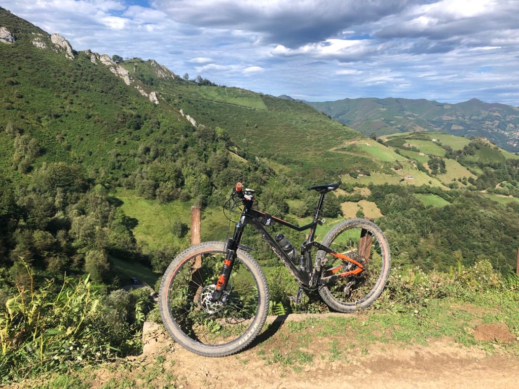
Payandi (Asturias)

MTB
MTB
Ref..: 896172
Published: 19/08/2020
Performed: 19/08/2020
Distance in Km: 31.68
Climb in m: 1126
IBP: 118 BYC

Near ...
Acebal (Pola De Laviana), Aldea (Pola De Laviana), Arbeya, La, Boza (Pola Laviana), Cabaña (Laviana), Campomojado
Daniel Sanchez 2
560 published routes

Add to my Group or Club

 Height in m      Climb in %      Speed in Km/h      Speed < 2 Km/h

Climbs > 10%

Climbs >5% Climbs >10% Climbs >15% Climbs >20% Climbs >25%
 Steep slope of 277 m.   Average slope  Distances  Download as waypoint
1
 Km 4.432  13%  277 m
 Steep slope of 235 m.  Average slope  Distances  Download as waypoint
2
 Km 5.292  16%  134 m
3
 Km 5.426  15%  101 m
 Steep slope of 109 m.  Average slope  Distances  Download as waypoint
4
 Km 6.266  11%  109 m
 Steep slope of 321 m.  Average slope  Distances  Download as waypoint
5
 Km 6.655  12%  104 m
6
 Km 7.035  11%  112 m
7
 Km 7.405  17%  105 m
 Steep slope of 434 m.  Average slope  Distances  Download as waypoint
8
 Km 8.732  20%  199 m
9
 Km 9.068  17%  98 m
10
 Km 9.166  16%  65 m
 Steep slope of 169 m.  Average slope  Distances  Download as waypoint
11
 Km 9.297  11%  33 m
12
 Km 9.33  17%  103 m
13
 Km 9.433  15%  33 m
 Steep slope of 271 m.  Average slope  Distances  Download as waypoint
14
 Km 10.092  10%  138 m
15
 Km 10.229  18%  32 m
16
 Km 10.261  18%  92 m
17
 Km 10.353  13%  101 m
 Steep slope of 528 m.  Average slope  Distances  Download as waypoint
18
 Km 12.459  14%  264 m
19
 Km 12.723  17%  232 m
20
 Km 12.955  13%  32 m
 Steep slope of 173 m.  Average slope  Distances  Download as waypoint
21
 Km 14.085  14%  173 m
 Steep slope of 367 m.  Average slope  Distances  Download as waypoint
22
 Km 15.591  13%  265 m
23
 Km 16.16  14%  102 m
 Steep slope of 101 m.  Average slope  Distances  Download as waypoint
24
 Km 16.724  13%  101 m
 Steep slope of 609 m.  Average slope  Distances  Download as waypoint
25
 Km 19.587  18%  193 m
26
 Km 19.78  13%  136 m
27
 Km 20.056  12%  141 m
28
 Km 20.338  13%  139 m
 Steep slope of 307 m.  Average slope  Distances  Download as waypoint
29
 Km 21.564  20%  102 m
30
 Km 21.666  12%  32 m


Description of the route


Presence of ramps


 Climbs  Distance  % of the total  Speed  Your speed would be  Time  Your time would be
   15 - 30%  1.999  6.31  4.42  ?  0:27:07  ?
   10 - 15%  2.666  8.42  5.14  ?  0:31:07  ?
   5 - 10%  4.266  13.46  6.92  ?  0:36:59  ?
   1 - 5%  4.198  13.25  9.09  ?  0:27:43  ?
   Total*  13.129 Km  41.44 %  6.41 Km/h  ? Km/h    2:02:56 h  ? h  
 Flat
   1 - -1%  4.253 Km  13.42 %  13.86 Km/h  ? Km/h    0:18:25 h  ? h  
 Descents
   -1 - -5%  6.484  20.47  18.18  ?  0:21:24  ?
   -5 - -10%  3.311  10.45  17.25  ?  0:11:31  ?
   -10 - -15%  2.212  6.98  10.89  ?  0:12:11  ?
   -15 - -30%  2.306  7.28  8.07  ?  0:17:09  ?
   Total*  14.314 Km  45.18 %  13.8 Km/h  ? Km/h    1:02:15 h  ? h  
* The total has not necessarily coincide with the sum of the partials after correction of errors

How long would it take you?

How long would it take you to cover this route?
There are routes without a valid time information, but with your average stats you can assess the possible duration

Daniel Sanchez 2 to cover this route you've need a time of:   3:23:36 h 
If you sign in and have a minimum of two tracks of this same modality, you can know your time for this route, calculated from your stats..


¿Cuanto consumirá tu E-BIKE?

Entra tu E-IBP (formato n,nn)

E-IBP :   X 118 = 


 Detected activity type =  ()
 Penalization due to track conditions: 78 %   ( > 50 % = MTB, < 50 % = RDB)
 Reliability of the track: B   (1126/64/0/-/-/64)
 Correction level applied to the track: 0
DIFFICULTY OF THE ROUTE
IBP = 118 BYC
According to your statistics
 Your time in motion would be: ? h
Your average speed would be: ? Km/h
 

 Total Distance: 31.68 Km
 Analysed distance: 31.68 Km
 Linear distance: 1.78 Km

 Cumulated positive ramps: 1125.94 m  list of points info
 Cumulated negative ramps: 1133.19 m
 Maximum height: 887 m
 Minimum height: 317.4 m
 Climbing Ratio: 8.58 %
 Descent ratio: 7.92 %
 Cumulated postive ramps per Km: 35.54 m
 Cumulated negative ramps per Km: 35.77 m

 Total time: 4:27:33 h
 Time in movement: 3:23:36 h
 According to your statistics
 Your time in motion would be: ? h  
 Stopped time: 1:03:57 h
 Maximum slope filter: ~30 %
 Minimum separation analysed: ~30 m
 Number of points: 2371   (cad. 13.36 m)
 Significant waypoints: 885   (cad. 35.84 m / 37.33 %)

 Changes in direction per Km: 11.58
 Changes in direction > 5º por Km: 9.25
 Cumulated straight stretches: 5.044 Km
 Straight stretches per Km: 159.22 m
 Penalized slope changes: 10
 Penalized slope changes per Km: 0.316

 Average speed in total: 7.11 Km/h
 Average speed while moving: 9.34 Km/h
 According to your statistics
 Your average speed would be: ? Km/h  
 Maximum sustained speed: 43.01 Km/h


Comments

You can be the first one in commenting this route

 
My comments
:
Add comment  (Registered users)
 
Notify me answers to my comment  Do not notify answers to my comment


Share this route with a friend

Your friend will receive a message with a link to this page:
will see your email and your user name if you do it as registered user.


Write here your name (optional)

E-mail address of your friend(s). You can include various addresses separated by commas

Text or comment (optional) maximum 255 characters long, 255 Available characters

As a non registered users you need to fill-in the captcha text.
  Change image
Type the image characters.
 
 Share with a friend


Visited history

Delete history

Marked routes for review later or compare

My favorites


  Notify anomaly in this route Share in Facebook