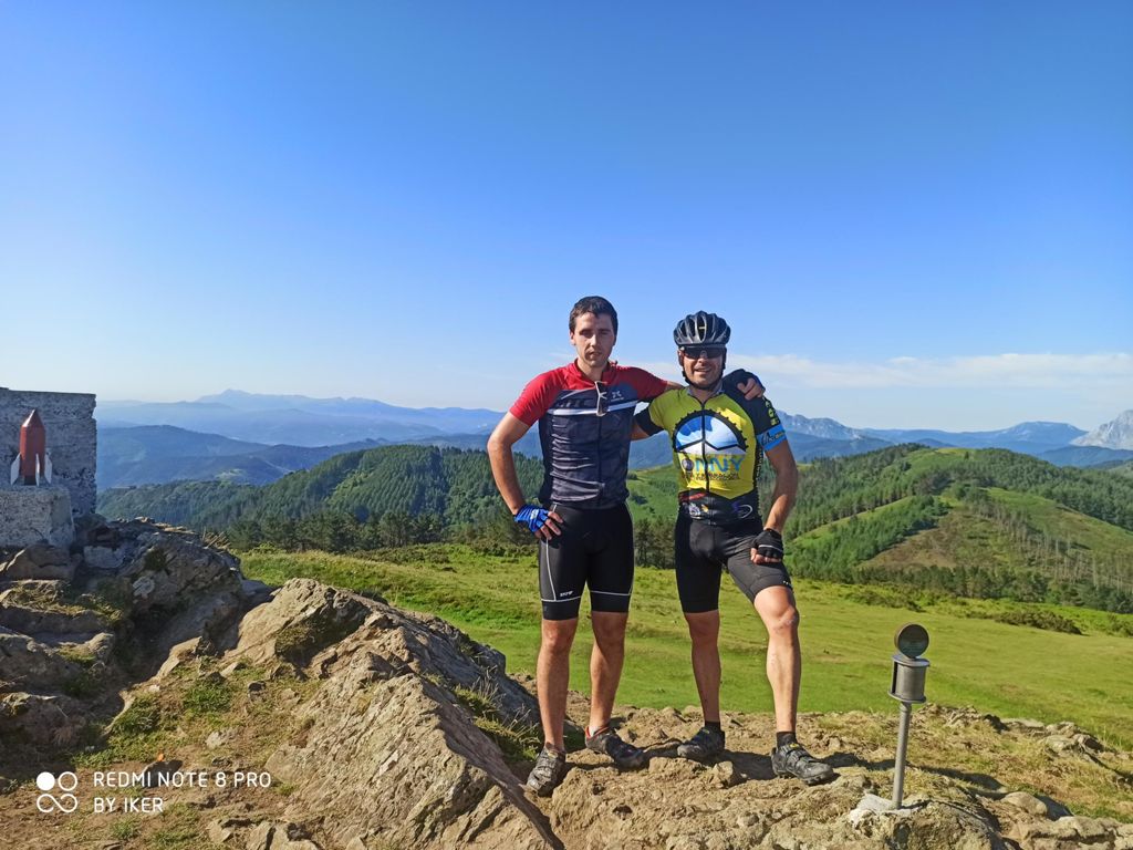
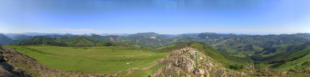
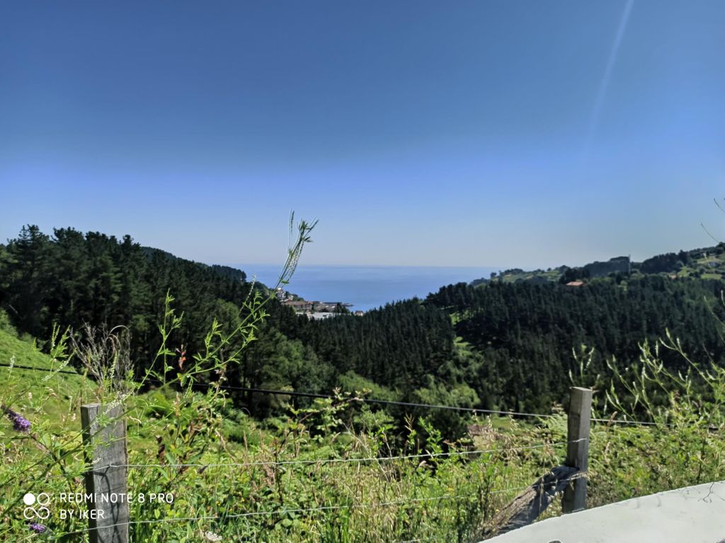
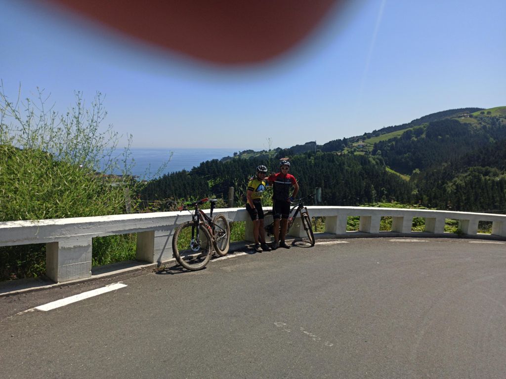
Eibar-Kalamua-Mutriku (por Arno)-Deba- Eibar BIKE-RUNNING

MTB
MTB
Ref..: 879927
Published: 22/06/2020
Performed: 21/06/2020
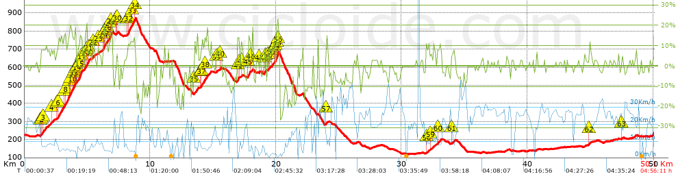
Distance in Km: 50.14
Climb in m: 1450
IBP: 125 BYC


 Height in m      Climb in %      Speed in Km/h      Speed < 2 Km/h

Climbs > 5%

Climbs >5% Climbs >10% Climbs >15% Climbs >20% Climbs >25%
 Steep slope of 833 m.   Average slope  Distances  Download as waypoint
1
 Km 1.26  7%  107 m
2
 Km 1.367  9%  108 m
3
 Km 1.476  8%  618 m
 Steep slope of 209 m.  Average slope  Distances  Download as waypoint
4
 Km 2.197  8%  209 m
 Steep slope of 1566 m.  Average slope  Distances  Download as waypoint
5
 Km 2.523  6%  179 m
6
 Km 2.701  12%  417 m
7
 Km 3.118  14%  102 m
8
 Km 3.22  14%  316 m
9
 Km 3.537  12%  102 m
10
 Km 3.638  15%  239 m
11
 Km 3.877  15%  107 m
12
 Km 3.984  19%  69 m
13
 Km 4.054  14%  35 m
 Steep slope of 1001 m.  Average slope  Distances  Download as waypoint
14
 Km 4.191  11%  178 m
15
 Km 4.369  19%  175 m
16
 Km 4.544  14%  35 m
17
 Km 4.58  6%  265 m
18
 Km 4.844  17%  71 m
19
 Km 4.915  18%  106 m
20
 Km 5.021  14%  66 m
21
 Km 5.088  10%  105 m
 Steep slope of 215 m.  Average slope  Distances  Download as waypoint
22
 Km 5.422  9%  215 m
 Steep slope of 1106 m.  Average slope  Distances  Download as waypoint
23
 Km 5.831  6%  446 m
24
 Km 6.276  19%  136 m
25
 Km 6.412  10%  145 m
26
 Km 6.557  10%  168 m
27
 Km 6.725  13%  175 m
28
 Km 6.9  19%  36 m
 Steep slope of 141 m.  Average slope  Distances  Download as waypoint
29
 Km 7.302  10%  105 m
30
 Km 7.407  11%  36 m
 Steep slope of 640 m.  Average slope  Distances  Download as waypoint
31
 Km 8.183  10%  42 m
32
 Km 8.225  13%  384 m
33
 Km 8.609  17%  145 m
34
 Km 8.754  19%  69 m
 Steep slope of 324 m.  Average slope  Distances  Download as waypoint
35
 Km 13.509  10%  324 m
 Steep slope of 863 m.  Average slope  Distances  Download as waypoint
36
 Km 13.984  8%  78 m
37
 Km 14.062  12%  317 m
38
 Km 14.379  9%  468 m
 Steep slope of 172 m.  Average slope  Distances  Download as waypoint
39
 Km 15.256  5%  172 m
 Steep slope of 115 m.  Average slope  Distances  Download as waypoint
40
 Km 15.532  7%  115 m
 Steep slope of 178 m.  Average slope  Distances  Download as waypoint
41
 Km 16.928  15%  143 m
42
 Km 17.071  9%  35 m
 Steep slope of 109 m.  Average slope  Distances  Download as waypoint
43
 Km 17.245  10%  109 m
 Steep slope of 377 m.  Average slope  Distances  Download as waypoint
44
 Km 17.775  9%  33 m
45
 Km 17.808  16%  169 m
46
 Km 17.977  7%  175 m
 Steep slope of 141 m.  Average slope  Distances  Download as waypoint
47
 Km 18.675  7%  141 m
 Steep slope of 163 m.  Average slope  Distances  Download as waypoint
48
 Km 19.062  13%  98 m
49
 Km 19.16  17%  65 m
 Steep slope of 193 m.  Average slope  Distances  Download as waypoint
50
 Km 19.337  9%  193 m
 Steep slope of 611 m.  Average slope  Distances  Download as waypoint
51
 Km 19.626  9%  197 m
52
 Km 19.822  11%  97 m
53
 Km 19.919  8%  98 m
54
 Km 20.017  15%  93 m
55
 Km 20.11  25%  93 m
56
 Km 20.203  17%  33 m
 Steep slope of 108 m.  Average slope  Distances  Download as waypoint
57
 Km 23.973  8%  108 m
 Steep slope of 186 m.  Average slope  Distances  Download as waypoint
58
 Km 31.926  6%  186 m
 Steep slope of 391 m.  Average slope  Distances  Download as waypoint
59
 Km 32.26  6%  391 m
 Steep slope of 331 m.  Average slope  Distances  Download as waypoint
60
 Km 32.839  8%  331 m
 Steep slope of 224 m.  Average slope  Distances  Download as waypoint
61
 Km 33.978  7%  224 m
 Steep slope of 132 m.  Average slope  Distances  Download as waypoint
62
 Km 44.903  7%  132 m
 Steep slope of 111 m.  Average slope  Distances  Download as waypoint
63
 Km 47.474  5%  111 m


Description of the route


Presence of ramps


 Climbs  Distance  % of the total  Speed  Your speed would be  Time  Your time would be
   15 - 30%  1.848  3.69  4.67  ?  0:23:44  ?
   10 - 15%  3.415  6.81  6.62  ?  0:30:57  ?
   5 - 10%  6.423  12.81  8.14  ?  0:47:20  ?
   1 - 5%  6.927  13.81  14.52  ?  0:28:37  ?
   Total*  18.613 Km  37.12 %  8.55 Km/h  ? Km/h    2:10:38 h  ? h  
 Flat
   1 - -1%  13.86 Km  27.64 %  18.52 Km/h  ? Km/h    0:44:54 h  ? h  
 Descents
   -1 - -5%  6.442  12.85  17.04  ?  0:22:41  ?
   -5 - -10%  6.143  12.25  20.07  ?  0:18:22  ?
   -10 - -15%  2.444  4.87  12.87  ?  0:11:24  ?
   -15 - -30%  2.643  5.27  7.75  ?  0:20:28  ?
   Total*  17.672 Km  35.24 %  14.54 Km/h  ? Km/h    1:12:55 h  ? h  
* The total has not necessarily coincide with the sum of the partials after correction of errors

How long would it take you?

How long would it take you to cover this route?
There are routes without a valid time information, but with your average stats you can assess the possible duration

Iker_Barbarrubio_Cortijo to cover this route you've need a time of:   4:08:27 h 
If you sign in and have a minimum of two tracks of this same modality, you can know your time for this route, calculated from your stats..


¿Cuanto consumirá tu E-BIKE?

Entra tu E-IBP (formato n,nn)

E-IBP :   X 125 = 


 Detected activity type =  ()
 Penalization due to track conditions: 66 %   ( > 50 % = MTB, < 50 % = RDB)
 Reliability of the track: A   (1450/75/0/-/-/75)
 Correction level applied to the track: 0
DIFFICULTY OF THE ROUTE
IBP = 125 BYC
According to your statistics
 Your time in motion would be: ? h
Your average speed would be: ? Km/h
 

 Total Distance: 50.14 Km
 Analysed distance: 50.14 Km
 Linear distance: 0.34 Km

 Cumulated positive ramps: 1450 m  list of points info
 Cumulated negative ramps: 1439 m
 Maximum height: 870.9 m
 Minimum height: 119.9 m
 Climbing Ratio: 7.79 %
 Descent ratio: 8.14 %
 Cumulated postive ramps per Km: 28.92 m
 Cumulated negative ramps per Km: 28.7 m

 Total time: 4:56:11 h
 Time in movement: 4:08:27 h
 According to your statistics
 Your time in motion would be: ? h  
 Stopped time: 0:47:44 h
 Maximum slope filter: ~30 %
 Minimum separation analysed: ~30 m
 Number of points: 3520   (cad. 14.25 m)
 Significant waypoints: 1375   (cad. 36.47 m / 39.06 %)

 Changes in direction per Km: 10.13
 Changes in direction > 5º por Km: 7.38
 Cumulated straight stretches: 10.328 Km
 Straight stretches per Km: 205.98 m
 Penalized slope changes: 16
 Penalized slope changes per Km: 0.319

 Average speed in total: 10.16 Km/h
 Average speed while moving: 12.11 Km/h
 According to your statistics
 Your average speed would be: ? Km/h  
 Maximum sustained speed: 45.47 Km/h


Comments

You can be the first one in commenting this route

 
My comments
:
Add comment  (Registered users)
 
Notify me answers to my comment  Do not notify answers to my comment


Share this route with a friend

Your friend will receive a message with a link to this page:
will see your email and your user name if you do it as registered user.


Write here your name (optional)

E-mail address of your friend(s). You can include various addresses separated by commas

Text or comment (optional) maximum 255 characters long, 255 Available characters

As a non registered users you need to fill-in the captcha text.
  Change image
Type the image characters.
 
 Share with a friend


Visited history

Delete history

Marked routes for review later or compare

My favorites


  Notify anomaly in this route Share in Facebook