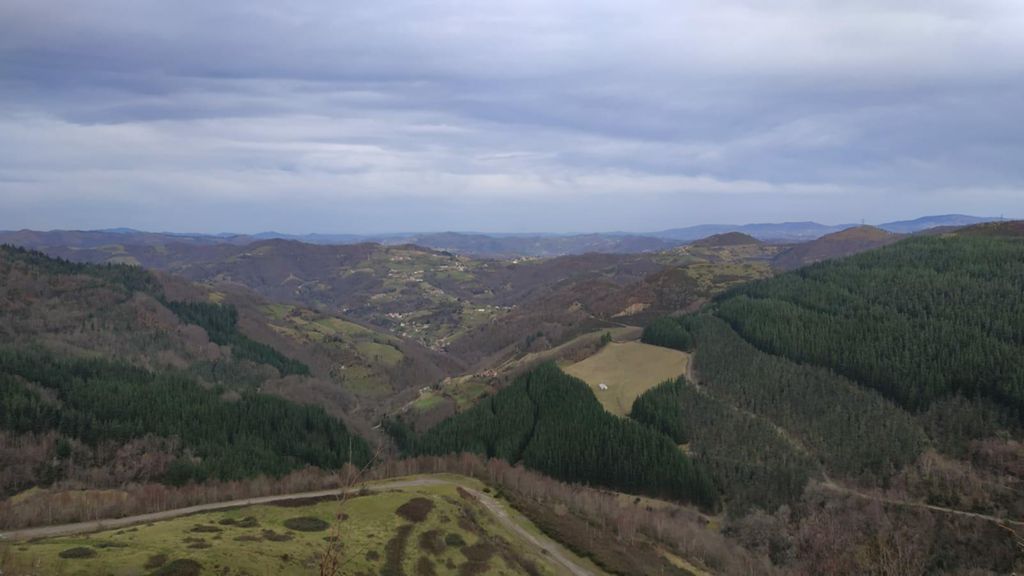
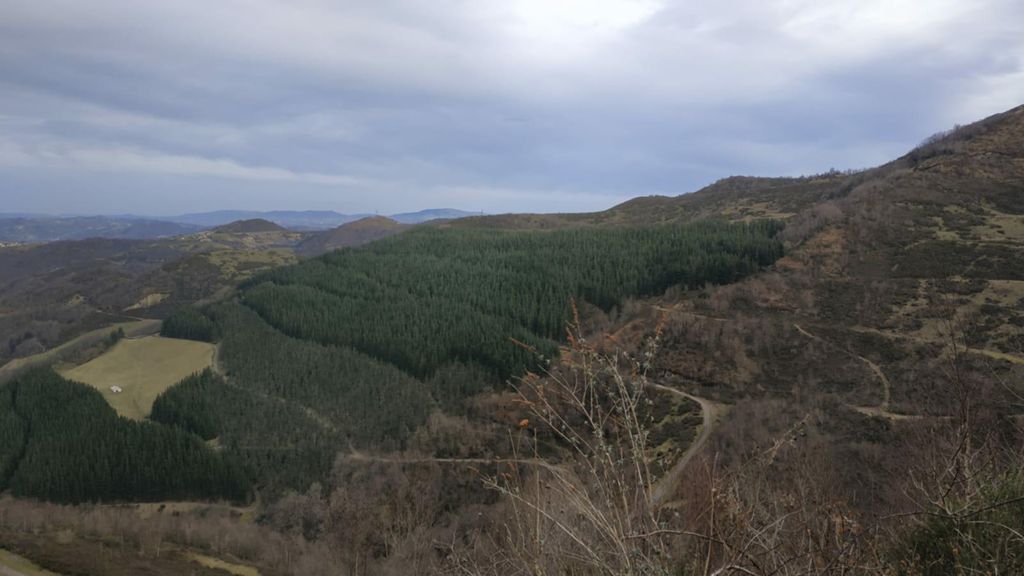
Les LLanes, Sto Emiliano,Respines,Polio, El Cabu,El Carbayu.

MTB
MTB
Ref..: 853556
Published: 15/01/2020
Performed: 14/01/2020
Distance in Km: 36.66
Climb in m: 1537
IBP: 148 BYC

Near ...
Andarujo, Artosa (Langreo), Barraca, La (Ciaño-Langreo), Barraca, La (Langreo), Barros, Bories, Les (Lada- Langreo)
Eduluna
Author: Eduluna
428 published routes

Add to my Group or Club

 Height in m      Climb in %      Speed in Km/h      Speed < 2 Km/h

Climbs > 5%

Climbs >5% Climbs >10% Climbs >15% Climbs >20% Climbs >25%
 Steep slope of 257 m.   Average slope  Distances  Download as waypoint
1
 Km 1.127  7%  257 m
 Steep slope of 415 m.  Average slope  Distances  Download as waypoint
2
 Km 1.516  10%  265 m
3
 Km 1.781  13%  34 m
4
 Km 1.815  20%  116 m
 Steep slope of 469 m.  Average slope  Distances  Download as waypoint
5
 Km 2.047  16%  220 m
6
 Km 2.267  14%  146 m
7
 Km 2.413  19%  68 m
8
 Km 2.482  15%  35 m
 Steep slope of 101 m.  Average slope  Distances  Download as waypoint
9
 Km 2.622  8%  101 m
 Steep slope of 375 m.  Average slope  Distances  Download as waypoint
10
 Km 3.228  8%  375 m
 Steep slope of 156 m.  Average slope  Distances  Download as waypoint
11
 Km 3.776  7%  156 m
 Steep slope of 930 m.  Average slope  Distances  Download as waypoint
12
 Km 4.079  8%  930 m
 Steep slope of 208 m.  Average slope  Distances  Download as waypoint
13
 Km 5.39  6%  208 m
 Steep slope of 178 m.  Average slope  Distances  Download as waypoint
14
 Km 8.349  8%  178 m
 Steep slope of 109 m.  Average slope  Distances  Download as waypoint
15
 Km 8.709  9%  109 m
 Steep slope of 127 m.  Average slope  Distances  Download as waypoint
16
 Km 8.991  6%  127 m
 Steep slope of 372 m.  Average slope  Distances  Download as waypoint
17
 Km 9.894  7%  161 m
18
 Km 10.055  12%  211 m
 Steep slope of 290 m.  Average slope  Distances  Download as waypoint
19
 Km 10.391  9%  37 m
20
 Km 10.428  12%  209 m
21
 Km 10.636  10%  44 m
 Steep slope of 980 m.  Average slope  Distances  Download as waypoint
22
 Km 11.209  8%  66 m
23
 Km 11.275  13%  105 m
24
 Km 11.38  5%  124 m
25
 Km 11.503  22%  135 m
26
 Km 11.639  9%  116 m
27
 Km 11.754  16%  82 m
28
 Km 11.836  23%  102 m
29
 Km 11.938  10%  75 m
30
 Km 12.013  10%  175 m
 Steep slope of 207 m.  Average slope  Distances  Download as waypoint
31
 Km 12.623  6%  36 m
32
 Km 12.659  23%  125 m
33
 Km 12.784  15%  46 m
 Steep slope of 185 m.  Average slope  Distances  Download as waypoint
34
 Km 13.103  13%  185 m
 Steep slope of 299 m.  Average slope  Distances  Download as waypoint
35
 Km 14.079  13%  64 m
36
 Km 14.143  16%  196 m
37
 Km 14.339  28%  39 m
 Steep slope of 270 m.  Average slope  Distances  Download as waypoint
38
 Km 14.909  16%  140 m
39
 Km 15.049  7%  130 m
 Steep slope of 96 m.  Average slope  Distances  Download as waypoint
40
 Km 15.306  9%  96 m
 Steep slope of 170 m.  Average slope  Distances  Download as waypoint
41
 Km 15.533  12%  33 m
42
 Km 15.567  17%  100 m
43
 Km 15.667  11%  37 m
 Steep slope of 114 m.  Average slope  Distances  Download as waypoint
44
 Km 15.82  13%  114 m
 Steep slope of 635 m.  Average slope  Distances  Download as waypoint
45
 Km 16.13  6%  41 m
46
 Km 16.171  14%  310 m
47
 Km 16.481  9%  284 m
 Steep slope of 291 m.  Average slope  Distances  Download as waypoint
48
 Km 16.951  12%  105 m
49
 Km 17.056  19%  186 m
 Steep slope of 108 m.  Average slope  Distances  Download as waypoint
50
 Km 18.286  6%  108 m
 Steep slope of 146 m.  Average slope  Distances  Download as waypoint
51
 Km 18.512  7%  146 m
 Steep slope of 1453 m.  Average slope  Distances  Download as waypoint
52
 Km 20.074  6%  297 m
53
 Km 20.371  12%  663 m
54
 Km 21.034  11%  125 m
55
 Km 21.158  13%  296 m
56
 Km 21.454  9%  72 m
 Steep slope of 108 m.  Average slope  Distances  Download as waypoint
57
 Km 21.636  10%  108 m
 Steep slope of 505 m.  Average slope  Distances  Download as waypoint
58
 Km 21.992  9%  505 m
 Steep slope of 697 m.  Average slope  Distances  Download as waypoint
59
 Km 22.774  12%  404 m
60
 Km 23.178  6%  293 m
 Steep slope of 366 m.  Average slope  Distances  Download as waypoint
61
 Km 25.415  8%  366 m
 Steep slope of 355 m.  Average slope  Distances  Download as waypoint
62
 Km 26.089  6%  355 m
 Steep slope of 348 m.  Average slope  Distances  Download as waypoint
63
 Km 30.125  8%  51 m
64
 Km 30.176  12%  211 m
65
 Km 30.387  11%  86 m
 Steep slope of 158 m.  Average slope  Distances  Download as waypoint
66
 Km 31.174  5%  55 m
67
 Km 31.229  16%  103 m
 Steep slope of 275 m.  Average slope  Distances  Download as waypoint
68
 Km 32.725  19%  125 m
69
 Km 32.85  23%  30 m
70
 Km 32.879  8%  89 m
71
 Km 32.969  14%  31 m


Description of the route


Presence of ramps


 Climbs  Distance  % of the total  Speed  Your speed would be  Time  Your time would be
   15 - 30%  2.34  6.38  5.26  ?  0:26:42  ?
   10 - 15%  3.999  10.91  6.19  ?  0:38:46  ?
   5 - 10%  6.302  17.19  7.37  ?  0:51:17  ?
   1 - 5%  5.041  13.75  9.05  ?  0:33:25  ?
   Total*  17.682 Km  48.23 %  7.06 Km/h  ? Km/h    2:30:10 h  ? h  
 Flat
   1 - -1%  2.752 Km  7.51 %  11.43 Km/h  ? Km/h    0:14:27 h  ? h  
 Descents
   -1 - -5%  4.674  12.75  13.05  ?  0:21:29  ?
   -5 - -10%  4.776  13.03  13.63  ?  0:21:01  ?
   -10 - -15%  3.757  10.25  16.59  ?  0:13:35  ?
   -15 - -30%  3.027  8.26  11.88  ?  0:15:17  ?
   Total*  16.234 Km  44.28 %  13.65 Km/h  ? Km/h    1:11:22 h  ? h  
* The total has not necessarily coincide with the sum of the partials after correction of errors

How long would it take you?

How long would it take you to cover this route?
There are routes without a valid time information, but with your average stats you can assess the possible duration

Eduluna to cover this route you've need a time of:   3:55:59 h 
If you sign in and have a minimum of two tracks of this same modality, you can know your time for this route, calculated from your stats..


¿Cuanto consumirá tu E-BIKE?

Entra tu E-IBP (formato n,nn)

E-IBP :   X 148 = 


 Detected activity type =  ()
 Penalization due to track conditions: 82 %   ( > 50 % = MTB, < 50 % = RDB)
 Reliability of the track: B   (1540/65/0/-/-/65)
 Correction level applied to the track: 0
DIFFICULTY OF THE ROUTE
IBP = 148 BYC
According to your statistics
 Your time in motion would be: ? h
Your average speed would be: ? Km/h
 

 Total Distance: 36.66 Km
 Analysed distance: 36.66 Km
 Linear distance: 0.03 Km

 Cumulated positive ramps: 1536.59 m  list of points info
 Cumulated negative ramps: 1538.39 m
 Maximum height: 1023.1 m
 Minimum height: 214.2 m
 Climbing Ratio: 8.69 %
 Descent ratio: 9.48 %
 Cumulated postive ramps per Km: 41.91 m
 Cumulated negative ramps per Km: 41.96 m

 Total time: 4:25:49 h
 Time in movement: 3:55:59 h
 According to your statistics
 Your time in motion would be: ? h  
 Stopped time: 0:29:50 h
 Maximum slope filter: ~30 %
 Minimum separation analysed: ~30 m
 Number of points: 1751   (cad. 20.94 m)
 Significant waypoints: 886   (cad. 41.43 m / 50.6 %)

 Changes in direction per Km: 10.09
 Changes in direction > 5º por Km: 8.4
 Cumulated straight stretches: 4.155 Km
 Straight stretches per Km: 113.34 m
 Penalized slope changes: 15
 Penalized slope changes per Km: 0.409

 Average speed in total: 8.28 Km/h
 Average speed while moving: 9.32 Km/h
 According to your statistics
 Your average speed would be: ? Km/h  
 Maximum sustained speed: 49.29 Km/h


Comments

You can be the first one in commenting this route

 
My comments
:
Add comment  (Registered users)
 
Notify me answers to my comment  Do not notify answers to my comment


Share this route with a friend

Your friend will receive a message with a link to this page:
will see your email and your user name if you do it as registered user.


Write here your name (optional)

E-mail address of your friend(s). You can include various addresses separated by commas

Text or comment (optional) maximum 255 characters long, 255 Available characters

As a non registered users you need to fill-in the captcha text.
  Change image
Type the image characters.
 
 Share with a friend


Visited history

Delete history

Marked routes for review later or compare

My favorites


  Notify anomaly in this route Share in Facebook