Sra da M¾

Road
Ref..: 462348
Published: 25/08/2018
Performed: 25/08/2018
Distance in Km: 104.11
Climb in m: 1776
IBP: 110 BYC
 View on STRAVA
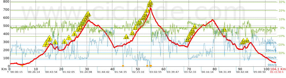


 list of points info

