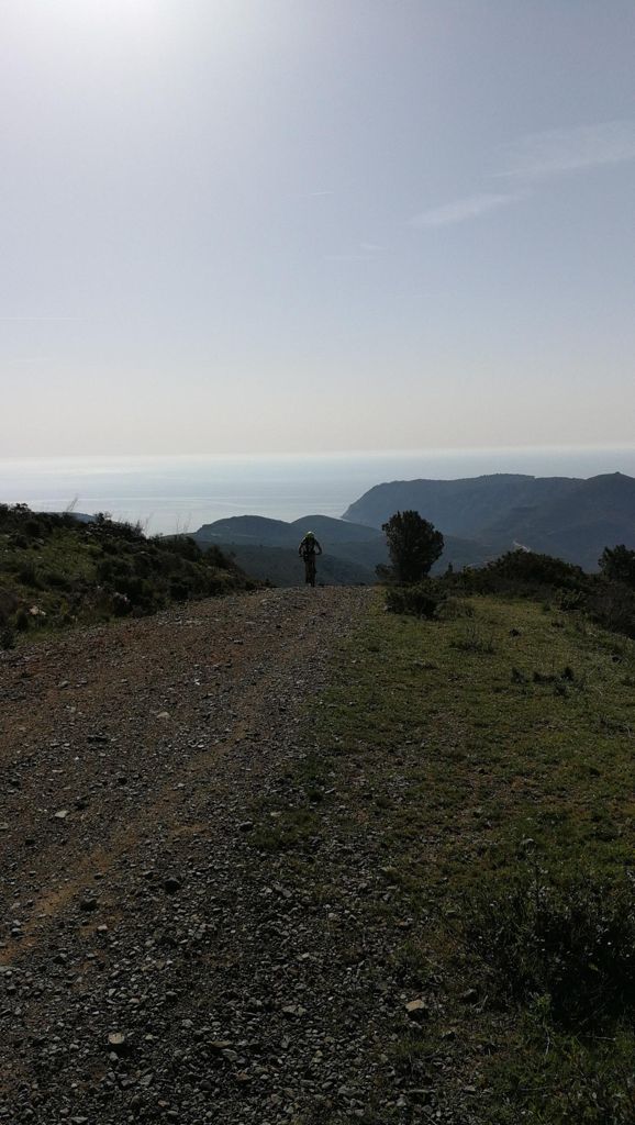
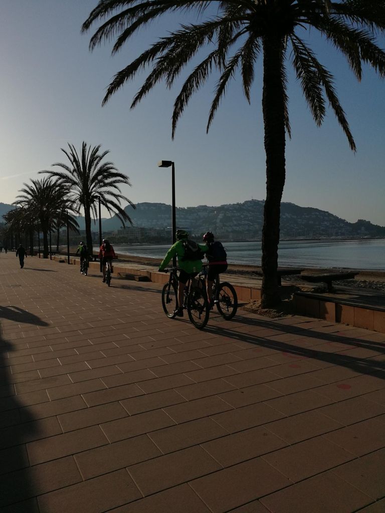
Roses a Cadaqués per cala Nans

MTB
MTB
Ref..: 386191
Published: 21/04/2018
Performed: 21/04/2018
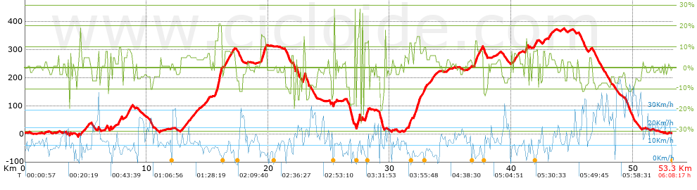
Distance in Km: 53.23
Climb in m: 1432
IBP: 116 BYC

Near ...
Canyelles Almadraba (Ajuntament Roses), Mas Fumats, El, Mas Oliva, El, Roses
jarcass
Author: jarcass
1339 published routes

Add to my Group or Club

 Height in m      Climb in %      Speed in Km/h      Speed < 2 Km/h

Climbs > 10%

Climbs >5% Climbs >10% Climbs >15% Climbs >20% Climbs >25%
 Steep slope of 106 m.   Average slope  Distances  Download as waypoint
1
 Km 4.52  10%  106 m
 Steep slope of 229 m.  Average slope  Distances  Download as waypoint
2
 Km 7.71  10%  229 m
 Steep slope of 583 m.  Average slope  Distances  Download as waypoint
3
 Km 15.622  13%  242 m
4
 Km 15.864  16%  35 m
5
 Km 15.899  21%  241 m
6
 Km 16.14  18%  65 m
 Steep slope of 394 m.  Average slope  Distances  Download as waypoint
7
 Km 19.429  15%  229 m
8
 Km 19.658  14%  165 m
 Steep slope of 174 m.  Average slope  Distances  Download as waypoint
9
 Km 22.871  15%  174 m
 Steep slope of 306 m.  Average slope  Distances  Download as waypoint
10
 Km 27.271  16%  306 m
 Steep slope of 106 m.  Average slope  Distances  Download as waypoint
11
 Km 27.71  26%  106 m
 Steep slope of 402 m.  Average slope  Distances  Download as waypoint
12
 Km 27.92  12%  402 m
 Steep slope of 226 m.  Average slope  Distances  Download as waypoint
13
 Km 31.551  12%  226 m
 Steep slope of 523 m.  Average slope  Distances  Download as waypoint
14
 Km 31.981  12%  260 m
15
 Km 32.241  15%  228 m
16
 Km 32.469  12%  35 m
 Steep slope of 253 m.  Average slope  Distances  Download as waypoint
17
 Km 36.979  13%  253 m
 Steep slope of 160 m.  Average slope  Distances  Download as waypoint
18
 Km 41.176  14%  160 m


Description of the route


Presence of ramps


 Climbs  Distance  % of the total  Speed  Your speed would be  Time  Your time would be
   15 - 30%  1.288  2.42  7.24  ?  0:10:40  ?
   10 - 15%  2.662  5.01  6.76  ?  0:23:38  ?
   5 - 10%  7.84  14.75  8.63  ?  0:54:30  ?
   1 - 5%  11.174  21.02  10.71  ?  1:02:37  ?
   Total*  22.963 Km  43.19 %  9.1 Km/h  ? Km/h    2:31:25 h  ? h  
 Flat
   1 - -1%  7.669 Km  14.42 %  11.7 Km/h  ? Km/h    0:39:20 h  ? h  
 Descents
   -1 - -5%  11.224  21.11  15.33  ?  0:43:56  ?
   -5 - -10%  7.15  13.45  17.64  ?  0:24:19  ?
   -10 - -15%  2.806  5.28  16.34  ?  0:10:18  ?
   -15 - -30%  1.461  2.75  8.25  ?  0:10:38  ?
   Total*  22.641 Km  42.58 %  15.23 Km/h  ? Km/h    1:29:11 h  ? h  
* The total has not necessarily coincide with the sum of the partials after correction of errors

How long would it take you?

How long would it take you to cover this route?
There are routes without a valid time information, but with your average stats you can assess the possible duration

jarcass to cover this route you've need a time of:   4:39:56 h 
If you sign in and have a minimum of two tracks of this same modality, you can know your time for this route, calculated from your stats..


¿Cuanto consumirá tu E-BIKE?

Entra tu E-IBP (formato n,nn)

E-IBP :   X 116 = 


 Detected activity type =  ()
 Penalization due to track conditions: 78 %   ( > 50 % = MTB, < 50 % = RDB)
 Reliability of the track: C   (1609/51/1/16/-/70)
 Correction level applied to the track: 1        See analyis without corrections
DIFFICULTY OF THE ROUTE
IBP = 116 BYC
According to your statistics
 Your time in motion would be: ? h
Your average speed would be: ? Km/h
 

 Total Distance: 53.17 Km
 Analysed distance: 53.17 Km
 Linear distance: 0.01 Km

 Cumulated positive ramps: 1432.43 m  list of points info
 Cumulated negative ramps: 1435.47 m
 Maximum height: 376.19 m
 Minimum height: -9.62 m
 Climbing Ratio: 6.24 %
 Descent ratio: 6.34 %
 Cumulated postive ramps per Km: 26.94 m
 Cumulated negative ramps per Km: 27 m

 Total time: 6:08:17 h
 Time in movement: 4:39:56 h
 According to your statistics
 Your time in motion would be: ? h  
 Stopped time: 1:28:21 h
 Maximum slope filter: ~30 %
 Minimum separation analysed: ~30 m
 Number of points: 4522   (cad. 11.76 m)
 Significant waypoints: 1527   (cad. 34.84 m / 33.77 %)

 Changes in direction per Km: 11.36
 Changes in direction > 5º por Km: 8.22
 Cumulated straight stretches: 8.111 Km
 Straight stretches per Km: 152.55 m
 Penalized slope changes: 17
 Penalized slope changes per Km: 0.32

 Average speed in total: 8.66 Km/h
 Average speed while moving: 11.4 Km/h
 According to your statistics
 Your average speed would be: ? Km/h  
 Maximum sustained speed: 49.28 Km/h


Comments

You can be the first one in commenting this route

 
My comments
:
Add comment  (Registered users)
 
Notify me answers to my comment  Do not notify answers to my comment


Share this route with a friend

Your friend will receive a message with a link to this page:
will see your email and your user name if you do it as registered user.


Write here your name (optional)

E-mail address of your friend(s). You can include various addresses separated by commas

Text or comment (optional) maximum 255 characters long, 255 Available characters

As a non registered users you need to fill-in the captcha text.
  Change image
Type the image characters.
 
 Share with a friend


Visited history

Delete history

Marked routes for review later or compare

My favorites


  Notify anomaly in this route Share in Facebook