El Atazar Torrejón y Cabeza Antón

MTB
Ref..: 355273
Published: 13/02/2018
Performed: 03/02/2018
Distance in Km: 20.42
Climb in m: 1044
IBP: 117 BYC
 Not from STRAVA
Near ...
Atazar, El
Atazar, El
 No activities
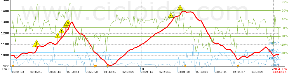


 list of points info

