Calicanto-Buńol-Pforata-Vgaeta-Macastre-Turís-Godelleta-Calicanto

Road
Ref..: 140218
Published: 01/03/2016
Performed: 01/03/2016
Distance in Km: 111.22
Climb in m: 1953
IBP: 121 BYC
 Not from STRAVA
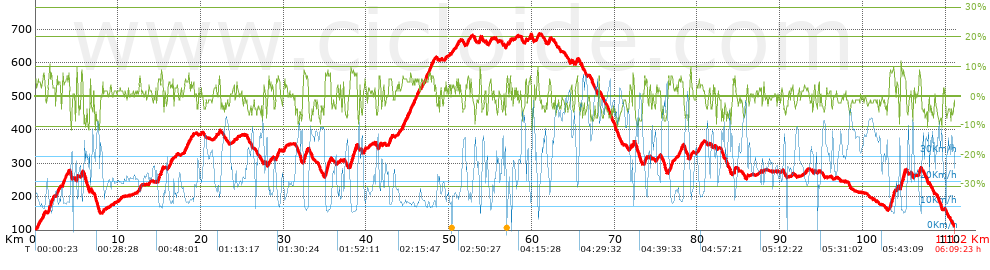


 list of points info

