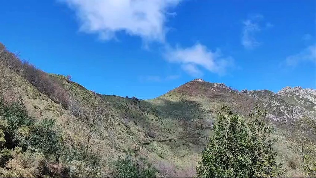
Anzò.Trapa, Prieres, Coballes, Campa La cruz, La Trapa, Coballes,Anzò.

MTB
MTB
Ref..: 1146759
Published: 19/04/2024
Performed: 18/04/2024
Distance in Km: 36.29
Climb in m: 1626
IBP: 174 BYC

Near ...
Agues, Anzo (Sobrescobio), Campiellos, Ladines (Sobrescobio), Polina, La, Rioseco De Sobrescobio
Eduluna
Author: Eduluna
428 published routes

Add to my Group or Club

 Height in m      Climb in %      Speed in Km/h      Speed < 2 Km/h

Climbs > 10%

Climbs >5% Climbs >10% Climbs >15% Climbs >20% Climbs >25%
 Steep slope of 1264 m.   Average slope  Distances  Download as waypoint
1
 Km 0.138  14%  177 m
2
 Km 0.315  10%  126 m
3
 Km 0.441  12%  129 m
4
 Km 0.57  18%  125 m
5
 Km 0.695  27%  548 m
6
 Km 1.243  12%  285 m
 Steep slope of 1287 m.  Average slope  Distances  Download as waypoint
7
 Km 1.69  10%  128 m
8
 Km 1.819  16%  230 m
9
 Km 2.048  19%  30 m
10
 Km 2.268  13%  291 m
11
 Km 2.559  17%  128 m
12
 Km 2.688  14%  128 m
13
 Km 2.815  13%  185 m
14
 Km 3  12%  94 m
15
 Km 3.285  10%  98 m
 Steep slope of 256 m.  Average slope  Distances  Download as waypoint
16
 Km 3.778  13%  256 m
 Steep slope of 973 m.  Average slope  Distances  Download as waypoint
17
 Km 5.145  14%  33 m
18
 Km 5.179  18%  267 m
19
 Km 5.551  10%  303 m
20
 Km 5.854  13%  33 m
21
 Km 5.887  17%  240 m
22
 Km 6.261  14%  33 m
23
 Km 6.293  22%  128 m
 Steep slope of 128 m.  Average slope  Distances  Download as waypoint
24
 Km 6.637  14%  128 m
 Steep slope of 2189 m.  Average slope  Distances  Download as waypoint
25
 Km 17.316  14%  100 m
26
 Km 17.652  11%  108 m
27
 Km 17.935  13%  71 m
28
 Km 18.006  17%  158 m
29
 Km 18.165  16%  33 m
30
 Km 18.326  15%  555 m
31
 Km 18.977  10%  133 m
32
 Km 19.11  10%  103 m
33
 Km 19.213  10%  162 m
34
 Km 19.375  17%  258 m
35
 Km 19.633  13%  98 m
36
 Km 19.73  13%  513 m
 Steep slope of 502 m.  Average slope  Distances  Download as waypoint
37
 Km 21.163  11%  129 m
38
 Km 21.292  18%  91 m
39
 Km 21.383  19%  282 m
 Steep slope of 607 m.  Average slope  Distances  Download as waypoint
40
 Km 21.768  28%  574 m
41
 Km 22.342  14%  33 m
 Steep slope of 164 m.  Average slope  Distances  Download as waypoint
42
 Km 23.746  12%  164 m
 Steep slope of 161 m.  Average slope  Distances  Download as waypoint
43
 Km 24.077  11%  161 m


Description of the route


Presence of ramps


 Climbs  Distance  % of the total  Speed  Your speed would be  Time  Your time would be
   15 - 30%  4.164  11.48  3.56  ?  1:10:06  ?
   10 - 15%  3.195  8.81  5.04  ?  0:38:02  ?
   5 - 10%  3.429  9.45  6.74  ?  0:30:31  ?
   1 - 5%  4.389  12.1  11.29  ?  0:23:19  ?
   Total*  15.178 Km  41.83 %  5.62 Km/h  ? Km/h    2:41:58 h  ? h  
 Flat
   1 - -1%  5.171 Km  14.25 %  17.2 Km/h  ? Km/h    0:18:02 h  ? h  
 Descents
   -1 - -5%  4.804  13.24  16.84  ?  0:17:07  ?
   -5 - -10%  3.871  10.67  20.4  ?  0:11:23  ?
   -10 - -15%  3.351  9.23  22.09  ?  0:09:06  ?
   -15 - -30%  3.913  10.78  19.98  ?  0:11:45  ?
   Total*  15.938 Km  43.92 %  19.38 Km/h  ? Km/h    0:49:21 h  ? h  
* The total has not necessarily coincide with the sum of the partials after correction of errors

How long would it take you?

How long would it take you to cover this route?
There are routes without a valid time information, but with your average stats you can assess the possible duration

Eduluna to cover this route you've need a time of:   3:49:21 h 
If you sign in and have a minimum of two tracks of this same modality, you can know your time for this route, calculated from your stats..


¿Cuanto consumirá tu E-BIKE?

Entra tu E-IBP (formato n,nn)

E-IBP :   X 174 = 


 Detected activity type =  ()
 Penalization due to track conditions: 72 %   ( > 50 % = MTB, < 50 % = RDB)
 Reliability of the track: A   (1629/75/0/-/-/75)
 Correction level applied to the track: 0
DIFFICULTY OF THE ROUTE
IBP = 174 BYC
According to your statistics
 Your time in motion would be: ? h
Your average speed would be: ? Km/h
 

 Total Distance: 36.29 Km
 Analysed distance: 36.29 Km
 Linear distance: 0.06 Km

 Cumulated positive ramps: 1625.98 m  list of points info
 Cumulated negative ramps: 1628.78 m
 Maximum height: 1123 m
 Minimum height: 406.4 m
 Climbing Ratio: 10.71 %
 Descent ratio: 10.22 %
 Cumulated postive ramps per Km: 44.81 m
 Cumulated negative ramps per Km: 44.88 m

 Total time: 4:26:13 h
 Time in movement: 3:49:21 h
 According to your statistics
 Your time in motion would be: ? h  
 Stopped time: 0:36:52 h
 Maximum slope filter: ~30 %
 Minimum separation analysed: ~30 m
 Number of points: 2715   (cad. 13.37 m)
 Significant waypoints: 986   (cad. 36.8 m / 36.32 %)

 Changes in direction per Km: 10.5
 Changes in direction > 5º por Km: 8.38
 Cumulated straight stretches: 5.004 Km
 Straight stretches per Km: 137.89 m
 Penalized slope changes: 14
 Penalized slope changes per Km: 0.386

 Average speed in total: 8.18 Km/h
 Average speed while moving: 9.49 Km/h
 According to your statistics
 Your average speed would be: ? Km/h  
 Maximum sustained speed: 71.12 Km/h


Comments

You can be the first one in commenting this route

 
My comments
:
Add comment  (Registered users)
 
Notify me answers to my comment  Do not notify answers to my comment


Share this route with a friend

Your friend will receive a message with a link to this page:
will see your email and your user name if you do it as registered user.


Write here your name (optional)

E-mail address of your friend(s). You can include various addresses separated by commas

Text or comment (optional) maximum 255 characters long, 255 Available characters

As a non registered users you need to fill-in the captcha text.
  Change image
Type the image characters.
 
 Share with a friend


Visited history

Delete history

Marked routes for review later or compare

My favorites


  Notify anomaly in this route Share in Facebook