montnegre-ramio

MTB
Ref..: 1132130
Published: 16/12/2023
Performed: 15/12/2023
Distance in Km: 55.76
Climb in m: 1096
IBP: 82 BYC
 Not from STRAVA
Near ...
Batlloria, La (Sant Celoni), Campins, Sant Celoni
Batlloria, La (Sant Celoni), Campins, Sant Celoni
 No activities
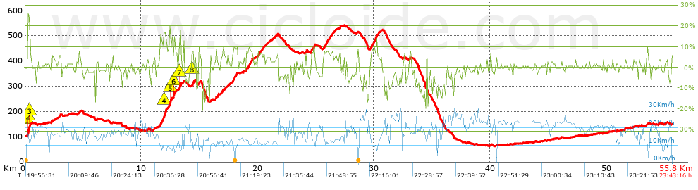


 list of points info

