CICLI. SERRALADA MARINA

MTB
MTB
Ref..: 1037475
Published: 11/04/2022
Performed: 07/04/2022
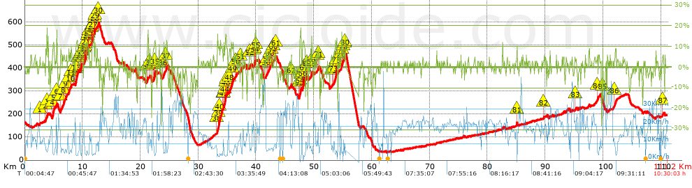
Distance in Km: 111.19
Climb in m: 2356
IBP: 180 BYC

Near ...
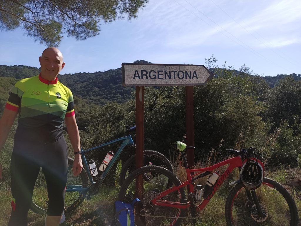
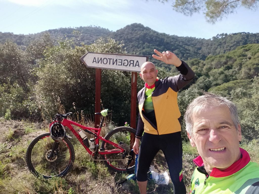
Batlloria, La (Sant Celoni), Sant Celoni, Santa Maria De Palautordera

 Height in m      Climb in %      Speed in Km/h      Speed < 2 Km/h

Climbs > 5%

Climbs >5% Climbs >10% Climbs >15% Climbs >20% Climbs >25%
 Steep slope of 108 m.   Average slope  Distances  Download as waypoint
1
 Km 2.606  7%  108 m
 Steep slope of 307 m.  Average slope  Distances  Download as waypoint
2
 Km 3.592  5%  240 m
3
 Km 3.833  15%  67 m
 Steep slope of 459 m.  Average slope  Distances  Download as waypoint
4
 Km 4.803  13%  194 m
5
 Km 4.997  8%  265 m
 Steep slope of 134 m.  Average slope  Distances  Download as waypoint
6
 Km 5.477  9%  134 m
 Steep slope of 364 m.  Average slope  Distances  Download as waypoint
7
 Km 6.173  6%  364 m
 Steep slope of 301 m.  Average slope  Distances  Download as waypoint
8
 Km 6.672  8%  301 m
 Steep slope of 230 m.  Average slope  Distances  Download as waypoint
9
 Km 7.076  7%  230 m
 Steep slope of 291 m.  Average slope  Distances  Download as waypoint
10
 Km 7.579  8%  291 m
 Steep slope of 131 m.  Average slope  Distances  Download as waypoint
11
 Km 7.966  8%  131 m
 Steep slope of 615 m.  Average slope  Distances  Download as waypoint
12
 Km 8.756  8%  100 m
13
 Km 8.856  12%  289 m
14
 Km 9.145  8%  226 m
 Steep slope of 321 m.  Average slope  Distances  Download as waypoint
15
 Km 9.583  7%  99 m
16
 Km 9.682  11%  97 m
17
 Km 9.779  9%  125 m
 Steep slope of 456 m.  Average slope  Distances  Download as waypoint
18
 Km 10.242  7%  138 m
19
 Km 10.38  12%  94 m
20
 Km 10.474  11%  95 m
21
 Km 10.569  12%  129 m
 Steep slope of 128 m.  Average slope  Distances  Download as waypoint
22
 Km 10.831  12%  128 m
 Steep slope of 160 m.  Average slope  Distances  Download as waypoint
23
 Km 10.99  8%  63 m
24
 Km 11.053  8%  97 m
 Steep slope of 616 m.  Average slope  Distances  Download as waypoint
25
 Km 11.613  6%  34 m
26
 Km 11.646  12%  163 m
27
 Km 11.809  9%  258 m
28
 Km 12.067  12%  97 m
29
 Km 12.164  8%  64 m
 Steep slope of 95 m.  Average slope  Distances  Download as waypoint
30
 Km 12.705  7%  95 m
 Steep slope of 228 m.  Average slope  Distances  Download as waypoint
31
 Km 21.127  10%  228 m
 Steep slope of 106 m.  Average slope  Distances  Download as waypoint
32
 Km 21.571  7%  106 m
 Steep slope of 420 m.  Average slope  Distances  Download as waypoint
33
 Km 22.229  6%  133 m
34
 Km 22.361  13%  128 m
35
 Km 22.489  10%  159 m
 Steep slope of 331 m.  Average slope  Distances  Download as waypoint
36
 Km 23.911  8%  331 m
 Steep slope of 295 m.  Average slope  Distances  Download as waypoint
37
 Km 24.396  7%  295 m
 Steep slope of 1025 m.  Average slope  Distances  Download as waypoint
38
 Km 33.159  7%  295 m
39
 Km 33.454  13%  231 m
40
 Km 33.686  10%  499 m
 Steep slope of 712 m.  Average slope  Distances  Download as waypoint
41
 Km 34.286  5%  108 m
42
 Km 34.394  11%  130 m
43
 Km 34.524  10%  92 m
44
 Km 34.616  13%  123 m
45
 Km 34.739  14%  65 m
46
 Km 34.804  16%  32 m
47
 Km 34.835  9%  162 m
 Steep slope of 395 m.  Average slope  Distances  Download as waypoint
48
 Km 35.348  7%  395 m
 Steep slope of 324 m.  Average slope  Distances  Download as waypoint
49
 Km 35.843  8%  324 m
 Steep slope of 262 m.  Average slope  Distances  Download as waypoint
50
 Km 36.509  6%  262 m
 Steep slope of 295 m.  Average slope  Distances  Download as waypoint
51
 Km 37.288  7%  295 m
 Steep slope of 167 m.  Average slope  Distances  Download as waypoint
52
 Km 38.822  5%  167 m
 Steep slope of 203 m.  Average slope  Distances  Download as waypoint
53
 Km 39.639  5%  170 m
54
 Km 39.81  12%  33 m
 Steep slope of 98 m.  Average slope  Distances  Download as waypoint
55
 Km 39.939  5%  98 m
 Steep slope of 202 m.  Average slope  Distances  Download as waypoint
56
 Km 41.669  6%  202 m
 Steep slope of 265 m.  Average slope  Distances  Download as waypoint
57
 Km 41.967  6%  265 m
 Steep slope of 232 m.  Average slope  Distances  Download as waypoint
58
 Km 42.336  6%  232 m
 Steep slope of 204 m.  Average slope  Distances  Download as waypoint
59
 Km 42.674  5%  204 m
 Steep slope of 100 m.  Average slope  Distances  Download as waypoint
60
 Km 43.014  5%  100 m
 Steep slope of 136 m.  Average slope  Distances  Download as waypoint
61
 Km 43.358  7%  136 m
 Steep slope of 101 m.  Average slope  Distances  Download as waypoint
62
 Km 46.066  7%  101 m
 Steep slope of 348 m.  Average slope  Distances  Download as waypoint
63
 Km 47.47  5%  73 m
64
 Km 47.543  14%  209 m
65
 Km 47.752  18%  66 m
 Steep slope of 489 m.  Average slope  Distances  Download as waypoint
66
 Km 48.022  12%  263 m
67
 Km 48.285  10%  226 m
 Steep slope of 101 m.  Average slope  Distances  Download as waypoint
68
 Km 48.757  10%  101 m
 Steep slope of 302 m.  Average slope  Distances  Download as waypoint
69
 Km 49.424  8%  302 m
 Steep slope of 103 m.  Average slope  Distances  Download as waypoint
70
 Km 50.538  5%  103 m
 Steep slope of 228 m.  Average slope  Distances  Download as waypoint
71
 Km 50.787  9%  228 m
 Steep slope of 107 m.  Average slope  Distances  Download as waypoint
72
 Km 53.203  6%  107 m
 Steep slope of 545 m.  Average slope  Distances  Download as waypoint
73
 Km 53.41  8%  312 m
74
 Km 53.722  13%  102 m
75
 Km 53.824  12%  131 m
 Steep slope of 236 m.  Average slope  Distances  Download as waypoint
76
 Km 54.689  9%  139 m
77
 Km 54.829  14%  97 m
 Steep slope of 109 m.  Average slope  Distances  Download as waypoint
78
 Km 55.095  7%  109 m
 Steep slope of 166 m.  Average slope  Distances  Download as waypoint
79
 Km 55.299  11%  103 m
80
 Km 55.403  13%  63 m
 Steep slope of 107 m.  Average slope  Distances  Download as waypoint
81
 Km 85.064  11%  107 m
 Steep slope of 104 m.  Average slope  Distances  Download as waypoint
82
 Km 89.696  5%  104 m
 Steep slope of 117 m.  Average slope  Distances  Download as waypoint
83
 Km 95.113  5%  117 m
 Steep slope of 132 m.  Average slope  Distances  Download as waypoint
84
 Km 98.989  10%  132 m
 Steep slope of 96 m.  Average slope  Distances  Download as waypoint
85
 Km 99.864  9%  96 m
 Steep slope of 292 m.  Average slope  Distances  Download as waypoint
86
 Km 101.971  7%  292 m
 Steep slope of 241 m.  Average slope  Distances  Download as waypoint
87
 Km 110.29  5%  241 m


Description of the route


Presence of ramps


 Climbs  Distance  % of the total  Speed  Your speed would be  Time  Your time would be
   15 - 30%  1.132  1.02  5.25  ?  0:12:57  ?
   10 - 15%  3.384  3.04  6.04  ?  0:33:38  ?
   5 - 10%  15.567  14  8.52  ?  1:49:40  ?
   1 - 5%  22.285  20.04  14.27  ?  1:33:44  ?
   Total*  42.368 Km  38.1 %  10.17 Km/h  ? Km/h    4:09:59 h  ? h  
 Flat
   1 - -1%  36.198 Km  32.56 %  18.79 Km/h  ? Km/h    1:55:35 h  ? h  
 Descents
   -1 - -5%  15.366  13.82  17.58  ?  0:52:26  ?
   -5 - -10%  8.84  7.95  18.67  ?  0:28:25  ?
   -10 - -15%  6.059  5.45  14.38  ?  0:25:17  ?
   -15 - -30%  2.356  2.12  15.53  ?  0:09:06  ?
   Total*  32.621 Km  29.34 %  16.99 Km/h  ? Km/h    1:55:14 h  ? h  
* The total has not necessarily coincide with the sum of the partials after correction of errors

How long would it take you?

How long would it take you to cover this route?
There are routes without a valid time information, but with your average stats you can assess the possible duration

Kiko_Vitamina__B_&_G to cover this route you've need a time of:   8:00:48 h 
If you sign in and have a minimum of two tracks of this same modality, you can know your time for this route, calculated from your stats..


¿Cuanto consumirá tu E-BIKE?

Entra tu E-IBP (formato n,nn)

E-IBP :   X 180 = 


 Detected activity type =  ()
 Penalization due to track conditions: 77 %   ( > 50 % = MTB, < 50 % = RDB)
 Reliability of the track: C   (2359/53/0/-/-/53)
 Correction level applied to the track: 0
DIFFICULTY OF THE ROUTE
IBP = 180 BYC
According to your statistics
 Your time in motion would be: ? h
Your average speed would be: ? Km/h
 

 Total Distance: 111.19 Km
 Analysed distance: 111.19 Km
 Linear distance: 0.03 Km

 Cumulated positive ramps: 2355.82 m  list of points info
 Cumulated negative ramps: 2325.44 m
 Maximum height: 593.5 m
 Minimum height: 33.5 m
 Climbing Ratio: 5.56 %
 Descent ratio: 7.13 %
 Cumulated postive ramps per Km: 21.19 m
 Cumulated negative ramps per Km: 20.91 m

 Total time: 10:30:03 h
 Time in movement: 8:00:48 h
 According to your statistics
 Your time in motion would be: ? h  
 Stopped time: 2:29:15 h
 Maximum slope filter: ~30 %
 Minimum separation analysed: ~30 m
 Number of points: 8744   (cad. 12.72 m)
 Significant waypoints: 3070   (cad. 36.22 m / 35.11 %)

 Changes in direction per Km: 11.79
 Changes in direction > 5º por Km: 7.25
 Cumulated straight stretches: 26.915 Km
 Straight stretches per Km: 242.06 m
 Penalized slope changes: 21
 Penalized slope changes per Km: 0.189

 Average speed in total: 10.59 Km/h
 Average speed while moving: 13.88 Km/h
 According to your statistics
 Your average speed would be: ? Km/h  
 Maximum sustained speed: 49.4 Km/h


Comments

You can be the first one in commenting this route

 
My comments
:
Add comment  (Registered users)
 
Notify me answers to my comment  Do not notify answers to my comment


Share this route with a friend

Your friend will receive a message with a link to this page:
will see your email and your user name if you do it as registered user.


Write here your name (optional)

E-mail address of your friend(s). You can include various addresses separated by commas

Text or comment (optional) maximum 255 characters long, 255 Available characters

As a non registered users you need to fill-in the captcha text.
  Change image
Type the image characters.
 
 Share with a friend


Visited history

Delete history

Marked routes for review later or compare

My favorites


  Notify anomaly in this route Share in Facebook