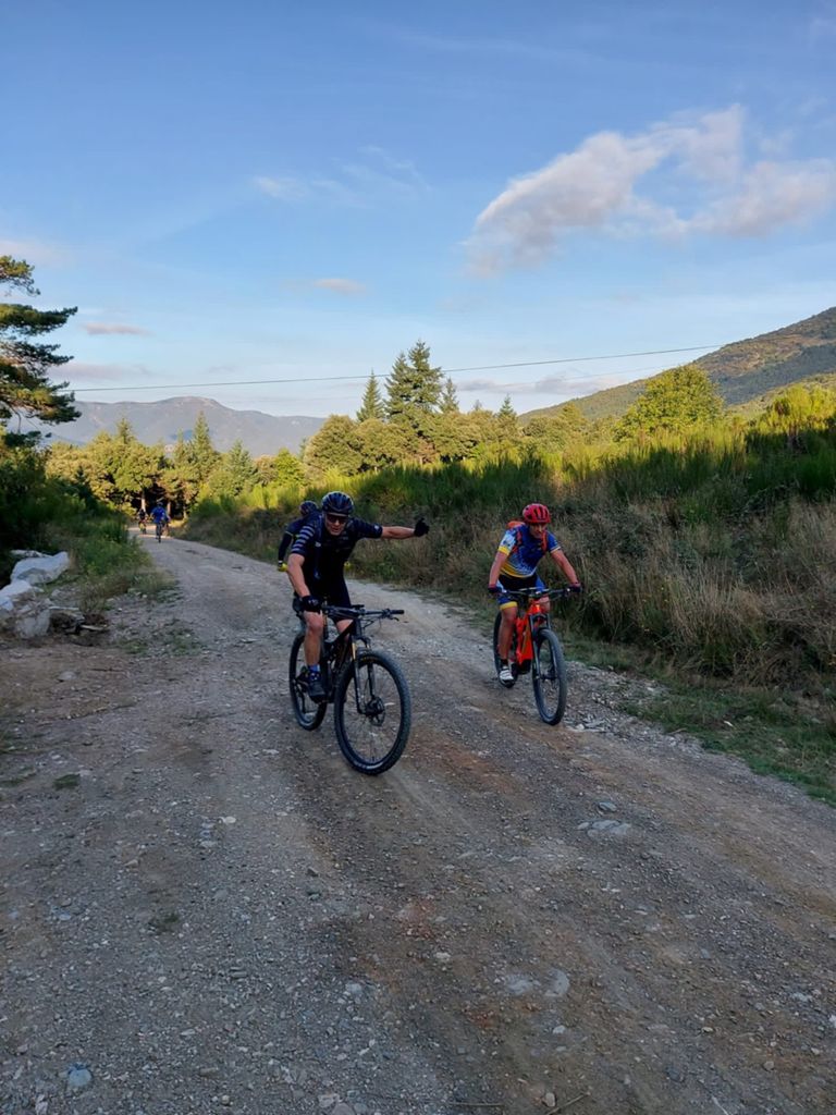
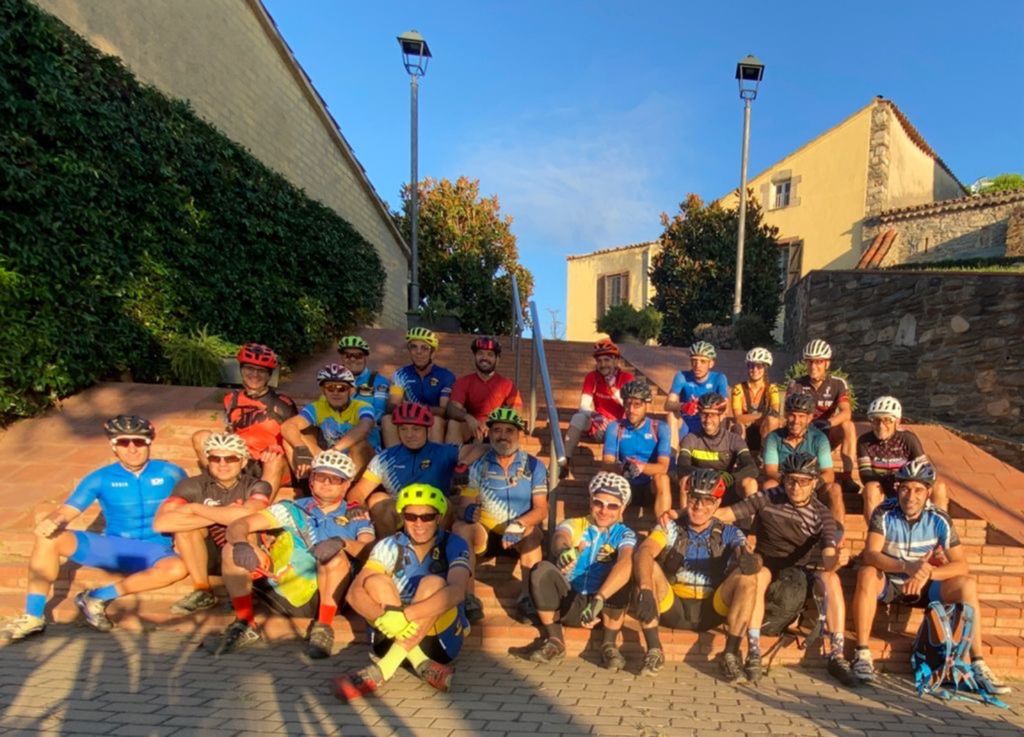
Turó de l'Home - Badalona 21

MTB
MTB
Ref..: 999521
Published: 04/10/2021
Performed: 02/10/2021
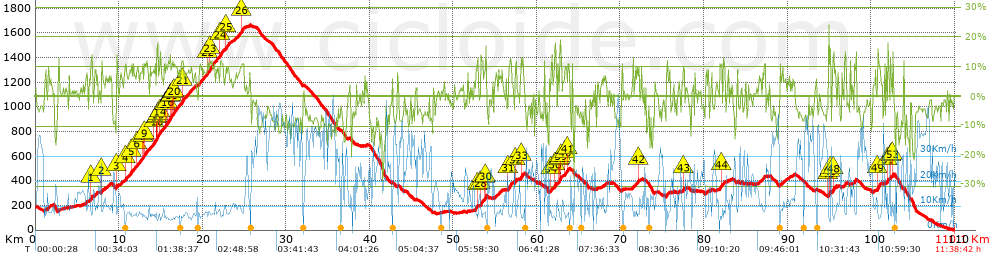
Distance in Km: 110.13
Climb in m: 3304
IBP: 227 BYC

Near ...
Batlloria, La (Sant Celoni), Sant Celoni, Sant Esteve De Palautordera, Santa Maria De Palautordera, Vilalba Sasserra
silvesterbike
397 published routes

Add to my Group or Club

 Height in m      Climb in %      Speed in Km/h      Speed < 2 Km/h

Climbs > 10%

Climbs >5% Climbs >10% Climbs >15% Climbs >20% Climbs >25%
 Steep slope of 207 m.   Average slope  Distances  Download as waypoint
1
 Km 6.643  13%  207 m
 Steep slope of 129 m.  Average slope  Distances  Download as waypoint
2
 Km 7.891  12%  129 m
 Steep slope of 3819 m.  Average slope  Distances  Download as waypoint
3
 Km 9.717  13%  128 m
4
 Km 10.779  10%  95 m
5
 Km 11.475  11%  101 m
6
 Km 12.153  10%  98 m
7
 Km 12.819  11%  165 m
8
 Km 12.984  10%  101 m
9
 Km 13.084  11%  200 m
10
 Km 14.157  12%  204 m
11
 Km 14.496  13%  32 m
12
 Km 14.528  17%  164 m
13
 Km 14.692  10%  68 m
14
 Km 14.862  12%  193 m
15
 Km 15.6  11%  98 m
16
 Km 15.801  12%  396 m
17
 Km 16.197  10%  97 m
18
 Km 16.294  10%  131 m
19
 Km 16.425  10%  137 m
20
 Km 16.561  10%  165 m
21
 Km 17.52  11%  296 m
22
 Km 20.593  11%  130 m
23
 Km 20.853  12%  337 m
24
 Km 22.109  12%  367 m
25
 Km 22.793  11%  105 m
26
 Km 24.618  11%  346 m
 Steep slope of 102 m.  Average slope  Distances  Download as waypoint
27
 Km 52.827  10%  102 m
 Steep slope of 433 m.  Average slope  Distances  Download as waypoint
28
 Km 53.292  11%  230 m
29
 Km 53.787  10%  100 m
30
 Km 53.887  17%  103 m
 Steep slope of 425 m.  Average slope  Distances  Download as waypoint
31
 Km 56.591  12%  425 m
 Steep slope of 162 m.  Average slope  Distances  Download as waypoint
32
 Km 57.455  12%  162 m
 Steep slope of 196 m.  Average slope  Distances  Download as waypoint
33
 Km 58.125  12%  196 m
 Steep slope of 128 m.  Average slope  Distances  Download as waypoint
34
 Km 61.696  11%  128 m
 Steep slope of 832 m.  Average slope  Distances  Download as waypoint
35
 Km 62.127  15%  63 m
36
 Km 62.19  18%  97 m
37
 Km 62.659  12%  101 m
38
 Km 62.76  17%  101 m
39
 Km 62.86  14%  98 m
 Steep slope of 294 m.  Average slope  Distances  Download as waypoint
40
 Km 63.384  12%  194 m
41
 Km 63.712  10%  100 m
 Steep slope of 100 m.  Average slope  Distances  Download as waypoint
42
 Km 72.173  11%  100 m
 Steep slope of 100 m.  Average slope  Distances  Download as waypoint
43
 Km 77.521  14%  100 m
 Steep slope of 201 m.  Average slope  Distances  Download as waypoint
44
 Km 82.096  12%  100 m
 Steep slope of 98 m.  Average slope  Distances  Download as waypoint
45
 Km 94.9  15%  166 m
46
 Km 95.066  20%  66 m
47
 Km 95.132  16%  33 m
 Steep slope of 195 m.  Average slope  Distances  Download as waypoint
48
 Km 95.429  13%  195 m
 Steep slope of 137 m.  Average slope  Distances  Download as waypoint
49
 Km 100.807  13%  323 m
 Steep slope of 164 m.  Average slope  Distances  Download as waypoint
50
 Km 101.967  11%  32 m
51
 Km 101.999  15%  132 m
 Steep slope of 101 m.  Average slope  Distances  Download as waypoint
52
 Km 102.346  13%  101 m
 Steep slope of 167 m.  Average slope  Distances  Download as waypoint
53
 Km 102.555  14%  167 m


Description of the route


Presence of ramps


 Climbs  Distance  % of the total  Speed  Your speed would be  Time  Your time would be
   15 - 30%  1.317  1.2  6.21  ?  0:12:43  ?
   10 - 15%  8.768  7.96  7.46  ?  1:10:32  ?
   5 - 10%  20.23  18.37  8.98  ?  2:15:07  ?
   1 - 5%  19.133  17.37  12.97  ?  1:28:32  ?
   Total*  49.448 Km  44.9 %  9.67 Km/h  ? Km/h    5:06:54 h  ? h  
 Flat
   1 - -1%  8.507 Km  7.72 %  15.17 Km/h  ? Km/h    0:33:39 h  ? h  
 Descents
   -1 - -5%  20.444  18.56  21.61  ?  0:56:45  ?
   -5 - -10%  22.962  20.85  27.9  ?  0:49:23  ?
   -10 - -15%  6.327  5.74  19.17  ?  0:19:48  ?
   -15 - -30%  2.443  2.22  14.35  ?  0:10:13  ?
   Total*  52.175 Km  47.38 %  22.99 Km/h  ? Km/h    2:16:09 h  ? h  
* The total has not necessarily coincide with the sum of the partials after correction of errors

How long would it take you?

How long would it take you to cover this route?
There are routes without a valid time information, but with your average stats you can assess the possible duration

silvesterbike to cover this route you've need a time of:   7:56:42 h 
If you sign in and have a minimum of two tracks of this same modality, you can know your time for this route, calculated from your stats..


¿Cuanto consumirá tu E-BIKE?

Entra tu E-IBP (formato n,nn)

E-IBP :   X 227 = 


 Detected activity type =  ()
 Penalization due to track conditions: 69 %   ( > 50 % = MTB, < 50 % = RDB)
 Reliability of the track: A   (3304/72/0/-/-/72)
 Correction level applied to the track: 0
DIFFICULTY OF THE ROUTE
IBP = 227 BYC
According to your statistics
 Your time in motion would be: ? h
Your average speed would be: ? Km/h
 

 Total Distance: 110.13 Km
 Analysed distance: 110.13 Km
 Linear distance: 31.14 Km

 Cumulated positive ramps: 3304.4 m  list of points info
 Cumulated negative ramps: 3489.8 m
 Maximum height: 1663.8 m
 Minimum height: 1.6 m
 Climbing Ratio: 6.68 %
 Descent ratio: 6.69 %
 Cumulated postive ramps per Km: 30 m
 Cumulated negative ramps per Km: 31.69 m

 Total time: 11:38:42 h
 Time in movement: 7:56:42 h
 According to your statistics
 Your time in motion would be: ? h  
 Stopped time: 3:42:00 h
 Maximum slope filter: ~30 %
 Minimum separation analysed: ~30 m
 Number of points: 8889   (cad. 12.39 m)
 Significant waypoints: 3130   (cad. 35.19 m / 35.21 %)

 Changes in direction per Km: 11.48
 Changes in direction > 5º por Km: 8.77
 Cumulated straight stretches: 17.058 Km
 Straight stretches per Km: 154.89 m
 Penalized slope changes: 25
 Penalized slope changes per Km: 0.227

 Average speed in total: 9.46 Km/h
 Average speed while moving: 13.86 Km/h
 According to your statistics
 Your average speed would be: ? Km/h  
 Maximum sustained speed: 58.99 Km/h


Comments

You can be the first one in commenting this route

 
My comments
:
Add comment  (Registered users)
 
Notify me answers to my comment  Do not notify answers to my comment


Share this route with a friend

Your friend will receive a message with a link to this page:
will see your email and your user name if you do it as registered user.


Write here your name (optional)

E-mail address of your friend(s). You can include various addresses separated by commas

Text or comment (optional) maximum 255 characters long, 255 Available characters

As a non registered users you need to fill-in the captcha text.
  Change image
Type the image characters.
 
 Share with a friend


Visited history

Delete history

Marked routes for review later or compare

My favorites


  Notify anomaly in this route Share in Facebook