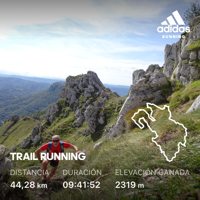
Zegama Aizkorri

Running
Ref..: 994096
Published: 12/09/2021
Performed: 12/09/2021
Distance in Km: 43.94
Climb in m: 2976
IBP: 583 RNG
 Not from STRAVA
Near ...
Arrieta, Barrenaldea, Olaran, Zegama, Zuloaga
Arrieta, Barrenaldea, Olaran, Zegama, Zuloaga
 No activities
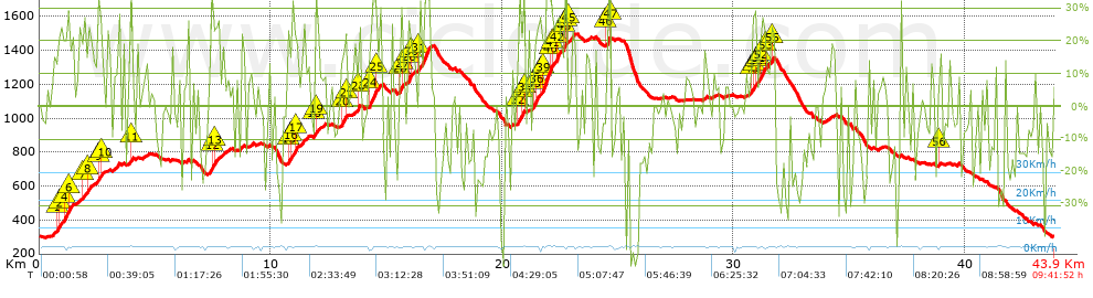


 list of points info

