Hospitalet De Llobregat, L' (Barcelona)

MTB
Ref..: 979327
Published: 19/07/2021
Performed: 19/07/2021
Distance in Km: 56.94
Climb in m: 1334
IBP: 96 BYC
 View on STRAVA
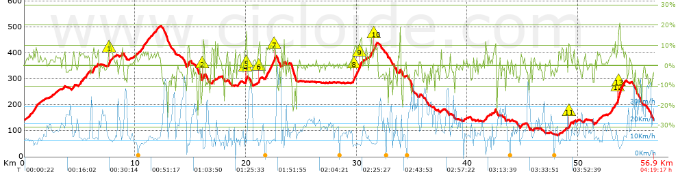


 list of points info

