Hospitalet De Llobregat, L' (Barcelona)

MTB
Ref..: 972714
Published: 25/06/2021
Performed: 25/06/2021
Distance in Km: 36.8
Climb in m: 801
IBP: 51 BYC
 View on STRAVA
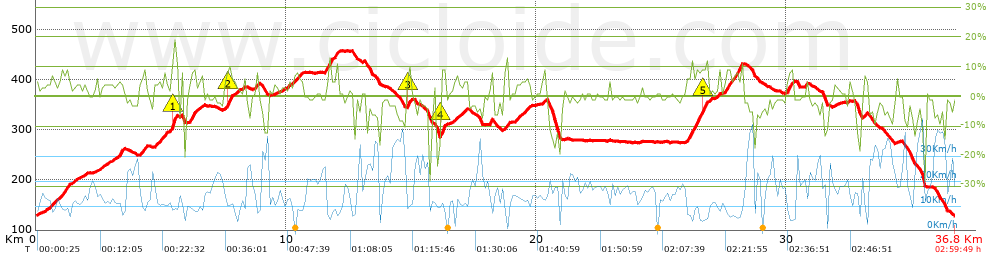


 list of points info

