Virreina, La (Tiana) (Barcelona)

MTB
MTB
Ref..: 934113
Published: 31/01/2021
Performed: 30/01/2021
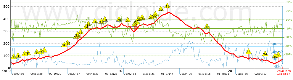
Distance in Km: 24.78
Climb in m: 724
IBP: 54 BYC

amra68
Author: amra68
119 published routes

Add to my Group or Club

 Height in m      Climb in %      Speed in Km/h      Speed < 2 Km/h

Climbs > 5%

Climbs >5% Climbs >10% Climbs >15% Climbs >20% Climbs >25%
 Steep slope of 101 m.   Average slope  Distances  Download as waypoint
1
 Km 0  9%  101 m
 Steep slope of 98 m.  Average slope  Distances  Download as waypoint
2
 Km 0.289  8%  98 m
 Steep slope of 331 m.  Average slope  Distances  Download as waypoint
3
 Km 0.695  7%  331 m
 Steep slope of 132 m.  Average slope  Distances  Download as waypoint
4
 Km 1.302  8%  132 m
 Steep slope of 105 m.  Average slope  Distances  Download as waypoint
5
 Km 1.612  5%  105 m
 Steep slope of 104 m.  Average slope  Distances  Download as waypoint
6
 Km 2.403  8%  104 m
 Steep slope of 139 m.  Average slope  Distances  Download as waypoint
7
 Km 2.76  7%  139 m
 Steep slope of 105 m.  Average slope  Distances  Download as waypoint
8
 Km 3.072  7%  105 m
 Steep slope of 196 m.  Average slope  Distances  Download as waypoint
9
 Km 4.819  5%  196 m
 Steep slope of 1010 m.  Average slope  Distances  Download as waypoint
10
 Km 5.185  7%  783 m
11
 Km 5.968  14%  130 m
12
 Km 6.098  9%  97 m
 Steep slope of 850 m.  Average slope  Distances  Download as waypoint
13
 Km 6.326  8%  590 m
14
 Km 6.917  11%  165 m
15
 Km 7.081  9%  95 m
 Steep slope of 168 m.  Average slope  Distances  Download as waypoint
16
 Km 7.621  7%  168 m
 Steep slope of 169 m.  Average slope  Distances  Download as waypoint
17
 Km 8.253  7%  169 m
 Steep slope of 201 m.  Average slope  Distances  Download as waypoint
18
 Km 8.558  7%  201 m
 Steep slope of 194 m.  Average slope  Distances  Download as waypoint
19
 Km 9.867  6%  32 m
20
 Km 9.899  13%  162 m
 Steep slope of 97 m.  Average slope  Distances  Download as waypoint
21
 Km 10.656  9%  97 m
 Steep slope of 461 m.  Average slope  Distances  Download as waypoint
22
 Km 11.273  13%  98 m
23
 Km 11.371  9%  135 m
24
 Km 11.507  12%  162 m
25
 Km 11.669  8%  66 m
 Steep slope of 96 m.  Average slope  Distances  Download as waypoint
26
 Km 11.943  8%  96 m
 Steep slope of 98 m.  Average slope  Distances  Download as waypoint
27
 Km 12.78  7%  98 m
 Steep slope of 588 m.  Average slope  Distances  Download as waypoint
28
 Km 13.019  13%  129 m
29
 Km 13.148  8%  459 m
 Steep slope of 108 m.  Average slope  Distances  Download as waypoint
30
 Km 13.702  7%  108 m
 Steep slope of 134 m.  Average slope  Distances  Download as waypoint
31
 Km 14.22  6%  134 m
 Steep slope of 102 m.  Average slope  Distances  Download as waypoint
32
 Km 17.875  8%  102 m
 Steep slope of 110 m.  Average slope  Distances  Download as waypoint
33
 Km 21.681  9%  110 m
 Steep slope of 98 m.  Average slope  Distances  Download as waypoint
34
 Km 23.209  7%  98 m
 Steep slope of 131 m.  Average slope  Distances  Download as waypoint
35
 Km 24.046  6%  131 m
 Steep slope of 282 m.  Average slope  Distances  Download as waypoint
36
 Km 24.342  6%  282 m


Description of the route


Presence of ramps


 Climbs  Distance  % of the total  Speed  Your speed would be  Time  Your time would be
   15 - 30%  0.161  0.65  4.6  ?  0:02:06  ?
   10 - 15%  1.143  4.61  6.23  ?  0:11:01  ?
   5 - 10%  5.34  21.55  8.52  ?  0:37:35  ?
   1 - 5%  5.548  22.39  10.64  ?  0:31:17  ?
   Total*  12.192 Km  49.21 %  8.92 Km/h  ? Km/h    1:21:59 h  ? h  
 Flat
   1 - -1%  1.703 Km  6.88 %  10.97 Km/h  ? Km/h    0:09:19 h  ? h  
 Descents
   -1 - -5%  4.422  17.85  14.73  ?  0:18:01  ?
   -5 - -10%  5.031  20.31  19.37  ?  0:15:35  ?
   -10 - -15%  1.163  4.69  10.71  ?  0:06:31  ?
   -15 - -30%  0.263  1.06  8.93  ?  0:01:46  ?
   Total*  10.88 Km  43.91 %  15.59 Km/h  ? Km/h    0:41:53 h  ? h  
* The total has not necessarily coincide with the sum of the partials after correction of errors

How long would it take you?

How long would it take you to cover this route?
There are routes without a valid time information, but with your average stats you can assess the possible duration

amra68 to cover this route you've need a time of:   2:13:11 h 
If you sign in and have a minimum of two tracks of this same modality, you can know your time for this route, calculated from your stats..


¿Cuanto consumirá tu E-BIKE?

Entra tu E-IBP (formato n,nn)

E-IBP :   X 54 = 


 Detected activity type =  ()
 Penalization due to track conditions: 77 %   ( > 50 % = MTB, < 50 % = RDB)
 Reliability of the track: B   (724/59/0/-/-/59)
 Correction level applied to the track: 0
DIFFICULTY OF THE ROUTE
IBP = 54 BYC
According to your statistics
 Your time in motion would be: ? h
Your average speed would be: ? Km/h
 

 Total Distance: 24.78 Km
 Analysed distance: 24.78 Km
 Linear distance: 0.5 Km

 Cumulated positive ramps: 724 m  list of points info
 Cumulated negative ramps: 687.7 m
 Maximum height: 454.4 m
 Minimum height: 33.8 m
 Climbing Ratio: 5.94 %
 Descent ratio: 6.32 %
 Cumulated postive ramps per Km: 29.22 m
 Cumulated negative ramps per Km: 27.75 m

 Total time: 2:14:58 h
 Time in movement: 2:13:11 h
 According to your statistics
 Your time in motion would be: ? h  
 Stopped time: 0:01:47 h
 Maximum slope filter: ~30 %
 Minimum separation analysed: ~30 m
 Number of points: 2059   (cad. 12.03 m)
 Significant waypoints: 713   (cad. 34.75 m / 34.63 %)

 Changes in direction per Km: 11.78
 Changes in direction > 5º por Km: 8.47
 Cumulated straight stretches: 4.321 Km
 Straight stretches per Km: 174.37 m
 Penalized slope changes: 5
 Penalized slope changes per Km: 0.202

 Average speed in total: 11.01 Km/h
 Average speed while moving: 11.16 Km/h
 According to your statistics
 Your average speed would be: ? Km/h  
 Maximum sustained speed: 42.8 Km/h


Comments

You can be the first one in commenting this route

 
My comments
:
Add comment  (Registered users)
 
Notify me answers to my comment  Do not notify answers to my comment


Share this route with a friend

Your friend will receive a message with a link to this page:
will see your email and your user name if you do it as registered user.


Write here your name (optional)

E-mail address of your friend(s). You can include various addresses separated by commas

Text or comment (optional) maximum 255 characters long, 255 Available characters

As a non registered users you need to fill-in the captcha text.
  Change image
Type the image characters.
 
 Share with a friend


Visited history

Delete history

Marked routes for review later or compare

My favorites


  Notify anomaly in this route Share in Facebook