Via Romana - Sta Llucia

MTB
Ref..: 928275
Published: 30/12/2020
Performed: 30/12/2020
Distance in Km: 42.91
Climb in m: 1430
IBP: 142 BYC
 Not from STRAVA
Near ...
Olot, Sant Cristofol Les Fonts, Sant Joan Les Fonts
Olot, Sant Cristofol Les Fonts, Sant Joan Les Fonts
 No activities
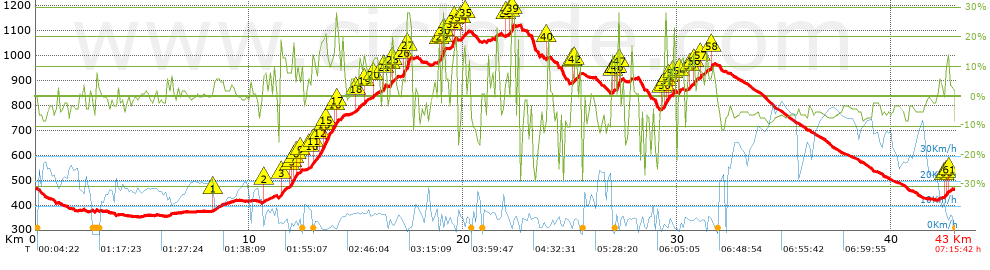


 list of points info

