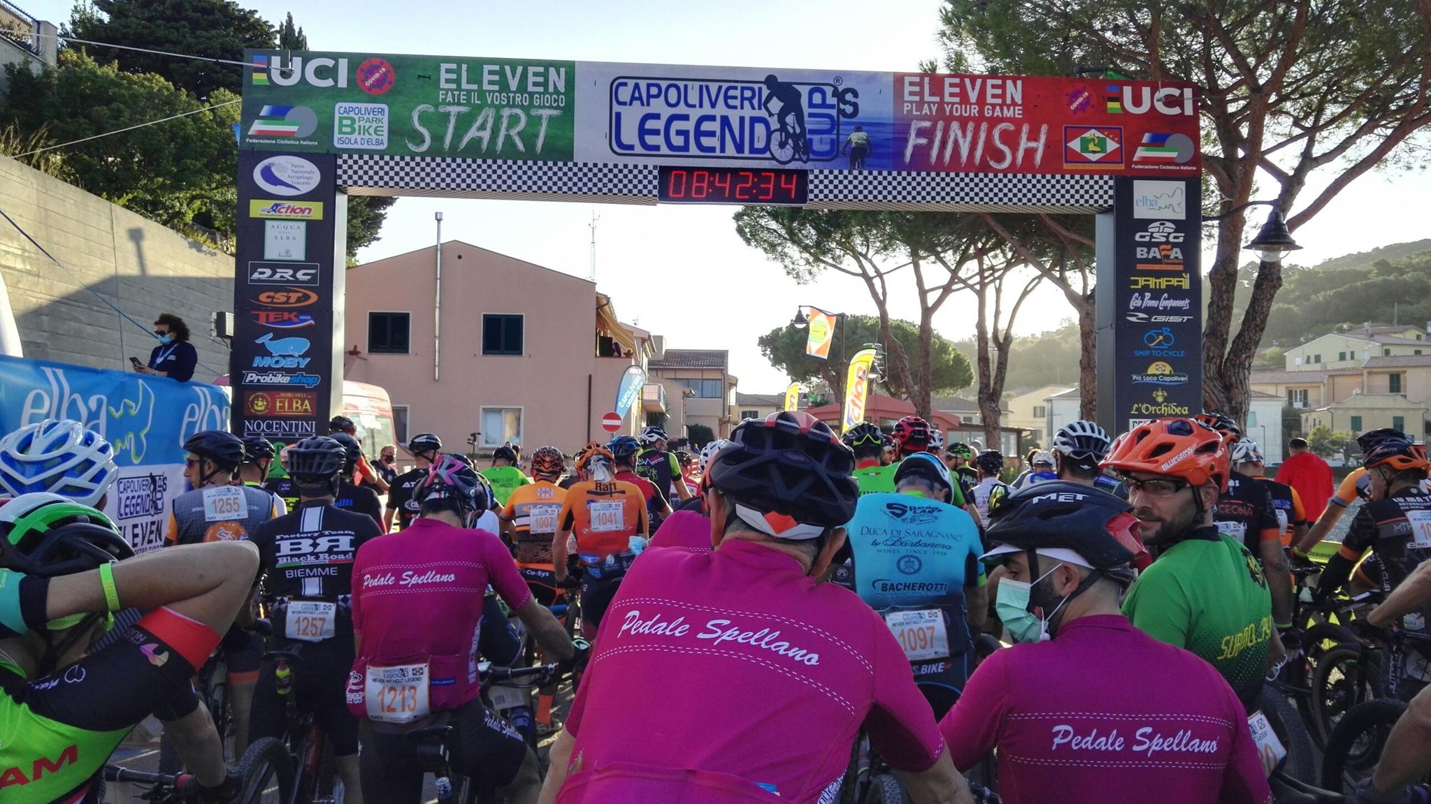
Capoliveri Legend Cup's Eleven __
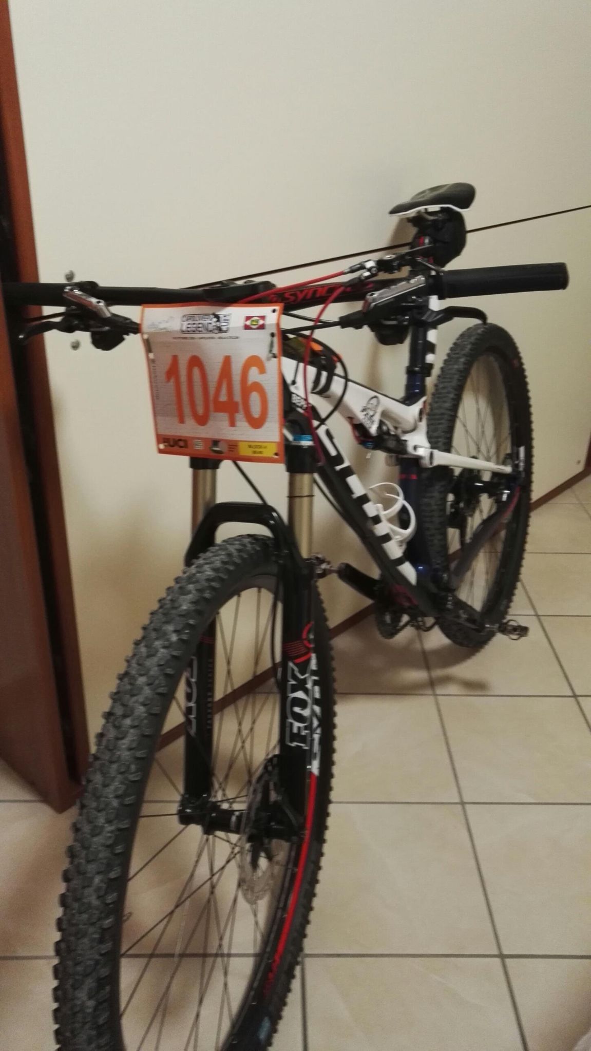
MTB
MTB
Ref..: 910015
Published: 11/10/2020
Performed: 10/10/2020
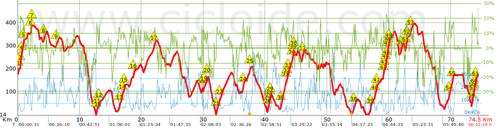
Distance in Km: 74.54
Climb in m: 2894
IBP: 229 BYC

Beppe Cavalli
569 published routes

Add to my Group or Club

 Height in m      Climb in %      Speed in Km/h      Speed < 2 Km/h

Climbs > 5%

Climbs >5% Climbs >10% Climbs >15% Climbs >20% Climbs >25%
 Steep slope of 1059 m.   Average slope  Distances  Download as waypoint
1
 Km 0  6%  38 m
2
 Km 0.038  14%  132 m
3
 Km 0.17  5%  206 m
4
 Km 0.376  18%  32 m
5
 Km 0.409  22%  197 m
6
 Km 0.606  19%  256 m
7
 Km 0.862  12%  198 m
 Steep slope of 245 m.  Average slope  Distances  Download as waypoint
8
 Km 1.352  6%  245 m
 Steep slope of 202 m.  Average slope  Distances  Download as waypoint
9
 Km 2.083  20%  135 m
10
 Km 2.218  12%  67 m
 Steep slope of 362 m.  Average slope  Distances  Download as waypoint
11
 Km 4.123  12%  263 m
12
 Km 4.386  10%  99 m
 Steep slope of 407 m.  Average slope  Distances  Download as waypoint
13
 Km 6.182  6%  33 m
14
 Km 6.214  11%  135 m
15
 Km 6.35  8%  239 m
 Steep slope of 109 m.  Average slope  Distances  Download as waypoint
16
 Km 7.926  6%  109 m
 Steep slope of 302 m.  Average slope  Distances  Download as waypoint
17
 Km 8.986  8%  302 m
 Steep slope of 300 m.  Average slope  Distances  Download as waypoint
18
 Km 12.713  18%  99 m
19
 Km 12.811  13%  66 m
20
 Km 12.877  7%  135 m
 Steep slope of 102 m.  Average slope  Distances  Download as waypoint
21
 Km 13.114  14%  102 m
 Steep slope of 1108 m.  Average slope  Distances  Download as waypoint
22
 Km 16.313  6%  35 m
23
 Km 16.347  13%  171 m
24
 Km 16.518  9%  335 m
25
 Km 16.853  11%  194 m
26
 Km 17.047  7%  134 m
27
 Km 17.181  11%  135 m
28
 Km 17.316  8%  104 m
 Steep slope of 461 m.  Average slope  Distances  Download as waypoint
29
 Km 18.042  9%  461 m
 Steep slope of 324 m.  Average slope  Distances  Download as waypoint
30
 Km 18.682  10%  35 m
31
 Km 18.717  12%  128 m
32
 Km 18.845  9%  161 m
 Steep slope of 135 m.  Average slope  Distances  Download as waypoint
33
 Km 19.421  8%  135 m
 Steep slope of 379 m.  Average slope  Distances  Download as waypoint
34
 Km 20.401  9%  379 m
 Steep slope of 371 m.  Average slope  Distances  Download as waypoint
35
 Km 20.881  6%  371 m
 Steep slope of 586 m.  Average slope  Distances  Download as waypoint
36
 Km 21.68  7%  281 m
37
 Km 21.96  11%  238 m
38
 Km 22.199  10%  67 m
 Steep slope of 202 m.  Average slope  Distances  Download as waypoint
39
 Km 24.692  10%  202 m
 Steep slope of 202 m.  Average slope  Distances  Download as waypoint
40
 Km 25.03  9%  202 m
 Steep slope of 101 m.  Average slope  Distances  Download as waypoint
41
 Km 25.348  6%  101 m
 Steep slope of 491 m.  Average slope  Distances  Download as waypoint
42
 Km 28.033  7%  491 m
 Steep slope of 300 m.  Average slope  Distances  Download as waypoint
43
 Km 28.626  7%  300 m
 Steep slope of 140 m.  Average slope  Distances  Download as waypoint
44
 Km 29.741  17%  100 m
45
 Km 29.841  6%  40 m
 Steep slope of 375 m.  Average slope  Distances  Download as waypoint
46
 Km 29.989  7%  35 m
47
 Km 30.024  12%  135 m
48
 Km 30.158  7%  205 m
 Steep slope of 210 m.  Average slope  Distances  Download as waypoint
49
 Km 30.534  6%  76 m
50
 Km 30.609  13%  100 m
51
 Km 30.709  9%  34 m
 Steep slope of 1127 m.  Average slope  Distances  Download as waypoint
52
 Km 32.112  12%  164 m
53
 Km 32.276  9%  261 m
54
 Km 32.538  11%  166 m
55
 Km 32.703  8%  536 m
 Steep slope of 763 m.  Average slope  Distances  Download as waypoint
56
 Km 33.377  6%  763 m
 Steep slope of 173 m.  Average slope  Distances  Download as waypoint
57
 Km 34.279  5%  173 m
 Steep slope of 399 m.  Average slope  Distances  Download as waypoint
58
 Km 36.291  9%  34 m
59
 Km 36.325  12%  65 m
60
 Km 36.39  17%  128 m
61
 Km 36.517  10%  172 m
 Steep slope of 306 m.  Average slope  Distances  Download as waypoint
62
 Km 37.009  9%  306 m
 Steep slope of 304 m.  Average slope  Distances  Download as waypoint
63
 Km 37.416  13%  99 m
64
 Km 37.515  7%  205 m
 Steep slope of 521 m.  Average slope  Distances  Download as waypoint
65
 Km 40.369  13%  194 m
66
 Km 40.562  16%  94 m
67
 Km 40.656  20%  33 m
68
 Km 40.688  7%  103 m
69
 Km 40.792  14%  97 m
 Steep slope of 1317 m.  Average slope  Distances  Download as waypoint
70
 Km 42.438  8%  33 m
71
 Km 42.472  13%  711 m
72
 Km 43.183  9%  125 m
73
 Km 43.308  10%  194 m
74
 Km 43.503  11%  126 m
75
 Km 43.628  12%  128 m
 Steep slope of 768 m.  Average slope  Distances  Download as waypoint
76
 Km 43.85  5%  34 m
77
 Km 43.884  9%  386 m
78
 Km 44.27  12%  222 m
79
 Km 44.492  19%  95 m
80
 Km 44.587  15%  31 m
 Steep slope of 210 m.  Average slope  Distances  Download as waypoint
81
 Km 45.034  5%  40 m
82
 Km 45.074  8%  137 m
83
 Km 45.211  14%  33 m
 Steep slope of 563 m.  Average slope  Distances  Download as waypoint
84
 Km 45.819  10%  134 m
85
 Km 45.954  13%  96 m
86
 Km 46.05  9%  333 m
 Steep slope of 132 m.  Average slope  Distances  Download as waypoint
87
 Km 48.453  10%  132 m
 Steep slope of 136 m.  Average slope  Distances  Download as waypoint
88
 Km 48.81  7%  136 m
 Steep slope of 170 m.  Average slope  Distances  Download as waypoint
89
 Km 49.657  8%  170 m
 Steep slope of 169 m.  Average slope  Distances  Download as waypoint
90
 Km 51.262  9%  104 m
91
 Km 51.366  13%  65 m
 Steep slope of 268 m.  Average slope  Distances  Download as waypoint
92
 Km 51.671  7%  268 m
 Steep slope of 334 m.  Average slope  Distances  Download as waypoint
93
 Km 54.064  7%  169 m
94
 Km 54.233  14%  132 m
95
 Km 54.364  7%  33 m
 Steep slope of 236 m.  Average slope  Distances  Download as waypoint
96
 Km 54.501  9%  236 m
 Steep slope of 331 m.  Average slope  Distances  Download as waypoint
97
 Km 56.844  6%  108 m
98
 Km 56.952  12%  34 m
99
 Km 56.985  18%  96 m
100
 Km 57.082  13%  93 m
 Steep slope of 136 m.  Average slope  Distances  Download as waypoint
101
 Km 57.278  6%  136 m
 Steep slope of 523 m.  Average slope  Distances  Download as waypoint
102
 Km 57.66  13%  226 m
103
 Km 57.886  6%  101 m
104
 Km 57.987  13%  161 m
105
 Km 58.149  10%  35 m
 Steep slope of 134 m.  Average slope  Distances  Download as waypoint
106
 Km 58.673  9%  134 m
 Steep slope of 1199 m.  Average slope  Distances  Download as waypoint
107
 Km 59.021  9%  30 m
108
 Km 59.052  18%  131 m
109
 Km 59.182  13%  127 m
110
 Km 59.309  5%  169 m
111
 Km 59.479  10%  34 m
112
 Km 59.512  18%  32 m
113
 Km 59.545  21%  229 m
114
 Km 59.774  18%  93 m
115
 Km 59.867  18%  95 m
116
 Km 59.962  13%  259 m
 Steep slope of 199 m.  Average slope  Distances  Download as waypoint
117
 Km 60.583  9%  199 m
 Steep slope of 392 m.  Average slope  Distances  Download as waypoint
118
 Km 61.847  12%  259 m
119
 Km 62.106  9%  133 m
 Steep slope of 422 m.  Average slope  Distances  Download as waypoint
120
 Km 62.661  8%  33 m
121
 Km 62.694  19%  158 m
122
 Km 62.852  10%  131 m
123
 Km 62.983  13%  100 m
 Steep slope of 433 m.  Average slope  Distances  Download as waypoint
124
 Km 63.305  5%  137 m
125
 Km 63.443  12%  132 m
126
 Km 63.574  10%  164 m
 Steep slope of 98 m.  Average slope  Distances  Download as waypoint
127
 Km 63.911  10%  98 m
 Steep slope of 99 m.  Average slope  Distances  Download as waypoint
128
 Km 67.218  9%  99 m
 Steep slope of 343 m.  Average slope  Distances  Download as waypoint
129
 Km 69.044  9%  343 m
 Steep slope of 811 m.  Average slope  Distances  Download as waypoint
130
 Km 69.627  7%  30 m
131
 Km 69.658  14%  329 m
132
 Km 69.987  8%  162 m
133
 Km 70.149  13%  290 m
 Steep slope of 814 m.  Average slope  Distances  Download as waypoint
134
 Km 73.361  10%  32 m
135
 Km 73.393  19%  160 m
136
 Km 73.552  15%  96 m
137
 Km 73.649  11%  133 m
138
 Km 73.781  13%  33 m
139
 Km 73.815  18%  131 m
140
 Km 73.946  14%  229 m


Description of the route


Presence of ramps


 Climbs  Distance  % of the total  Speed  Your speed would be  Time  Your time would be
   15 - 30%  3.895  5.23  4.83  ?  0:48:21  ?
   10 - 15%  7.772  10.43  6.32  ?  1:13:47  ?
   5 - 10%  12.048  16.16  8.7  ?  1:23:06  ?
   1 - 5%  11.212  15.04  13.15  ?  0:51:09  ?
   Total*  34.927 Km  46.86 %  8.17 Km/h  ? Km/h    4:16:23 h  ? h  
 Flat
   1 - -1%  9.241 Km  12.4 %  20.25 Km/h  ? Km/h    0:27:23 h  ? h  
 Descents
   -1 - -5%  10.506  14.09  23.12  ?  0:27:16  ?
   -5 - -10%  7.926  10.63  24.29  ?  0:19:35  ?
   -10 - -15%  5.562  7.46  22.76  ?  0:14:40  ?
   -15 - -30%  6.378  8.56  18.27  ?  0:20:57  ?
   Total*  30.373 Km  40.75 %  22.1 Km/h  ? Km/h    1:22:28 h  ? h  
* The total has not necessarily coincide with the sum of the partials after correction of errors

How long would it take you?

How long would it take you to cover this route?
There are routes without a valid time information, but with your average stats you can assess the possible duration

Beppe Cavalli to cover this route you've need a time of:   6:06:14 h 
If you sign in and have a minimum of two tracks of this same modality, you can know your time for this route, calculated from your stats..


¿Cuanto consumirá tu E-BIKE?

Entra tu E-IBP (formato n,nn)

E-IBP :   X 229 = 


 Detected activity type =  ()
 Penalization due to track conditions: 66 %   ( > 50 % = MTB, < 50 % = RDB)
 Reliability of the track: A   (2895/76/0/-/-/76)
 Correction level applied to the track: 0
DIFFICULTY OF THE ROUTE
IBP = 229 BYC
According to your statistics
 Your time in motion would be: ? h
Your average speed would be: ? Km/h
 

 Total Distance: 74.54 Km
 Analysed distance: 74.54 Km
 Linear distance: 0.27 Km

 Cumulated positive ramps: 2894 m  list of points info
 Cumulated negative ramps: 2883.6 m
 Maximum height: 398.2 m
 Minimum height: 0 m
 Climbing Ratio: 8.29 %
 Descent ratio: 9.49 %
 Cumulated postive ramps per Km: 38.82 m
 Cumulated negative ramps per Km: 38.69 m

 Total time: 6:12:18 h
 Time in movement: 6:06:14 h
 According to your statistics
 Your time in motion would be: ? h  
 Stopped time: 0:06:04 h
 Maximum slope filter: ~30 %
 Minimum separation analysed: ~30 m
 Number of points: 6063   (cad. 12.29 m)
 Significant waypoints: 2135   (cad. 34.91 m / 35.21 %)

 Changes in direction per Km: 11.6
 Changes in direction > 5º por Km: 9.46
 Cumulated straight stretches: 9.185 Km
 Straight stretches per Km: 123.22 m
 Penalized slope changes: 35
 Penalized slope changes per Km: 0.47

 Average speed in total: 12.01 Km/h
 Average speed while moving: 12.21 Km/h
 According to your statistics
 Your average speed would be: ? Km/h  
 Maximum sustained speed: 56.09 Km/h


Comments

You can be the first one in commenting this route

 
My comments
:
Add comment  (Registered users)
 
Notify me answers to my comment  Do not notify answers to my comment


Share this route with a friend

Your friend will receive a message with a link to this page:
will see your email and your user name if you do it as registered user.


Write here your name (optional)

E-mail address of your friend(s). You can include various addresses separated by commas

Text or comment (optional) maximum 255 characters long, 255 Available characters

As a non registered users you need to fill-in the captcha text.
  Change image
Type the image characters.
 
 Share with a friend


Visited history

Delete history

Marked routes for review later or compare

My favorites


  Notify anomaly in this route Share in Facebook