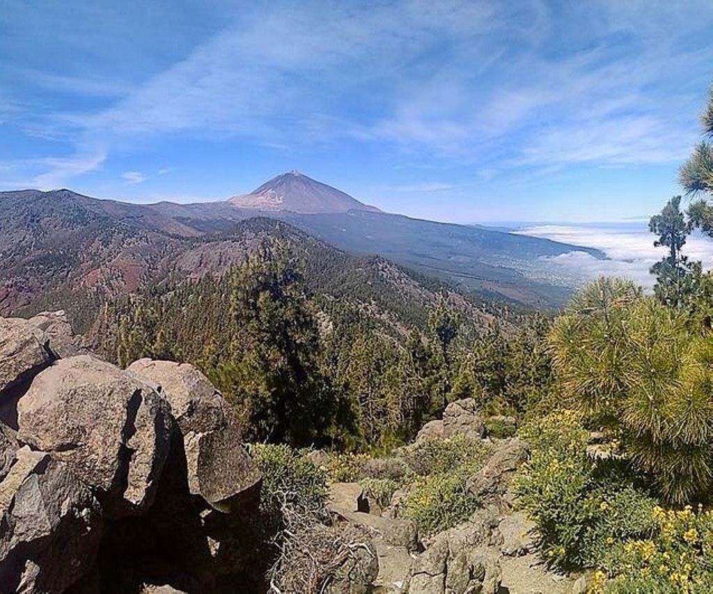
Parque Natural de Corona Forestal

Road
Road
Ref..: 903902
Published: 16/09/2020
Performed: 15/09/2020
Distance in Km: 19.79
Climb in m: 1535
IBP: 200 BYC

Near ...
Aguamansa, Bebedero, El, Benijos, Chasna, Dehesa Alta, Florida Alta

 Height in m      Climb in %      Speed in Km/h      Speed < 2 Km/h

Climbs > 10%

Climbs >5% Climbs >10% Climbs >15% Climbs >20% Climbs >25%
 Steep slope of 3161 m.   Average slope  Distances  Download as waypoint
1
 Km 0  22%  146 m
2
 Km 0.146  10%  108 m
3
 Km 0.254  15%  345 m
4
 Km 0.599  16%  84 m
5
 Km 0.831  13%  118 m
6
 Km 0.949  26%  378 m
7
 Km 1.327  19%  62 m
8
 Km 1.389  20%  172 m
9
 Km 1.562  27%  126 m
10
 Km 1.688  21%  112 m
11
 Km 1.8  28%  212 m
12
 Km 2.011  24%  144 m
13
 Km 2.155  28%  1051 m
14
 Km 3.207  28%  67 m
15
 Km 3.274  18%  36 m
 Steep slope of 1046 m.  Average slope  Distances  Download as waypoint
16
 Km 3.478  11%  30 m
17
 Km 3.509  17%  115 m
18
 Km 3.624  22%  43 m
19
 Km 3.667  27%  218 m
20
 Km 3.885  23%  51 m
21
 Km 3.936  18%  232 m
22
 Km 4.168  12%  357 m
 Steep slope of 534 m.  Average slope  Distances  Download as waypoint
23
 Km 5.547  28%  534 m
 Steep slope of 313 m.  Average slope  Distances  Download as waypoint
24
 Km 6.652  12%  313 m
 Steep slope of 305 m.  Average slope  Distances  Download as waypoint
25
 Km 11.187  13%  155 m
26
 Km 11.342  18%  150 m
 Steep slope of 796 m.  Average slope  Distances  Download as waypoint
27
 Km 15.475  11%  148 m
28
 Km 15.623  19%  49 m
29
 Km 15.672  20%  41 m
30
 Km 15.713  28%  558 m
31
 Km 16.271  28%  80 m
 Steep slope of 114 m.  Average slope  Distances  Download as waypoint
32
 Km 17.642  27%  114 m


Description of the route


Presence of ramps


 Climbs  Distance  % of the total  Speed  Your speed would be  Time  Your time would be
   15 - 30%  4.978  25.16  3.06  ?  1:37:42  ?
   10 - 15%  1.37  6.92  3.85  ?  0:21:22  ?
   5 - 10%  1.174  5.94  4.68  ?  0:15:03  ?
   1 - 5%  1.405  7.1  3.78  ?  0:22:19  ?
   Total*  8.928 Km  45.12 %  3.42 Km/h  ? Km/h    2:36:26 h  ? h  
 Flat
   1 - -1%  0.447 Km  2.26 %  4.48 Km/h  ? Km/h    0:05:59 h  ? h  
 Descents
   -1 - -5%  1.721  8.7  4.71  ?  0:21:57  ?
   -5 - -10%  1.778  8.98  3.85  ?  0:27:43  ?
   -10 - -15%  2.342  11.84  5.06  ?  0:27:45  ?
   -15 - -30%  4.675  23.63  4.38  ?  1:04:00  ?
   Total*  10.516 Km  53.15 %  4.46 Km/h  ? Km/h    2:21:25 h  ? h  
* The total has not necessarily coincide with the sum of the partials after correction of errors

How long would it take you?

How long would it take you to cover this route?
There are routes without a valid time information, but with your average stats you can assess the possible duration

?_olaf_alvaro_h._g._? to cover this route you've need a time of:   5:03:50 h 
If you sign in and have a minimum of two tracks of this same modality, you can know your time for this route, calculated from your stats..


¿Cuanto consumirá tu E-BIKE?

Entra tu E-IBP (formato n,nn)

E-IBP :   X 200 = 


 Detected activity type =  ()
 Penalization due to track conditions: 48 %   ( > 50 % = MTB, < 50 % = RDB)
 Reliability of the track: A   (1616/94/0/-/-/94)
 Correction level applied to the track: 0
DIFFICULTY OF THE ROUTE
IBP = 200 BYC
According to your statistics
 Your time in motion would be: ? h
Your average speed would be: ? Km/h
 

 Total Distance: 19.79 Km
 Analysed distance: 19.79 Km
 Linear distance: 0.01 Km

 Cumulated positive ramps: 1534.65 m  list of points info
 Cumulated negative ramps: 1538.75 m
 Maximum height: 2018.3 m
 Minimum height: 1072.3 m
 Climbing Ratio: 17.19 %
 Descent ratio: 14.63 %
 Cumulated postive ramps per Km: 77.55 m
 Cumulated negative ramps per Km: 77.75 m

 Total time: 7:15:10 h
 Time in movement: 5:03:50 h
 According to your statistics
 Your time in motion would be: ? h  
 Stopped time: 2:11:20 h
 Maximum slope filter: ~30 %
 Minimum separation analysed: ~30 m
 Number of points: 1283   (cad. 15.42 m)
 Significant waypoints: 526   (cad. 37.76 m / 41 %)

 Changes in direction per Km: 15.11
 Changes in direction > 5º por Km: 13.09
 Cumulated straight stretches: 1.053 Km
 Straight stretches per Km: 53.21 m
 Penalized slope changes: 15
 Penalized slope changes per Km: 0.758

 Average speed in total: 2.73 Km/h
 Average speed while moving: 3.91 Km/h
 According to your statistics
 Your average speed would be: ? Km/h  
 Maximum sustained speed: 7.63 Km/h


Comments

You can be the first one in commenting this route

 
My comments
:
Add comment  (Registered users)
 
Notify me answers to my comment  Do not notify answers to my comment


Share this route with a friend

Your friend will receive a message with a link to this page:
will see your email and your user name if you do it as registered user.


Write here your name (optional)

E-mail address of your friend(s). You can include various addresses separated by commas

Text or comment (optional) maximum 255 characters long, 255 Available characters

As a non registered users you need to fill-in the captcha text.
  Change image
Type the image characters.
 
 Share with a friend


Visited history

Delete history

Marked routes for review later or compare

My favorites


  Notify anomaly in this route Share in Facebook