Calooooooooor! _

MTB
Ref..: 880657
Published: 24/06/2020
Performed: 24/06/2020
Distance in Km: 42.49
Climb in m: 876
IBP: 57 BYC
 View on STRAVA
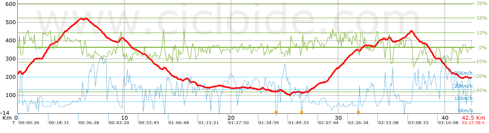


 list of points info

