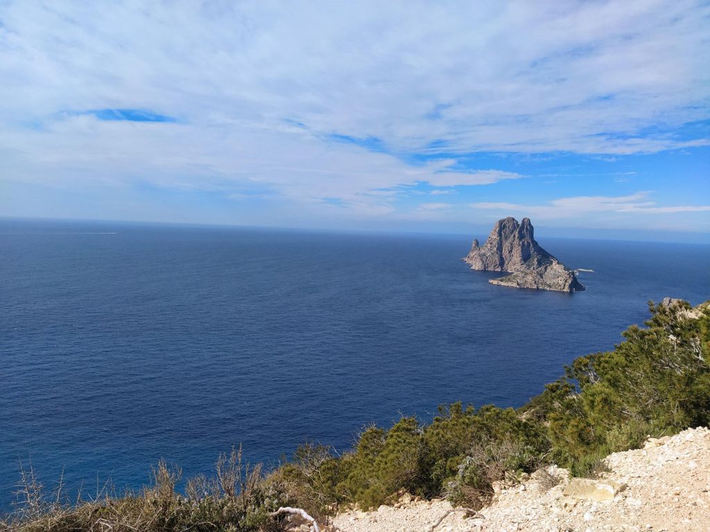
Cala llentrisca

MTB
Ref..: 862307
Published: 02/03/2020
Performed: 01/03/2020
Distance in Km: 63.33
Climb in m: 1340
IBP: 105 BYC
 View on STRAVA
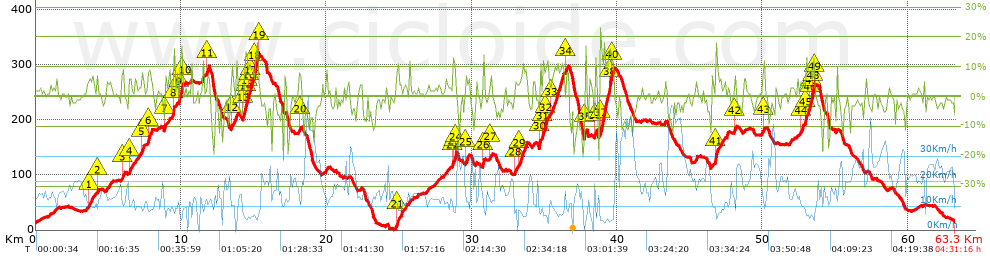


 list of points info

