Ambato - Fuerte Patria incluida bajada de llanta _

Road
Ref..: 831196
Published: 24/09/2019
Performed: 21/09/2019
Distance in Km: 118.19
Climb in m: 1177
IBP: 88 BYC
 View on STRAVA
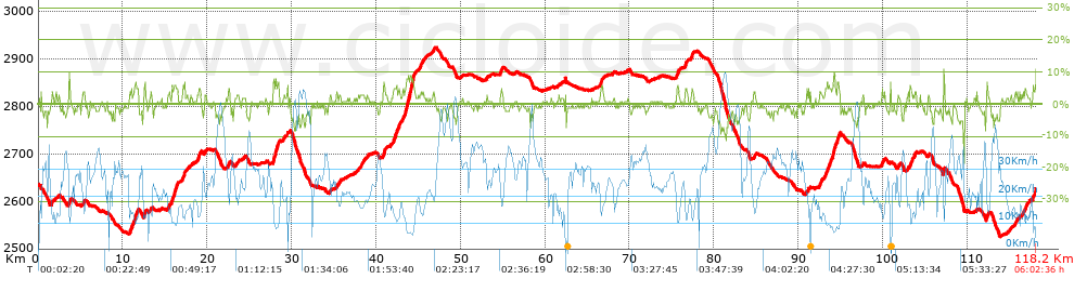


 list of points info

