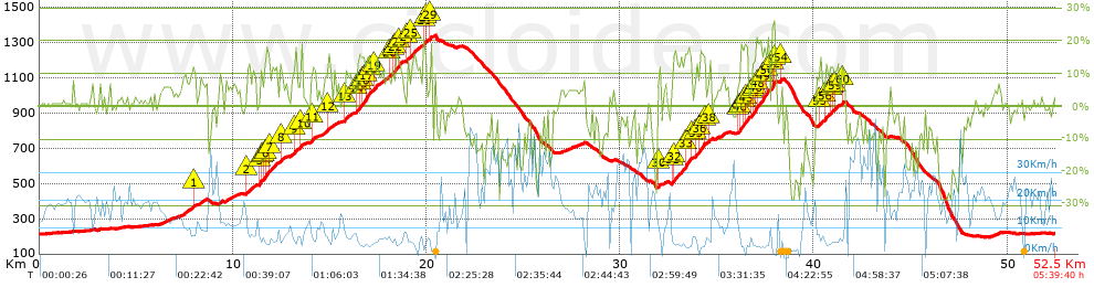
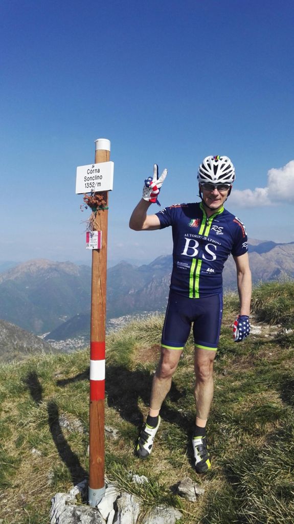
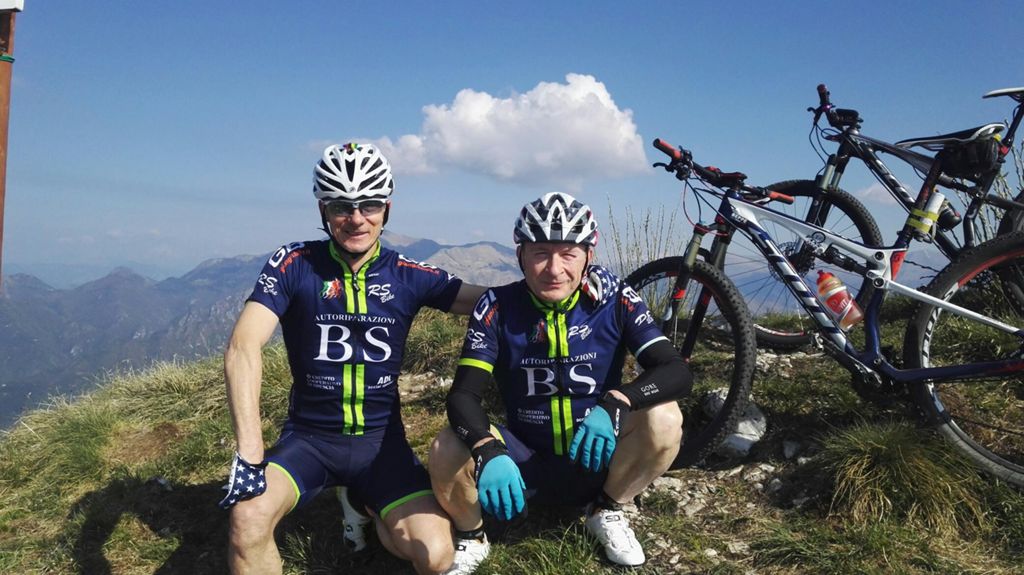
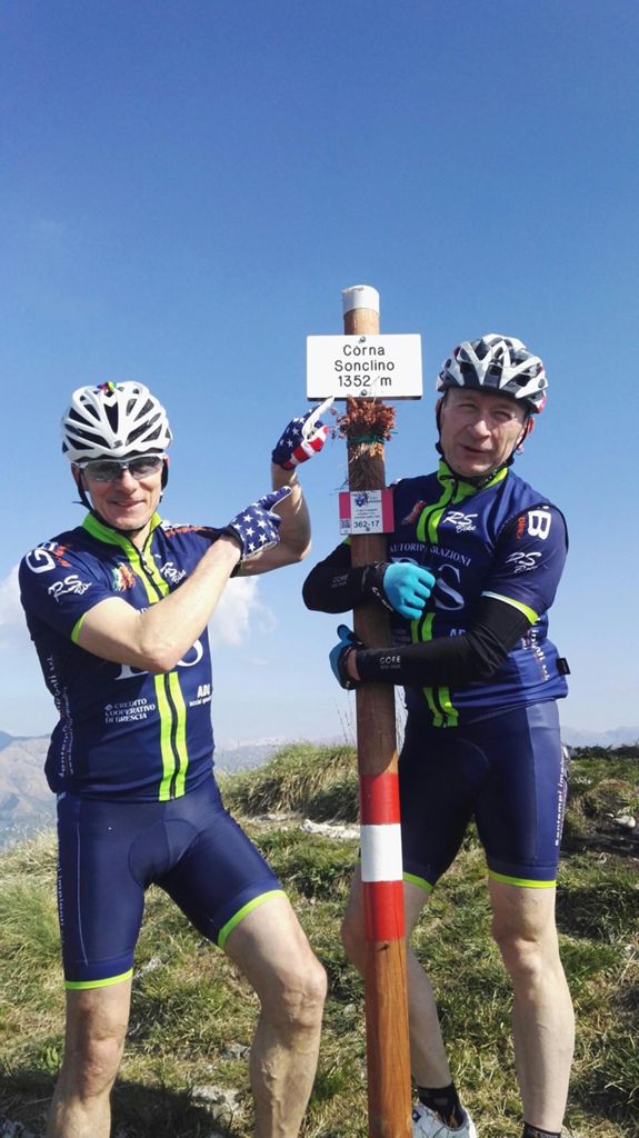
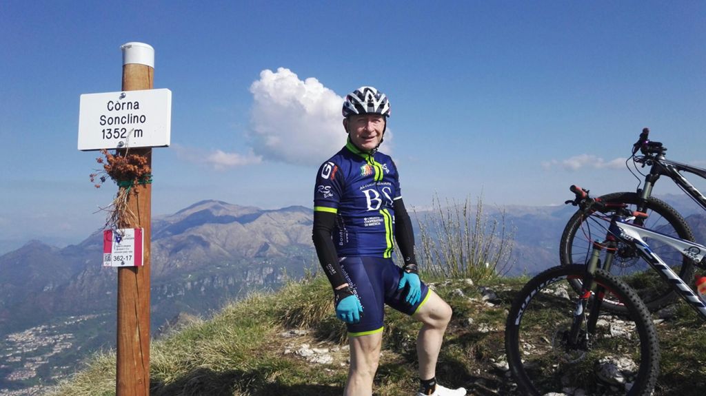
Tour val Gobbia e dintorni _

MTB
MTB
Ref..: 695260
Published: 03/05/2019
Performed: 01/05/2019
Distance in Km: 52.53
Climb in m: 2096
IBP: 180 BYC

Beppe Cavalli
568 published routes

Add to my Group or Club

 Height in m      Climb in %      Speed in Km/h      Speed < 2 Km/h

Climbs > 10%

Climbs >5% Climbs >10% Climbs >15% Climbs >20% Climbs >25%
 Steep slope of 104 m.   Average slope  Distances  Download as waypoint
1
 Km 7.921  10%  104 m
 Steep slope of 1307 m.  Average slope  Distances  Download as waypoint
2
 Km 10.693  10%  167 m
3
 Km 11.352  18%  96 m
4
 Km 11.448  11%  67 m
5
 Km 11.616  12%  63 m
6
 Km 11.679  17%  162 m
7
 Km 11.841  12%  357 m
8
 Km 12.434  14%  103 m
9
 Km 13.145  14%  165 m
10
 Km 13.479  15%  127 m
 Steep slope of 1917 m.  Average slope  Distances  Download as waypoint
11
 Km 14.058  14%  129 m
12
 Km 14.904  11%  134 m
13
 Km 15.751  12%  199 m
14
 Km 16.363  12%  162 m
15
 Km 16.525  18%  96 m
16
 Km 16.621  14%  263 m
17
 Km 16.884  17%  221 m
18
 Km 17.105  13%  63 m
19
 Km 17.264  13%  160 m
20
 Km 18.061  10%  162 m
21
 Km 18.223  10%  158 m
22
 Km 18.381  14%  198 m
23
 Km 18.579  15%  96 m
 Steep slope of 646 m.  Average slope  Distances  Download as waypoint
24
 Km 18.976  14%  126 m
25
 Km 19.201  13%  328 m
26
 Km 19.838  20%  132 m
27
 Km 19.969  13%  60 m
 Steep slope of 123 m.  Average slope  Distances  Download as waypoint
28
 Km 20.165  15%  31 m
29
 Km 20.196  20%  92 m
 Steep slope of 130 m.  Average slope  Distances  Download as waypoint
30
 Km 31.962  14%  130 m
 Steep slope of 990 m.  Average slope  Distances  Download as waypoint
31
 Km 32.681  15%  130 m
32
 Km 32.811  13%  510 m
33
 Km 33.321  16%  318 m
34
 Km 33.639  16%  32 m
 Steep slope of 669 m.  Average slope  Distances  Download as waypoint
35
 Km 33.868  13%  226 m
36
 Km 34.094  17%  250 m
37
 Km 34.344  15%  32 m
38
 Km 34.57  13%  161 m
 Steep slope of 523 m.  Average slope  Distances  Download as waypoint
39
 Km 36.091  10%  103 m
40
 Km 36.194  18%  126 m
41
 Km 36.32  17%  32 m
42
 Km 36.417  13%  32 m
43
 Km 36.449  19%  197 m
 Steep slope of 1028 m.  Average slope  Distances  Download as waypoint
44
 Km 36.78  14%  130 m
45
 Km 36.91  15%  62 m
46
 Km 36.971  27%  63 m
47
 Km 37.035  21%  33 m
48
 Km 37.067  14%  287 m
49
 Km 37.354  18%  197 m
50
 Km 37.551  14%  65 m
51
 Km 37.844  24%  32 m
52
 Km 37.876  27%  99 m
53
 Km 37.975  16%  60 m
 Steep slope of 97 m.  Average slope  Distances  Download as waypoint
54
 Km 38.285  11%  97 m
 Steep slope of 646 m.  Average slope  Distances  Download as waypoint
55
 Km 40.288  13%  129 m
56
 Km 40.551  13%  195 m
57
 Km 40.841  12%  160 m
58
 Km 41.001  10%  99 m
59
 Km 41.099  12%  162 m
 Steep slope of 129 m.  Average slope  Distances  Download as waypoint
60
 Km 41.43  12%  129 m


Description of the route


Presence of ramps


 Climbs  Distance  % of the total  Speed  Your speed would be  Time  Your time would be
   15 - 30%  3.462  6.59  4.56  ?  0:45:32  ?
   10 - 15%  5.471  10.42  5.93  ?  0:55:23  ?
   5 - 10%  7.541  14.36  9.17  ?  0:49:21  ?
   1 - 5%  8.999  17.13  12.81  ?  0:42:09  ?
   Total*  25.473 Km  48.5 %  7.94 Km/h  ? Km/h    3:12:25 h  ? h  
 Flat
   1 - -1%  7.481 Km  14.24 %  19.54 Km/h  ? Km/h    0:22:58 h  ? h  
 Descents
   -1 - -5%  5.649  10.75  21.61  ?  0:15:41  ?
   -5 - -10%  5.022  9.56  19.4  ?  0:15:32  ?
   -10 - -15%  4.093  7.79  21.92  ?  0:11:12  ?
   -15 - -30%  4.829  9.19  11.72  ?  0:24:43  ?
   Total*  19.592 Km  37.3 %  17.51 Km/h  ? Km/h    1:07:08 h  ? h  
* The total has not necessarily coincide with the sum of the partials after correction of errors

How long would it take you?

How long would it take you to cover this route?
There are routes without a valid time information, but with your average stats you can assess the possible duration

Beppe Cavalli to cover this route you've need a time of:   4:42:31 h 
If you sign in and have a minimum of two tracks of this same modality, you can know your time for this route, calculated from your stats..


¿Cuanto consumirá tu E-BIKE?

Entra tu E-IBP (formato n,nn)

E-IBP :   X 180 = 


 Detected activity type =  ()
 Penalization due to track conditions: 58 %   ( > 50 % = MTB, < 50 % = RDB)
 Reliability of the track: A   (2099/83/0/-/-/83)
 Correction level applied to the track: 0
DIFFICULTY OF THE ROUTE
IBP = 180 BYC
According to your statistics
 Your time in motion would be: ? h
Your average speed would be: ? Km/h
 

 Total Distance: 52.53 Km
 Analysed distance: 52.53 Km
 Linear distance: 0.01 Km

 Cumulated positive ramps: 2095.87 m  list of points info
 Cumulated negative ramps: 2095.46 m
 Maximum height: 1338 m
 Minimum height: 196.2 m
 Climbing Ratio: 8.23 %
 Descent ratio: 10.7 %
 Cumulated postive ramps per Km: 39.9 m
 Cumulated negative ramps per Km: 39.89 m

 Total time: 5:39:40 h
 Time in movement: 4:42:31 h
 According to your statistics
 Your time in motion would be: ? h  
 Stopped time: 0:57:09 h
 Maximum slope filter: ~30 %
 Minimum separation analysed: ~30 m
 Number of points: 4370   (cad. 12.02 m)
 Significant waypoints: 1500   (cad. 35.04 m / 34.32 %)

 Changes in direction per Km: 11.61
 Changes in direction > 5º por Km: 8.76
 Cumulated straight stretches: 10.174 Km
 Straight stretches per Km: 193.68 m
 Penalized slope changes: 16
 Penalized slope changes per Km: 0.305

 Average speed in total: 9.28 Km/h
 Average speed while moving: 11.16 Km/h
 According to your statistics
 Your average speed would be: ? Km/h  
 Maximum sustained speed: 50.72 Km/h


Comments

You can be the first one in commenting this route

 
My comments
:
Add comment  (Registered users)
 
Notify me answers to my comment  Do not notify answers to my comment


Share this route with a friend

Your friend will receive a message with a link to this page:
will see your email and your user name if you do it as registered user.


Write here your name (optional)

E-mail address of your friend(s). You can include various addresses separated by commas

Text or comment (optional) maximum 255 characters long, 255 Available characters

As a non registered users you need to fill-in the captcha text.
  Change image
Type the image characters.
 
 Share with a friend


Visited history

Delete history

Marked routes for review later or compare

My favorites


  Notify anomaly in this route Share in Facebook