Olot - Oix - Beget - Campodron - Serra Cavallera - Ogassa - Vallfogona - Olot

Road
Ref..: 4815
Published: 23/04/2011
Performed: 22/04/2011
Distance in Km: 105.62
Climb in m: 2498
IBP: 157 BYC
 Not from STRAVA
Near ...
Olot, Preses, Les, Sant Cristofol Les Fonts, Sant Miquel De Corb
Olot, Preses, Les, Sant Cristofol Les Fonts, Sant Miquel De Corb

 No activities
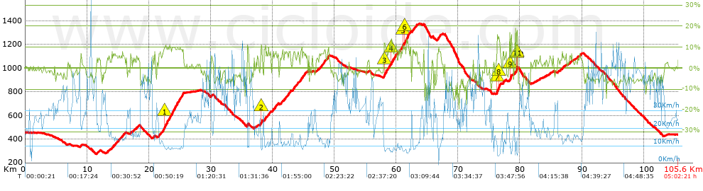


 list of points info

