Excursión de mańana

Hiking
Ref..: 390919
Published: 02/05/2018
Performed: 01/05/2018
Distance in Km: 13.28
Climb in m: 670
IBP: 71 HKG
 View on STRAVA
Near ...
Amunartia, Ezcaray, Ojacastro, Ulizarna
Amunartia, Ezcaray, Ojacastro, Ulizarna
 No activities
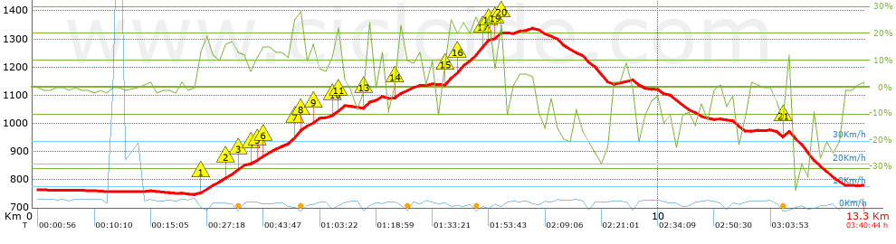


 list of points info

