Montroig - Pratdip Una Volta Pel Baix Camp

MTB
Ref..: 254
Published: 15/08/2005
Performed: 03/08/2005
Distance in Km: 29.44
Climb in m: 607
IBP: 49 BYC
 Not from STRAVA
 No activities
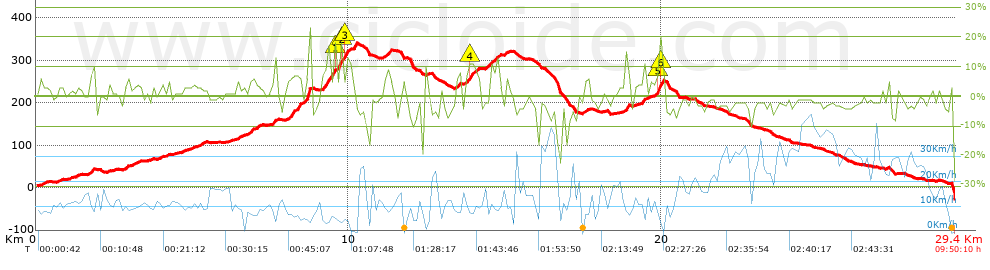


 list of points info

