Vilafranca - Pareres - Cova Bolet - Avellŕ - Baltanes - Vilafranca - 20240228

MTB
Ref..: 1140183
Published: 28/02/2024
Performed: 28/02/2024
Distance in Km: 52.08
Climb in m: 1060
IBP: 88 BYC
 Not from STRAVA
Near ...
Arboçar, L' (Avinyonet Del Penedes), Cabanyes, Les, Can Trabal (Olerdola), Casetes, Les (Castellet I La Gornal), Castellet I La Gornal, Clariana (Castellet I La Gornal)
Arboçar, L' (Avinyonet Del Penedes), Cabanyes, Les, Can Trabal (Olerdola), Casetes, Les (Castellet I La Gornal), Castellet I La Gornal, Clariana (Castellet I La Gornal)
 No activities
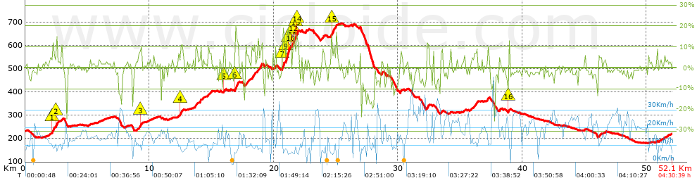


 list of points info

