Vuelta en bicicleta de montaþa matutina

MTB
Ref..: 1138419
Published: 12/02/2024
Performed: 11/02/2024
Distance in Km: 39.21
Climb in m: 1238
IBP: 102 BYC
 View on STRAVA
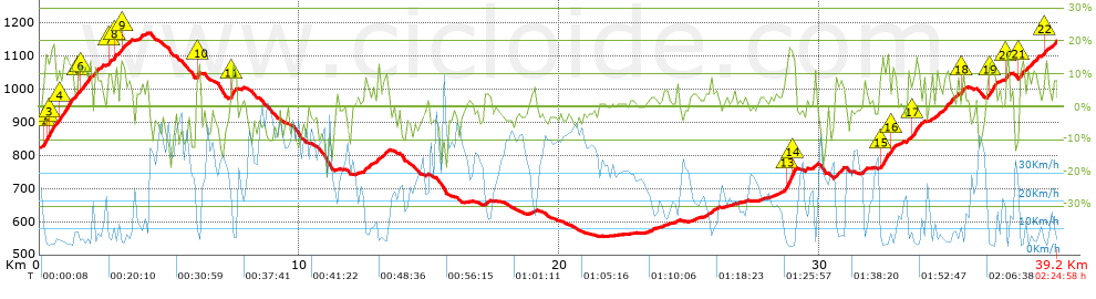


 list of points info

