De Vic A Santa Perpetua

MTB
Ref..: 13677
Published: 19/05/2013
Performed: 19/05/2013
Distance in Km: 72.05
Climb in m: 1396
IBP: 120 BYC
 Not from STRAVA
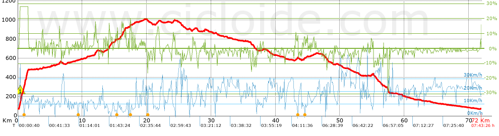


 list of points info

