Almoster (Tarragona)

MTB
Ref..: 974862
Published: 04/07/2021
Performed: 03/07/2021
Distance in Km: 37.42
Climb in m: 864
IBP: 51 BYC
 View on STRAVA
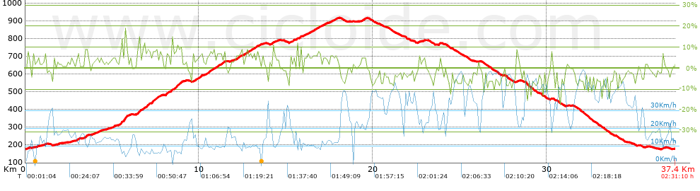


 list of points info

