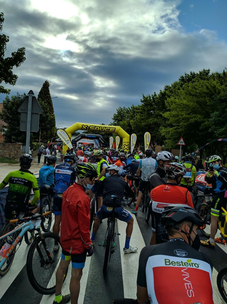
Power race astorga 2021

MTB
MTB
Ref..: 971848
Published: 21/06/2021
Performed: 20/06/2021
Distance in Km: 110.91
Climb in m: 2502
IBP: 189 BYC


 Height in m      Climb in %      Speed in Km/h      Speed < 2 Km/h

Climbs > 10%

Climbs >5% Climbs >10% Climbs >15% Climbs >20% Climbs >25%
 Steep slope of 98 m.   Average slope  Distances  Download as waypoint
1
 Km 4.336  11%  98 m
 Steep slope of 99 m.  Average slope  Distances  Download as waypoint
2
 Km 9.693  12%  99 m
 Steep slope of 214 m.  Average slope  Distances  Download as waypoint
3
 Km 10.795  18%  179 m
4
 Km 10.973  14%  35 m
 Steep slope of 228 m.  Average slope  Distances  Download as waypoint
5
 Km 19.55  12%  228 m
 Steep slope of 101 m.  Average slope  Distances  Download as waypoint
6
 Km 34.61  11%  101 m
 Steep slope of 98 m.  Average slope  Distances  Download as waypoint
7
 Km 36.103  11%  98 m
 Steep slope of 200 m.  Average slope  Distances  Download as waypoint
8
 Km 41.834  13%  33 m
9
 Km 41.867  25%  135 m
10
 Km 42.002  13%  32 m
 Steep slope of 946 m.  Average slope  Distances  Download as waypoint
11
 Km 45.269  11%  233 m
12
 Km 45.665  15%  128 m
13
 Km 45.793  12%  356 m
14
 Km 46.148  10%  97 m
15
 Km 46.245  11%  130 m
16
 Km 46.508  12%  99 m
 Steep slope of 355 m.  Average slope  Distances  Download as waypoint
17
 Km 55  11%  98 m
18
 Km 55.375  11%  128 m
19
 Km 55.503  10%  133 m
20
 Km 55.636  13%  129 m
 Steep slope of 325 m.  Average slope  Distances  Download as waypoint
21
 Km 56.27  11%  197 m
22
 Km 56.467  11%  227 m
23
 Km 56.694  11%  128 m
 Steep slope of 551 m.  Average slope  Distances  Download as waypoint
24
 Km 68.487  13%  100 m
25
 Km 68.717  10%  162 m
26
 Km 68.878  11%  131 m
27
 Km 69.01  12%  130 m
28
 Km 69.14  19%  159 m
 Steep slope of 103 m.  Average slope  Distances  Download as waypoint
29
 Km 70.643  17%  103 m
 Steep slope of 456 m.  Average slope  Distances  Download as waypoint
30
 Km 70.915  11%  130 m
31
 Km 71.174  19%  33 m
32
 Km 71.207  22%  227 m
33
 Km 71.434  19%  66 m
 Steep slope of 1467 m.  Average slope  Distances  Download as waypoint
34
 Km 71.597  25%  97 m
35
 Km 71.694  17%  158 m
36
 Km 71.851  28%  34 m
37
 Km 72.01  13%  539 m
38
 Km 72.549  16%  128 m
39
 Km 72.677  13%  32 m
40
 Km 72.908  13%  32 m
41
 Km 72.941  18%  190 m
42
 Km 73.131  15%  70 m
43
 Km 73.298  10%  97 m
 Steep slope of 291 m.  Average slope  Distances  Download as waypoint
44
 Km 83.631  13%  65 m
45
 Km 83.696  15%  96 m
46
 Km 83.792  13%  130 m
 Steep slope of 263 m.  Average slope  Distances  Download as waypoint
47
 Km 89.501  12%  263 m


Description of the route


Presence of ramps


 Climbs  Distance  % of the total  Speed  Your speed would be  Time  Your time would be
   15 - 30%  2.116  1.91  4.64  ?  0:27:22  ?
   10 - 15%  4.816  4.34  6.32  ?  0:45:43  ?
   5 - 10%  11.18  10.08  8.49  ?  1:19:00  ?
   1 - 5%  26.81  24.17  12.9  ?  2:04:43  ?
   Total*  44.923 Km  40.5 %  9.74 Km/h  ? Km/h    4:36:48 h  ? h  
 Flat
   1 - -1%  21.391 Km  19.29 %  17.92 Km/h  ? Km/h    1:11:38 h  ? h  
 Descents
   -1 - -5%  24.163  21.79  21.67  ?  1:06:54  ?
   -5 - -10%  14.866  13.4  28.94  ?  0:30:49  ?
   -10 - -15%  4.131  3.72  27.85  ?  0:08:54  ?
   -15 - -30%  1.433  1.29  26.6  ?  0:03:14  ?
   Total*  44.594 Km  40.21 %  24.36 Km/h  ? Km/h    1:49:51 h  ? h  
* The total has not necessarily coincide with the sum of the partials after correction of errors

How long would it take you?

How long would it take you to cover this route?
There are routes without a valid time information, but with your average stats you can assess the possible duration

Autor 15048 to cover this route you've need a time of:   7:38:17 h 
If you sign in and have a minimum of two tracks of this same modality, you can know your time for this route, calculated from your stats..


¿Cuanto consumirá tu E-BIKE?

Entra tu E-IBP (formato n,nn)

E-IBP :   X 189 = 


 Detected activity type =  ()
 Penalization due to track conditions: 59 %   ( > 50 % = MTB, < 50 % = RDB)
 Reliability of the track: B   (2502/67/0/-/-/67)
 Correction level applied to the track: 0
DIFFICULTY OF THE ROUTE
IBP = 189 BYC
According to your statistics
 Your time in motion would be: ? h
Your average speed would be: ? Km/h
 

 Total Distance: 110.91 Km
 Analysed distance: 110.91 Km
 Linear distance: 0.11 Km

 Cumulated positive ramps: 2501.5 m  list of points info
 Cumulated negative ramps: 2509 m
 Maximum height: 1557.1 m
 Minimum height: 845.2 m
 Climbing Ratio: 5.57 %
 Descent ratio: 5.63 %
 Cumulated postive ramps per Km: 22.55 m
 Cumulated negative ramps per Km: 22.62 m

 Total time: 7:59:05 h
 Time in movement: 7:38:17 h
 According to your statistics
 Your time in motion would be: ? h  
 Stopped time: 0:20:48 h
 Maximum slope filter: ~30 %
 Minimum separation analysed: ~30 m
 Number of points: 8866   (cad. 12.51 m)
 Significant waypoints: 3157   (cad. 35.13 m / 35.61 %)

 Changes in direction per Km: 11.21
 Changes in direction > 5º por Km: 6.7
 Cumulated straight stretches: 29.101 Km
 Straight stretches per Km: 262.38 m
 Penalized slope changes: 28
 Penalized slope changes per Km: 0.252

 Average speed in total: 13.89 Km/h
 Average speed while moving: 14.52 Km/h
 According to your statistics
 Your average speed would be: ? Km/h  
 Maximum sustained speed: 58.59 Km/h


Comments

You can be the first one in commenting this route

 
My comments
:
Add comment  (Registered users)
 
Notify me answers to my comment  Do not notify answers to my comment


Share this route with a friend

Your friend will receive a message with a link to this page:
will see your email and your user name if you do it as registered user.


Write here your name (optional)

E-mail address of your friend(s). You can include various addresses separated by commas

Text or comment (optional) maximum 255 characters long, 255 Available characters

As a non registered users you need to fill-in the captcha text.
  Change image
Type the image characters.
 
 Share with a friend


Visited history

Delete history

Marked routes for review later or compare

My favorites


  Notify anomaly in this route Share in Facebook