El Meridi‡ Verd. P2 - Bruges - Dunkerque

Road
Ref..: 3102
Published: 10/03/2010
Performed: 10/03/2010
Distance in Km: 63.01
Climb in m: 43
IBP: 20 BYC
Drawn route
 Not from STRAVA
Near ...
Coudekerque-Branche, Dunkerque
Coudekerque-Branche, Dunkerque

This route belongs to a multi-day journey 17 days documented with 17 independent routes
You can download the tracks of this multi-day route from each of the associated stages .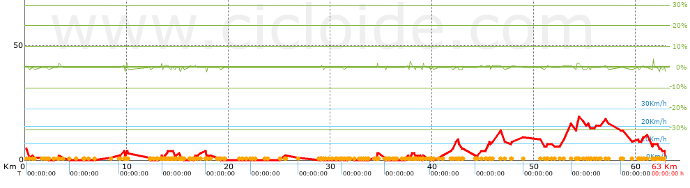
Description of the route
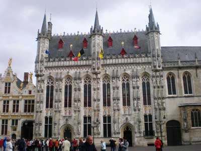
Dunkerque
Presence of ramps
| Climbs | Distance | % of the total | Speed | Your speed would be | Time | Your time would be | |
| 15 - 30% | 0 | 0 | 0 | ? | 0:00:00 | ? | |
| 10 - 15% | 0 | 0 | 0 | ? | 0:00:00 | ? | |
| 5 - 10% | 0 | 0 | 0 | ? | 0:00:00 | ? | |
| 1 - 5% | 2.785 | 4.42 | 0 | ? | 0:00:00 | ? | |
| Total* | 2.785 Km | 4.42 % | 0 Km/h | ?
Km/h  |
0:00:00 h | ? h |
|
| Flat | |||||||
| 1 - -1% | 58.136 Km | 92.26 % | 0 Km/h | ?
Km/h |
0:00:00 h | ? h |
|
| Descents | |||||||
| -1 - -5% | 2.093 | 3.32 | 0 | ? | 0:00:00 | ? | |
| -5 - -10% | 0 | 0 | 0 | ? | 0:00:00 | ? | |
| -10 - -15% | 0 | 0 | 0 | ? | 0:00:00 | ? | |
| -15 - -30% | 0 | 0 | 0 | ? | 0:00:00 | ? | |
| Total* | 2.093 Km | 3.32 % | 0 Km/h | ?
Km/h |
0:00:00 h | ? h |
|
How long would it take you?
 |
|
øCuanto consumir· tu E-BIKE?
Entra tu E-IBP (formato n,nn)
| Detected activity type = () |
| Penalization due to track conditions: 11 % ( > 50 % = MTB, < 50 % = RDB) |
|
|
| Correction level applied to the track: 0 |
|
|
| DIFFICULTY OF THE ROUTE |
IBP = 20 BYC |
| According to your statistics Your time in motion would be: ? h |
| Your average speed would be:
? Km/h |
| Total Distance: 63.01 Km |
| Analysed distance: 63.01 Km |
| Linear distance: 55.42 Km |
| Cumulated positive ramps: 43 m |
 list of points info list of points info |
| Cumulated negative ramps: 32 m | |
| Maximum height: 19 m | |
| Minimum height: 0 m | |
| Climbing Ratio: 1.54 % | |
| Descent ratio: 1.53 % | |
| Cumulated postive ramps per Km: 0.68 m | |
| Cumulated negative ramps per Km: 0.51 m | |
| Total time: --- h |
| Time in movement: --- h |
| According to your statistics Your time in motion would be: ? h
|
| Stopped time: --- h |
| Maximum slope filter: ~30 % |
| Minimum separation analysed: ~30 m |
| Number of points: 230 (cad. 273.97 m) |
| Significant waypoints: 214 (cad. 294.46 m / 93.04 %) |
| Changes in direction per Km: 1.48 |
| Changes in direction > 5∫ por Km: 1.38 |
| Cumulated straight stretches: 5.047 Km |
| Straight stretches per Km: 80.1 m |
| Penalized slope changes: 0 |
| Penalized slope changes per Km: 0 |
| Average speed in total: 0 Km/h |
| Average speed while moving: 0 Km/h |
| According to your statistics Your average speed would be: ? Km/h
|
| Maximum sustained speed: 0 Km/h |


